How to Verify a Vacant-Lot Topographic Survey Before a Site Plan
Use a jurisdiction-aware worksheet to check a vacant-lot topo survey's identity, date, datum, contours, features and omissions before siting a home.
The short answer
Before relying on a vacant-lot topographic survey, match it to the correct parcel, confirm its field date, licensed preparer, units, coordinate system, vertical datum, benchmark and contour or spot-elevation detail, then cross-check visible drainage, utilities, easements, critical areas and your local site-plan checklist. If any item is missing or unclear, pause house siting and send a written clarification request to the surveyor or civil designer.How to Verify a Vacant-Lot Topographic Survey Before a Site Plan
Before relying on a vacant-lot topographic survey, match it to the correct parcel, confirm its field date, licensed preparer, units, coordinate system, vertical datum, benchmark and contour or spot-elevation detail, then cross-check visible drainage, utilities, easements, critical areas and your local site-plan checklist. If anything is missing or unclear, pause house siting and send a written clarification request to the surveyor or civil designer.
Use a release gate, not a visual thumbs-up #
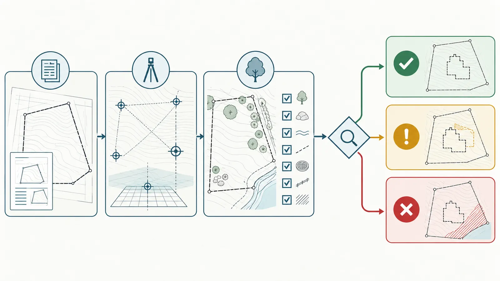
A delivered topographic survey is ready to inform concept siting only when its identity, scope, control, observable features, limitations and local submission requirements reconcile; a sheet that looks detailed is not enough to release the site to design.
The practical question is not “Does this look like a real survey?” It is “Can the next professional use this exact file for the next defined decision without guessing?” For a vacant lot, that next decision is usually a concept location for the house, driveway and primary site work, followed by a conversation with a civil designer, architect or permitting staff. A later decision may be whether the same information can support a formal site-plan submission. Those are related but different gates.
This guide uses a three-status release gate:
| Status | What it means | What you may do next | What you must not infer |
|---|---|---|---|
| Rely for the stated stage | The parcel and scope match, control is readable, the needed features are shown or expressly limited, and the local checklist has no unresolved survey dependency. | Give the complete survey package to the architect or civil designer for concept siting, with the worksheet and local checklist attached. | That the parcel is buildable, the house will be permitted, or the survey certifies title, soils, drainage design or engineering. |
| Clarify before relying | One or more items are absent, contradictory or ambiguous, but a written answer or corrected sheet may resolve the issue. | Send a numbered request to the licensed surveyor; freeze decisions that depend on the item. | That a missing note is harmless because a contractor can “work around it.” |
| Supplement before relying | The survey scope, age, coverage or control cannot support the decision, or the authority requires fieldwork or information not present. | Ask the surveyor or civil designer to define supplemental fieldwork, updated control, utility locating, drainage observation or other professional scope. | That public GIS, an aerial image, a phone GPS reading or a visible stake substitutes for the needed survey work. |
The gate is deliberately narrower than a permit approval. Virginia, for example, has a regulation for topographic surveys that lists visible improvements and visible evidence of underground features when the method and scale allow, elevations, benchmarks, datum, scale, contour interval, coordinate system and a survey-method statement among the information to show. That is useful as a checklist model, but it applies to topographic surveys performed under Virginia law, not automatically to a lot in another state. See Virginia's topographic-survey minimum standards.
Originality brief: the missing homeowner decision
Current answers. Existing explanations commonly define a topographic survey, list generic survey components or reproduce a permit checklist for one city. They often explain what contours are without giving the homeowner a release gate for a delivered survey. They also blur boundary evidence, topographic control, buried-utility locating and buildability.
Missing decision. The homeowner needs to decide whether this specific package is complete enough for concept siting and a local site-plan conversation, or whether to return it for clarification or supplemental fieldwork before design money is committed.
Brictale contribution. The contribution is the “Survey acceptance worksheet: release, clarify or supplement.” It separates observable document checks from professional certifications and routes each unresolved item to the person who can answer it. The worksheet is a synthesis of the jurisdiction-specific source checks cited in this article; it is not a new surveying standard.
Contribution method. Compare the delivered signed sheet, digital files and metadata with the applicable authority checklist; mark each item confirmed, missing, unclear or not applicable; then route unresolved items to the licensed surveyor, civil designer or permitting authority. The article uses illustrative examples to show how the gate works and does not treat the worksheet as a survey certification.
Contribution limitations. The worksheet cannot certify boundaries, confirm title, locate buried private utilities, determine buildability, replace geotechnical or engineering work, or guarantee permit acceptance. Local agencies can require more current, more precise or differently controlled information.
How to check it. Print or copy the worksheet into your project record. Put the exact sheet number, note, layer, file name or authority checklist line beside each answer. A different person should be able to follow those references and see why the survey was released, returned or supplemented. If your authority's checklist conflicts with this article, the authority's current checklist controls for that submittal.
What this gate covers and what it excludes
The gate covers a vacant lot after a boundary or topographic survey has been delivered and before the house footprint, driveway, grading concept or civil design is treated as dependable. It covers the information needed to ask better questions, not the professional act of certifying the information.
It does not determine whether you have clear title, whether a lot is legally buildable, whether a septic system will pass, whether soil can support a foundation, whether a wetland or flood hazard exists beyond what the survey depicts, whether a house complies with zoning, or whether a civil or structural design is safe. Those conclusions belong to the relevant title professional, surveyor, environmental consultant, geotechnical professional, engineer, architect or local authority.
It also does not turn a survey symbol into a guarantee about a buried line. Virginia's rule addresses visible evidence of underground features as observed through a survey method and at a survey scale. That is not the same service as locating every private buried utility. Before anyone excavates, PHMSA's 811 guidance says homeowners and professional excavators should contact the one-call center so affected facility operators can locate and mark underground facilities. State timing and private-facility coverage vary.
The people responsible for each handoff
The homeowner owns the release decision and the record of what was requested. You can compare the delivered package with the agreed scope, identify missing labels, log contradictions and ask for explanations. You should not redraw the boundary, adjust an elevation, or silently “clean up” an omission.
The licensed land surveyor is responsible for the survey work, professional seal or certification where required, field methods, control, boundary evidence, topographic observations and the explanation of limitations. If a benchmark, contour interval, field date or feature is missing, the surveyor—not the homeowner—decides whether the answer is a note, corrected deliverable, revisit or new scope.
The architect or civil designer converts reliable survey information into a site concept and later design. That person should tell you which survey elements are actually needed for the proposed house, driveway, retaining work, drainage concept and utility connections. They should not be asked to infer an unshown benchmark or resolve a boundary conflict by eye.
The local authority decides what its current application requires. A planner, permit reviewer, public-works department or utility owner may apply a checklist that is more specific than a state minimum or different from a neighboring jurisdiction. Ask for the current checklist for the exact parcel and permit path, including any subdivision, critical-area, grading, floodplain or utility review.
Confirm identity, scope and responsibility before reading elevations #
First confirm that every file belongs to the parcel and decision in front of you; a beautifully drafted survey for the wrong lot, wrong phase or wrong scope is not usable evidence for house siting.
Start with the administrative cover sheet, title block, legal description and file package. Do not begin by tracing the contours. A title or parcel-number mismatch can make every later measurement irrelevant, while an omitted scope note can make a correct-looking sheet too limited for your next step.
Identity checks
Record the following exactly as shown, preserving punctuation and leading zeros:
| Check | Record | Acceptable evidence | Stop or clarify when |
|---|---|---|---|
| Parcel identity | Site address, assessor parcel number, lot/block or metes-and-bounds reference | Title block, legal description, recorded plat reference and client instructions agree | The survey uses a tax parcel number that differs from your closing or county record, or the legal description is missing. |
| Jurisdiction | State, county and municipality, including unincorporated status if applicable | Survey title and local application path agree | The parcel is near a city boundary, annexation area, county island or special district and no one has confirmed the reviewing authority. |
| Requested scope | Boundary, topographic, tree, ALTA/NSPS, as-built, existing-conditions or other stated scope | Proposal, invoice, surveyor email and sheet notes | You ordered “boundary and topo” but received a boundary-only drawing, a desktop exhibit or a file with unexplained exclusions. |
| Client and preparer | Owner or commissioning party, survey firm, surveyor name, contact and license information where shown | Title block, seal, signature and transmittal | The sheet has no responsible professional, an illegible seal, no date or a different firm than the one you hired. |
| Deliverable set | Signed PDF, CAD or GIS files, metadata, notes, field report or control report if promised | Transmittal list and file names | A digital surface or point file is missing, layers are flattened, units are not stated, or the PDF and CAD disagree. |
A local standard can be more detailed than your contract. Virginia's rule, for example, calls for a title identifying the land surveyed and the state, county or city; the client and land-surveyor contact information; date; graphic and numerical scale; contour interval; north arrow; meridian source; nearby reference; horizontal and vertical units; coordinate system; and a method-and-accuracy statement. Use those items as questions to ask, not as a claim that every U.S. survey must display Virginia's exact wording. Read the Virginia list in its jurisdictional context.
Boundary scope is not title certification
For a homeowner, “boundary survey” can mean several things in conversation: a drawing from a seller, a mortgage survey, a boundary retracement by a licensed surveyor, or a property-survey product with a particular purpose. The label alone does not tell you how the corners were researched, what monuments were found, or whether an easement was plotted from record documents.
Ask the surveyor to identify the boundary basis used and the documents reviewed. In Georgia, the technical standard says a surveyor should acquire and analyze deeds, maps, title certificates, centerline and right-of-way data, adjacent descriptions and other available boundary information, then coordinate that analysis with field monuments. It also says the surveyor should explain why a field survey cannot be reconciled with record title or other evidence. That is a Georgia rule, not a national title opinion, but it shows why “the line was drawn” and “the line was responsibly located” are different questions. See Georgia Rule 180-7-.02.
Your worksheet should therefore ask for a boundary-source note, not a personal conclusion that the legal boundary is correct. Record whether the sheet identifies the recorded plat, deed book/page, right-of-way record, found or set monuments, occupation evidence, adjoining descriptions and any conflict or gap. If the answer is “not part of this scope,” keep that limitation visible and ask the civil designer whether the proposed house or driveway depends on the unresolved line.
Do not use a fence, tree line, driveway edge, old stake, county GIS parcel polygon or seller sketch as a substitute for the surveyor's boundary analysis. Such observations can be useful questions for the surveyor, especially if they disagree with the drawing, but they do not decide the line.
Scope and intended use must be written down
Send the surveyor or designer one sentence describing the next decision: “We need to choose a concept location for a single-family house, driveway and preliminary drainage conversation on the vacant parcel at [identifier], and we need to know whether this survey is adequate for that stage.” That sentence is more useful than “Please verify the survey,” because it lets the professional say whether the requested use is within the delivered scope.
Then add the likely site features: steep slope, retaining wall, septic or sewer connection, driveway crossing a ditch, stream, wetland, floodplain, existing well, overhead line, possible rock outcrop, shared access, or proposed accessory structure. The surveyor may already have excluded some of these, or the civil designer may require fieldwork beyond the original order.
This is where a homeowner can save a round trip. If the proposed site depends on a feature that was not part of the order, identify it before the architect draws around it. A boundary-and-topo survey may not include tree inventory, wetland delineation, geotechnical borings, infiltration testing, private utility locating, septic design or a formal flood-elevation study. The omission may be entirely proper; it is still a reason to create a new task.
First handoff: owner to surveyor and designer
Build a single handoff folder containing the signed PDF, native or point files if delivered, the proposal and invoice, record plat or deed supplied to the surveyor, local checklist, site photographs, parcel record, and your numbered questions. Do not send only screenshots of a contour corner.
Ask the designer to mark the survey elements that control the next concept: property lines and setbacks, road and access, finished-floor assumptions, existing grade around the building area, drainage outfalls, utility tie points, critical areas and trees or walls if relevant. Ask for a written “usable for concept only” or “not usable until corrected/supplemented” response when the project has material cost exposure.
The safest next decision after this chapter is not house placement. It is whether the package is correctly identified and scoped enough to continue into control and feature checks. If not, return it before spending design hours.
Reconcile control: date, method, units, coordinate system and datum #
You can trust an elevation only when you know what it is measured from, how it was obtained, when the field data was collected, and how another professional can reproduce the relationship; a number without that context is not a reliable design input.
Control is the survey's reference framework. It ties horizontal positions and elevations to monuments, benchmarks, coordinate systems, units and a stated method. The same physical point can carry different numeric values under different vertical datums, and a contour interval can hide more relief than the house concept can tolerate. This is why the control review comes before you interpret whether the lot is “flat enough.”
Date is a design input, not a freshness badge
Record at least three dates if they exist:
- the date or dates of field work;
- the date of aerial photography, lidar capture or other remote data;
- the date the plat, model or digital file was prepared, revised and signed.
Then ask what has changed since field work. On a vacant lot, clearing, grading, a new driveway, a neighbor's wall, storm damage, erosion, a new utility installation, a relocated ditch or a new monument can change the usefulness of the data without changing the legal parcel. A survey date is not an automatic expiration date, but it is a prompt to compare the sheet with current conditions and the local review requirement.
Maricopa County, Arizona, illustrates why age must be checked against the actual authority: its engineered plan submittal page calls for a current topographic survey with the field-survey date and requires a certification of accuracy for field surveys older than one year. That is a Maricopa County submittal condition, not a one-year national rule. Check the current Maricopa County engineered-plan requirements.
Virginia's rule also requires the statement to identify the date original data or imagery was obtained. Georgia's topography rule requires field-run topographic work to state field dates and equipment. The practical test is whether you can tell which portions are old, which were revisited and which professional signed responsibility for the final representation. Compare the Virginia date-and-method language with Georgia's field-run survey requirements.
Method tells you what was observed and what may be hidden
Look for the field method: conventional total station, RTK GNSS, leveling, photogrammetry, lidar, mobile scanning, a combination, or existing public data. Method alone does not rank a survey as good or bad. It tells you which limitations to ask about.
For a field-run survey, ask whether the crew occupied and checked control, whether tree canopy, tall grass, standing water or steep ground blocked shots, and whether the deliverable labels areas that could not be reliably observed. For remote sensing, ask for the date of imagery, source, control points, check points, ground conditions and obscured areas. For a hybrid product, ask which features came from field observations and which came from imagery or public data.
Georgia's rule treats multiple methods and remote data within its topographic standards and requires the drawing or electronic work product to state the type of survey and explain areas that are not certified or reliable. It also requires a field-run survey to state the field dates and equipment, while other methods carry different control and check-point disclosures. Use that structure to ask “what was measured directly?” rather than assuming every line had the same accuracy. Read the method and reliability provisions in Georgia Rule 180-7-.04.
If the survey says “surface features approximate,” “utilities shown from record information,” “not a boundary survey,” “dense vegetation limited shots,” “elevations from public data,” or similar, copy the limitation into the worksheet. Do not bury it in an email.
Units, horizontal system and source of meridian
Confirm whether horizontal distances are feet, international feet, meters or another unit; whether elevations use feet or meters; and whether the drawing scale agrees with the stated units. Record the coordinate system and datum, adjustment or epoch when supplied. Confirm the north arrow and source of meridian.
This is not busywork. A CAD file can import at the wrong scale, a metric surface can appear plausible in a feet-based drawing, and a grid bearing can be confused with a record bearing. You do not need to perform a coordinate transformation to complete the homeowner gate. You do need to prevent a downstream professional from treating an unlabeled number as universal.
Virginia's minimum topographic-survey information expressly includes the horizontal and vertical units, coordinate system and data, including adjustments if applicable, as well as the source of meridian. That is a strong model for the questions to record, but the applicable state and authority may use different terminology or control. See the Virginia control-information requirement.
Ask the surveyor these focused questions:
- What are the horizontal and vertical units?
- What horizontal coordinate system, datum, zone and adjustment or epoch were used, if applicable?
- What vertical datum is used, and how was it transferred or checked onto the site?
- What is the basis of bearing or source of meridian?
- Are the PDF, CAD, point file and surface in the same units and coordinate basis?
- Which control points or benchmarks can a future survey crew recover?
Vertical datum and benchmark are the elevation handshake
A benchmark is a defined reference point used to connect elevations. The vertical datum is the reference framework that gives the elevation meaning. The note should identify the benchmark, location, description, elevation, datum and method of tie or verification. “Elevation 100.00” without that handshake is not enough for a reliable cross-discipline handoff.
Some jurisdictions are explicit. Bellevue, Washington, says residential site plans must use NAVD 88 as the vertical database and the same datum for all elevation information. Seattle Public Utilities says the vertical datum for applicable survey work is NAVD 88 and requires benchmark reference number, description, location and elevation, including project-site benchmarks. Seattle also identifies a distant benchmark, an omitted description and showing only one benchmark as common causes of plan rejection. Those are local examples: do not transplant Seattle's requirement to a different agency without checking that agency. Read Bellevue's residential site-plan guidance and Seattle Public Utilities' survey requirements.
Maricopa County gives another local example: its engineered-plan checklist calls for a certified temporary benchmark referenced to site datum and places it within specified horizontal and vertical distances from the structure location. The useful homeowner question is not “Does every lot need a TBM 400 feet away?” It is “Does the authority reviewing my project require a recoverable project benchmark, and does my survey provide the required control?” Use the Maricopa checklist for the exact county program.
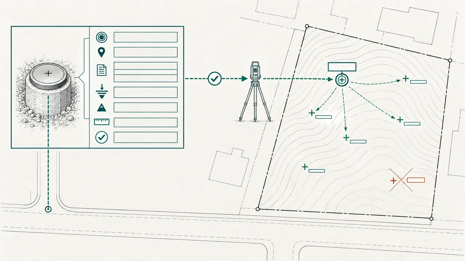
Do not convert a datum casually. If one record uses a local city datum and another uses NAVD 88, ask the surveyor to establish and document the relationship. Seattle's guidance specifically describes showing a local conversion factor when older City of Seattle Datum records are used alongside NAVD 88, with the relevant benchmark description and record reference. That is a Seattle-specific example of why the conversion must be documented rather than guessed. See Seattle's datum and benchmark notes.
Worked example: why an unlabeled elevation can derail a site concept
Illustrative example, not a measurement or site conclusion. Suppose a homeowner receives a contour labeled 212.0 near the street and a proposed finished-floor assumption of 214.5 in an architect's sketch. The sheet does not say whether the elevations are feet, which vertical datum applies, or where the benchmark is. The difference appears to be 2.5 units, but the number cannot be safely interpreted as a 2.5-foot rise until the units, datum and reference are confirmed.
The correct response is not to move the house by a guessed amount. The response is to ask the surveyor to identify the vertical datum, benchmark, units, control transfer and whether the architect's proposed elevation uses the same basis. If the architect has already drawn a driveway, ask the civil designer to hold the grade-dependent concept until the control is reconciled.
The next decision after control review is whether the elevation framework is sufficiently documented for the level of design being purchased. If the answer is no, the surveyor should clarify or supplement it before any slope, drainage or finished-floor conclusion is treated as real.
Test whether the elevation picture is detailed enough for siting #
The elevation picture is adequate for a stated design stage only when its contour interval, spot elevations, grade breaks, drainage clues and reliability notes can answer the questions that stage creates; a contour map is not automatically a grading plan.
Contours show a pattern, not every point
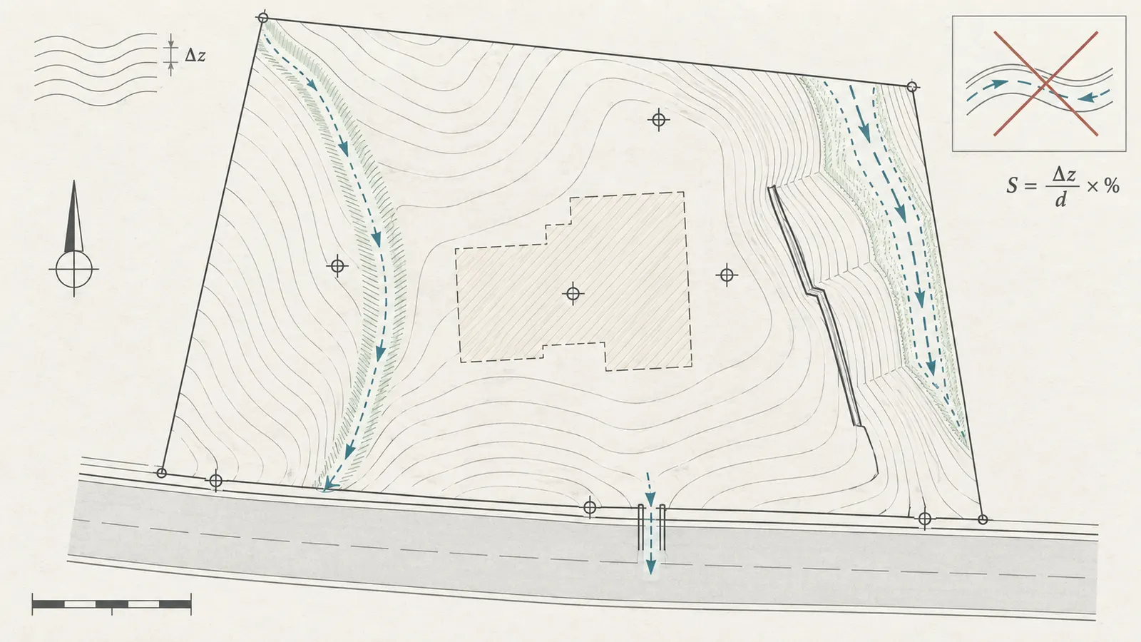
A contour connects locations represented as having the same elevation. Contour spacing gives a visual indication of slope: closer lines generally signal a steeper change over horizontal distance, while wider spacing generally signals a gentler change. But contours are generalized representations. They do not show every low point, swale, berm, lip, curb invert, drainage inlet, rock ledge or abrupt grade break unless the survey scope and depiction include them.
Record the contour interval and scale. Ask whether the interval is suitable for the proposed decision, especially where the building pad, driveway, accessible route, septic area, retaining wall or stormwater outlet could turn on a small vertical difference. A survey can be technically valid at its stated interval and still need supplemental spot elevations for a particular house concept.
Virginia publishes one example of how a jurisdiction can connect map scale and contour interval to accuracy. Its table lists 1- or 2-foot contours for scales from 1 inch equals 20, 30, 40, 50 and 100 feet, and larger intervals at smaller scales; it also provides separate vertical-accuracy values and states that the positional accuracy is given at the 95% confidence level. These values are Virginia's standards, not a universal design tolerance. Review the Virginia scale, contour and accuracy tables.
Bellevue's residential site-plan guidance illustrates a different level of local submission detail: it calls for existing and proposed contours at 2-foot intervals and NAVD 88 as the vertical database. That does not mean a Bellevue contour interval is suitable for an unrelated county, nor does it mean the delivered survey already shows proposed contours. It tells a Bellevue applicant what the site-plan review may expect. See Bellevue's explicit contour requirement.
Spot elevations and grade breaks close the questions contours leave open
Spot elevations are especially valuable at the proposed building corners or perimeter, road edge, driveway tie, ditch bottom and top, drainage inlet or outfall, wall ends, culvert ends, swale low points, visible utility structures and other places where a concept changes direction. The surveyor decides which points to collect; the homeowner's job is to ask whether the delivered points are enough for the intended next decision.
Use this test: write down the five to ten points a designer needs to compare the likely house and driveway concept with existing grade. For each, mark “shown,” “not shown,” or “not applicable.” Do not add your own phone-level measurements to the survey as though they were survey points. If the missing point affects the concept, request a surveyor-defined supplemental shot or field visit.
If the house location has not yet been chosen, use a zone rather than pretending to know exact corners. For example: “the north half of the parcel within 20 feet of the east boundary and outside the mapped drainage swale.” Ask the designer which perimeter and tie points become necessary once a concept footprint exists. This keeps the survey review from inventing a building design while still finding obvious gaps.
Drainage evidence is not drainage design
Record visible ditches, swales, channels, culverts, catch basins, inlets, outlets, flow arrows, high and low points, ponds, springs or standing-water evidence if shown. Note whether the survey identifies invert elevations, rim elevations, flow direction or only a line feature. Ask whether vegetation, water, debris, snow or inaccessible ground limited observation.
Maricopa County's engineered-plan checklist shows the difference between existing information and design: it asks for existing and proposed contour lines, drainage patterns, flow-direction arrows and grade breaks, then separately lists engineered drainage requirements, calculations and other design details for applicable projects. You should not read a line labeled “drainage” as approval of a drainage solution. See Maricopa County's grading and drainage checklist items.
Bellevue likewise calls for utilities and proposed water, sewer and storm-drainage systems on a residential site plan, and identifies critical areas such as streams, wetlands, flood hazards and steep or unstable slopes. Those are site-plan content items in Bellevue; the survey by itself does not determine the regulatory buffer, engineering design or permit outcome. Read the Bellevue site-plan list.
Calculate slope only from compatible, stated inputs
For a straight, representative run, the basic slope formula is:
slope percentage = (vertical change ÷ horizontal distance) × 100
Use the same units in both numerator and denominator. If a surveyor or designer confirms point A is 426.20 feet and point B is 430.70 feet, the vertical change is 4.50 feet. If the horizontal distance is 150 feet, the illustrative slope is:
(4.50 ft ÷ 150 ft) × 100 = 3.0%
This is a modeled example using invented inputs to demonstrate the formula, not a statement about any lot. It assumes the points are on the same vertical datum and that the horizontal distance is appropriate for the direction being evaluated. It does not account for intermediate dips, cross-slope, curvature, drainage structures, grade breaks or proposed earthwork.
Sensitivity matters. If the vertical readings were each subject to an illustrative uncertainty of ±0.10 foot, the difference could vary by roughly ±0.20 foot before considering horizontal uncertainty. The illustrative slope range would be:
- low case: 4.30 ft ÷ 150 ft × 100 = 2.87%;
- center case: 4.50 ft ÷ 150 ft × 100 = 3.00%;
- high case: 4.70 ft ÷ 150 ft × 100 = 3.13%.
Those are arithmetic scenarios, not a survey accuracy claim. Virginia's published accuracy table gives different values depending on contour interval, spot elevations and map scale, and says professionals remain responsible for work appropriate to conditions. Do not substitute the example uncertainty for the applicable surveyor's stated accuracy. Use the Virginia accuracy table only within its scope.
The calculation is useful for spotting questions, not for approving a driveway or foundation. If the conclusion changes under a reasonable documented sensitivity, ask the designer whether more detailed field data is required.
Reliability notes are a release condition
A shaded area, dashed line, “approximate,” “not located,” “from record,” “not field verified,” “outside limits,” “obscured” or “not certified” note is not decorative. It tells you where the surveyor is limiting reliance. Copy each limitation into the worksheet and map it to the proposed decision.
Georgia's topography rule requires a clear explanation and delineation of portions of contours or elevation data that are not certified or reliable, including areas obscured or otherwise unable to meet the mapping precision. It even gives a statement for data obtained from a public agency or other lawful source that is not certified correct by the surveyor. Again, this is a Georgia rule, but it captures the right homeowner behavior: isolate the unreliable area instead of averaging it into the rest of the parcel. Read Georgia's reliability disclosure language.
Examples of release-blocking reliability questions include:
- Is the likely house pad inside the obscured area?
- Does the only apparent drainage path cross a zone labeled approximate?
- Is the road tie from a different source or older field visit?
- Are the contours interpolated across a retaining wall, ditch or dense vegetation?
- Does the digital terrain model include the same breaklines and spot elevations shown on the PDF?
If yes, do not erase the note. Ask the surveyor to state whether the package is adequate for concept siting and what supplemental work would remove the limitation.
Cross-check boundaries, easements, utilities and critical features #
The survey should be tested as a coordinated existing-conditions record: every feature that can change the house envelope, access, drainage or service path must either be shown, excluded with a reason, or assigned to a separate professional investigation.
Use a feature inventory, not a symbol hunt
Walk the parcel with the sheet in hand only for observation and question generation. Do not move monuments, enter unsafe areas or treat a visual comparison as a new survey. Photograph from public or permitted locations, date the photos, and write “observed by owner” rather than “verified.”
For each feature below, mark whether it is shown, not shown, excluded, uncertain or outside the contracted limits:
| Feature group | Questions to answer from the survey package | What a homeowner may do | What needs a professional response |
|---|---|---|---|
| Boundary and access | Are corners, monuments, rights of way, road edges, access drives and recorded bearings or distances identified? | Compare parcel records and site observations; log conflicts. | Resolve the boundary, easement or right-of-way location. |
| Easements and restrictions | Are utility, drainage, access, conservation, open-space, setback or plat-required lines shown with recording references? | Compare with the recorded plat and local checklist. | Interpret legal effect or confirm an unplotted record item. |
| Visible utilities | Are poles, transformers, manholes, pedestals, meters, hydrants, lines and service connections shown when visible? | Ask why a visible feature is absent; contact utility owners. | Locate buried private lines or design a service connection. |
| Drainage | Are ditches, culverts, inlets, outfalls, swales, ponds, springs, grade breaks and flow clues represented? | Mark observed seasonal water or erosion as an observation. | Delineate drainage, size a system or determine floodplain/wetland status. |
| Structures and walls | Are neighboring or on-site structures, fences, walls, rockeries and top/bottom elevations shown where relevant? | Compare approximate location from safe vantage points. | Confirm structural condition, encroachment or retaining design. |
| Trees and vegetation | Are trees, tree-protection zones, wooded limits or clearing constraints within the scope? | Record that tree information is absent or partial. | Obtain an arborist or authority-specific tree inventory if required. |
| Critical areas | Are streams, wetlands, flood hazards, steep slopes, unstable soils, buffers or mine hazards identified? | Check the local critical-area/floodplain portal and ask for source. | Obtain delineation, geotechnical, environmental or flood-elevation work. |
This table is a decision aid, not a substitute for the local checklist. Bellevue's residential site-plan guidance, for example, specifically calls for easements, above- and below-ground utilities, structures, trees, critical areas, rockeries and retaining walls, as well as existing and proposed grades. The list is useful because it connects the survey review to the later drawing, but it applies to Bellevue's process. Use Bellevue's current page for Bellevue projects.
Easements require both drawing evidence and record evidence
An easement shown on a survey is not necessarily the full legal story, and an easement missing from a survey is not proof that none exists. Record the label, purpose, width, recording reference, adjacent parcel and whether the surveyor received the governing document. Then ask the surveyor or title professional what source was reviewed and whether the drawing depicts the record location or only an apparent use.
Do not assume an easement is a setback. A utility easement, access easement, drainage easement, conservation restriction, building setback line and zoning setback can have different sources and consequences. A local site plan may need several of them, and the designer may need to keep the house, septic area, driveway, stormwater work or tree removal outside more than one constraint.
Maricopa County asks engineered-plan applicants to identify easement locations and purposes and, for recently split lots, lot-split recording information and associated easements. Bellevue asks for easements on or adjacent to the property and, in its guidance, includes recording information for existing easements. These examples show why “there is an easement line” is not a complete handoff; the next professional needs its purpose and source. See Maricopa's easement item and Bellevue's easement guidance.
Visible utility evidence is useful but bounded
A topographic survey may show visible manholes, catch basins, telephone pedestals, power transformers, poles, hydrants or other surface evidence. Virginia's topographic rule specifically addresses visible evidence of underground features and says that if the methodology or scale prevents depiction, the map or metadata must clearly state what is not depicted. This is a rule for Virginia, but it gives a precise question to ask anywhere: what could the method and scale see, and what was expressly outside it? Read Virginia's visible-feature disclosure.
Do not infer buried alignment, depth, capacity, ownership or service availability from a surface symbol. Public utility mapping may omit private lines. A locator's paint may mark an approximate corridor, not the exact depth or a safe excavation boundary. Before any digging for test pits, drainage, septic, tree planting or construction, follow the applicable 811 process and ask about private facilities. PHMSA explains the 811 one-call purpose.
For siting, write the decision as a question: “Can the proposed service route reach the street without crossing the shown easement or a conflict zone?” Then send the survey and question to the civil designer and utility providers. The survey can be a base record for that conversation; it is not a utility availability letter.
Critical areas trigger a different investigation
A survey note naming a stream, wetland, flood hazard, steep slope, unstable soil or other critical feature is a trigger to stop and identify the governing program. A survey that does not show the feature is not proof that the feature does not exist.
Bellevue's site-plan guidance lists streams, wetlands, special flood hazards, steep slopes greater than 40 percent, unstable soils and coal-mine hazard areas with buffers and structural setbacks, and notes that a geotechnical report may be required depending on plat conditions, specific improvements or soil conditions. That list is specific to Bellevue, but it illustrates why a topographic review must ask about the authority's separate critical-area and geotechnical processes. Read Bellevue's critical-area and geotechnical notes.
The responsible handoff depends on the feature. A surveyor can explain what was located or depicted. A wetland professional may delineate a wetland. A geotechnical professional may evaluate soil and slope stability. A floodplain administrator or engineer may determine the applicable elevation and permit path. A homeowner can assemble the records and request the correct scope; a homeowner should not self-certify a buffer from a contour line.
Common failure case: “The sheet shows a line, so it must be the constraint”
A line can represent a property boundary, a contour, a utility, a centerline, a setback, an easement, a limit of survey, a fence, an approximate feature or an annotation. Use the legend and source note. If the line has no legend entry or conflicts with the CAD layer, stop and ask.
A second common failure is comparing a survey to an aerial photograph and concluding the survey is wrong because a driveway, tree or wall looks offset. Orthophotos have their own positional limits and perspective, while the survey may show a feature's legal or measured location. Treat the mismatch as a question for the surveyor, not a correction you make with a mouse.
The next decision is whether the feature inventory is complete enough for the proposed concept. If the house envelope, access path or drainage idea touches an unresolved feature, route it for professional clarification before siting.
Apply your jurisdiction's site-plan checklist without generalizing it #
A survey is acceptable for a local site-plan conversation only after you compare it with the exact reviewing authority's current requirements; Virginia, Bellevue, Seattle, Georgia and Maricopa County demonstrate why one jurisdiction's checklist cannot be treated as a national standard.
Get the right checklist before marking “complete”
Identify the reviewing agency and application type first:
- State, county and municipality, including whether the parcel is inside city limits.
- New single-family home, grading permit, civil permit, building permit, septic approval, critical-area review, utility service or another application.
- New lot, recently split lot, subdivision plat, shoreline, floodplain, hillside, private road or other special condition.
- Current checklist publication or revision date and a contact for questions.
Save the actual PDF or webpage as a project record with the date you accessed it. A page title alone is not enough when the authority updates its checklist. Ask the reviewer which items must come from a licensed surveyor and which may come from a civil engineer or other specialist.
Then create a two-column difference list:
| Local authority asks for | Delivered survey provides | Action |
|---|---|---|
| Existing contours at a stated interval and datum | Contours exist but interval or datum is absent | Surveyor clarification or corrected sheet. |
| Easements with recording references | Easement line is drawn without record number | Ask for source and whether the local checklist is satisfied. |
| Benchmark or temporary benchmark near proposed structure | General benchmark note only | Ask surveyor/civil designer whether additional project control is required. |
| Existing utilities and proposed utility routes | Surface utilities shown; no private-service confirmation | Utility-provider and civil-design follow-up; do not infer buried lines. |
| Critical areas and buffers | Note says “subject to further review” | Route to the authority and qualified specialist before siting. |
| Survey no older than a stated age or updated certification | Field date exceeds local threshold | Ask whether an update, recertification or field visit is required. |
Virginia: use the rule as a content and metadata check
In the Commonwealth of Virginia, 18VAC10-20-382 applies to topographic surveys performed under the state's survey law. It requires the topographic result to show or contain information including visible improvements and visible underground-feature evidence where visible by method and scale, spot elevations/contours/digital terrain models, a nearby benchmark and vertical-datum basis, parcel and client identity, surveyor information, date, scales, contour interval, north arrow, meridian source, nearby reference, units, coordinate system and a method-and-accuracy statement. The Virginia Administrative Code page contains the full current text.
For a homeowner, the action is to mark those items against the sheet and metadata, not to calculate whether the professional met every positional-accuracy table. If a contour interval or scale is missing, ask for the applicable statement. If visible features are omitted because of method or scale, ask that the limitation be stated. If the survey appears to meet the list but the proposed house lies near a grade break, ask the surveyor or designer whether supplemental points are still needed.
Bellevue, Washington: coordinate the survey with the site plan
The City of Bellevue says a residential site plan must accurately depict property lines, setbacks, streets, rights of way and easements, and that residential and civil plans must be coordinated so they do not contradict. Its list includes 2-foot existing and proposed contours using NAVD 88, easements, above- and below-ground utilities, structures, trees, critical areas, rockeries and retaining-wall elevations, among other items. Review Bellevue's residential site-plan guidance.
The homeowner action is a coordination check. Put the survey PDF beside the first site-plan draft and compare parcel lines, north, scale, contour datum, setbacks, easements, utilities and critical areas. If the civil drawing uses a different elevation basis or shows a feature absent from the survey, mark the discrepancy and send both documents to the responsible professional. Do not choose which drawing is “more correct” by visual preference.
Bellevue also says aerial photographs are not acceptable site plans and describes the site plan as a to-scale drawing of existing and proposed development. That is a reminder that a satellite image can help orient a conversation but cannot replace the measured and coordinated submission content. It also says the guidance is informational and does not replace the land-use or construction codes. Keep Bellevue's scope note attached to your review.
Seattle, Washington: benchmark documentation is part of the handoff
Seattle Public Utilities' survey guidance applies to applicable utility-related work and says the vertical datum is NAVD 88. It requires plans to show benchmark reference number, description, location and elevation, project-site benchmarks and ties to the datum; it warns that incorrect datum naming, missing benchmark descriptions, benchmarks too far from the project, showing only one benchmark and omitted control are common rejection mistakes. Read the Seattle requirements directly.
The homeowner action is to check that a future surveyor or designer could find and understand the control without an oral explanation from the original crew. If the benchmark is described only as “nail in curb” with no reference or elevation, ask whether that is enough for the applicable Seattle review. If the project is outside Seattle Public Utilities' scope, ask the actual authority what it requires rather than importing Seattle's number of benchmarks or datum rule.
Georgia: ask how control and unreliable areas were handled
Georgia's technical standards distinguish boundary research from topographic control. For topography, the rule calls for the vertical datum and how it was verified or placed, survey type, contour interval or vertical precision, at least three fixed positions usable for future vertical control and clear delineation of unverified or unreliable portions. It also specifies method-specific information, including field dates and equipment for field-run surveys. Read Georgia Rule 180-7-.04.
The homeowner action is to ask a method question and a reliability question together: “What field or remote method generated this surface, where is the vertical control, and which portions are not certified to the stated mapping precision?” If the answer does not appear on the sheet or metadata, request it in writing. Do not label a Georgia-style three-point control requirement as a national minimum; use the local authority's checklist for the actual project.
Maricopa County, Arizona: age and temporary benchmark are program-specific
Maricopa County's engineered plan submittal requirements show how a local program can place explicit conditions on survey age and project control. The page calls for a current topographic survey with the field date, certification of accuracy for field surveys older than one year, and a certified temporary benchmark referenced to site datum within stated distances from the structure location. It also separates existing contours and drainage patterns from proposed grading and drainage design. Check the Maricopa County page before applying it.
The homeowner action is to ask the civil designer which Maricopa County checklist path applies and whether the existing survey can be used as the base. If the house location is not chosen, you cannot yet test the TBM distance from the structure; flag the item as pending rather than pass it. If the survey is older than the program threshold, ask what certification or field update is required.
Local-rule comparison: what can and cannot be combined
The following comparison is intentionally narrow:
| Question | Virginia | Bellevue, Washington | Seattle Public Utilities | Georgia | Maricopa County, Arizona |
|---|---|---|---|---|---|
| Date and method visible? | Yes, including original data/imagery date and method statement. | Site-plan guidance focuses on submission content; verify survey-specific requirements with the authority. | Survey guidance focuses on control and plan review. | Yes, with method-specific details. | Field-survey date is expressly requested for engineered plans. |
| Vertical reference | State rule requires datum and basis; NAVD preferred. | NAVD 88 for residential site plans. | NAVD 88 for applicable SPU survey work. | Datum and verification/placement method stated. | TBM referenced to site datum; current checklist may specify program details. |
| Contours/elevation detail | Spots, contours or DTM; interval and accuracy tables. | Existing/proposed 2-foot contours. | Control and benchmark documentation emphasized. | Interval or vertical precision plus reliability disclosure. | Existing/proposed contours, drainage patterns and grade breaks for engineered plans. |
| Boundary/easement/feature content | Visible improvements and survey identity/control. | Property lines, setbacks, easements, utilities, trees, critical areas and structures. | Monuments, control and benchmarks for applicable work. | Record-title and monument analysis plus conflict explanation. | Parcel, easement, access, utilities, drainage and flood items in engineered checklist. |
| Can this be used nationally? | No. | No. | No. | No. | No. |
The combined lesson is a workflow, not a combined rule: identify the authority, copy its exact requirements, map each item to the delivered package, and ask the responsible professional about every gap. The next decision is whether your local difference list has zero unresolved items for the intended design stage.
Run the worksheet and route exceptions to the right professional #
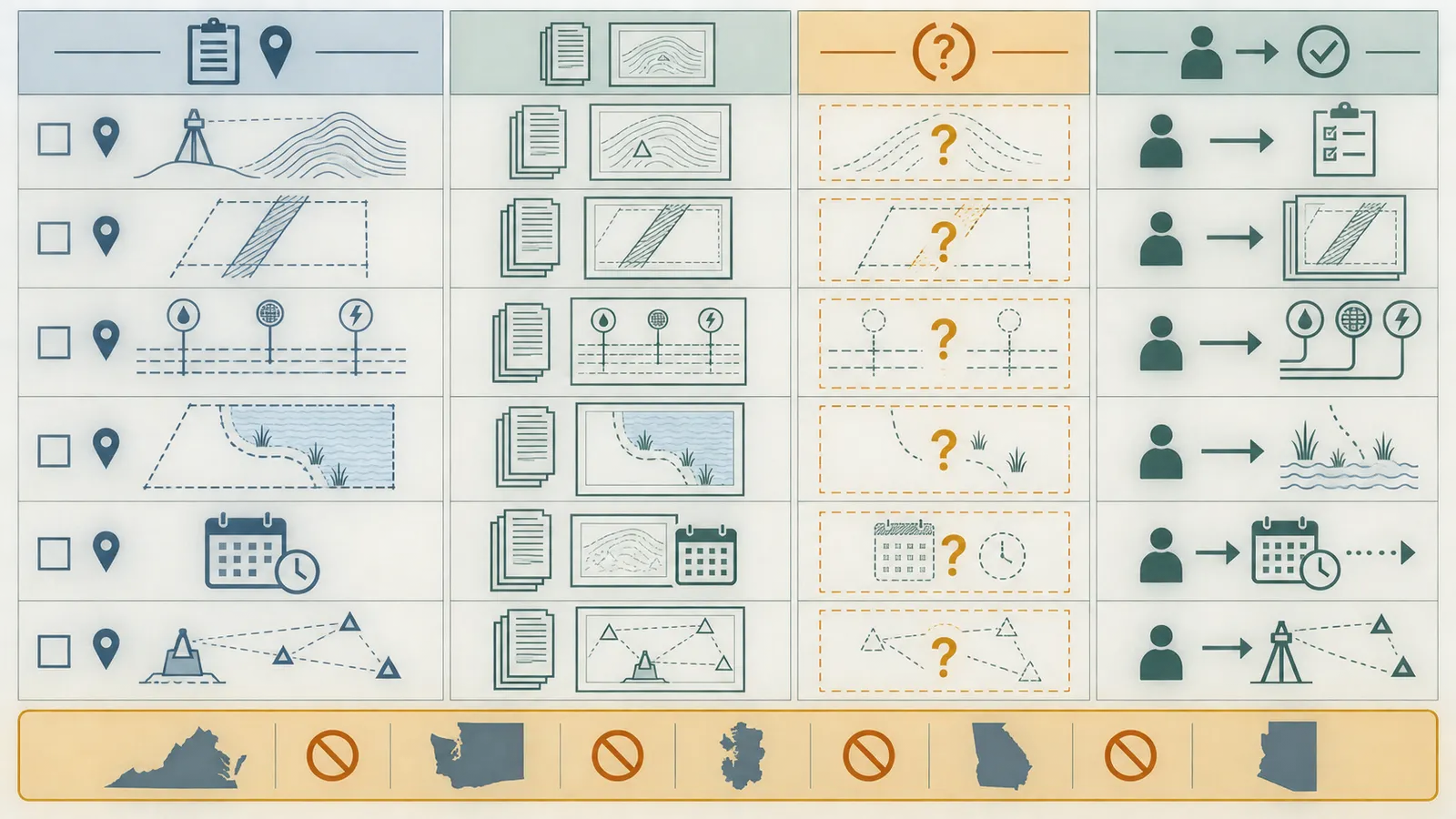
The worksheet is complete only when every row has an evidence reference, a responsible person and a next action; “looks fine” is not a verification status.
Copy the following into your project log. Use one row per item, not one general note per category. The “evidence reference” can be a sheet number, note, layer name, file name, record book/page, authority checklist line or written response. Keep the original delivered files unchanged and store corrected versions with revision dates.
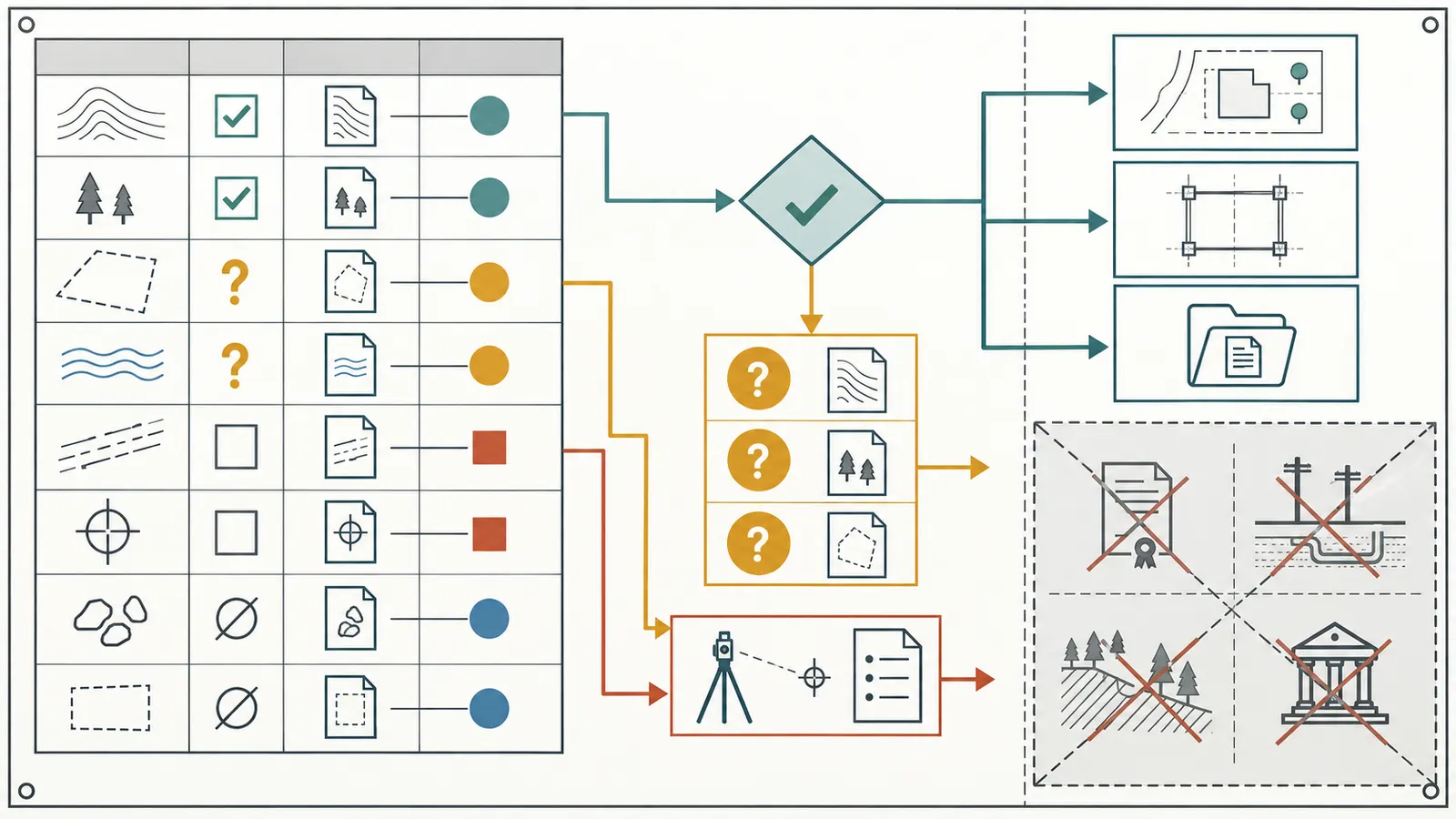
Survey-acceptance worksheet
Project identity
- Parcel address: ______________________________
- Assessor parcel number: ______________________
- Legal description / lot and block / recorded plat: ______________________
- State, county and municipality: ______________________________
- Inside city limits? Yes / No / Unconfirmed
- Reviewing authority and application type: ______________________________
- Local checklist URL or file and accessed date: ______________________________
- Intended next decision: concept siting / civil base / site-plan review / other: ______________________________
Package inventory
| Item | Delivered? | Evidence reference | Status: confirmed / unclear / missing / N/A | Owner of next action |
|---|---|---|---|---|
| Signed and dated PDF | ||||
| Native CAD or GIS files, if promised | ||||
| Point file or surface, if promised | ||||
| Metadata, control report or field notes, if promised | ||||
| Proposal and scope | ||||
| Revision history |
Identity and boundary-source review
| Item to verify | Evidence reference | Status | Question or action |
|---|---|---|---|
| Address and parcel number match the owner record | |||
| Legal description or recorded plat identified | |||
| State, county and city/unincorporated status correct | |||
| Survey scope states boundary, topographic and exclusions | |||
| Surveyor and firm identified; seal/signature/date readable | |||
| Deeds, plats, rights of way, adjoining descriptions or other sources identified where relevant | |||
| Found/set monuments and boundary conflicts explained | |||
| Easement or restriction sources identified |
Control and metadata review
| Item to verify | Evidence reference | Status | Question or action |
|---|---|---|---|
| Field date(s) recorded | |||
| Imagery/lidar or other source dates recorded | |||
| Sheet preparation, revision and certification dates recorded | |||
| Field, GNSS, lidar, photogrammetry or hybrid method stated | |||
| Obscured, excluded, approximate or uncertified areas identified | |||
| Horizontal units and coordinate system stated | |||
| Vertical units stated | |||
| Vertical datum and basis of tie stated | |||
| Benchmark/TBM reference, description, location and elevation stated | |||
| North arrow, source of meridian, graphic and numerical scale shown | |||
| Contour interval and vertical-accuracy statement or applicable standard identified | |||
| Digital files use the same units, datum and coordinate basis as the sheet |
Existing-feature review
| Item to verify | Evidence reference | Status | Question or action |
|---|---|---|---|
| Existing contours, spot elevations and grade breaks | |||
| Road edge, curb, ditch, driveway and access features | |||
| Drainage, swales, culverts, inlets, outlets and flow clues | |||
| Visible overhead and surface utility features | |||
| Structures, fences, walls, rockeries and relevant elevations | |||
| Trees or vegetation limits if in scope | |||
| Streams, wetlands, flood hazards, steep slopes or other critical-area notes | |||
| Feature outside survey limits or based on record/public data clearly labeled |
Local release review
| Local requirement | Survey or supporting document | Status | Responsible follow-up |
|---|---|---|---|
| Current survey-age rule or update requirement | |||
| Required datum and contour interval | |||
| Required benchmark/TBM or control | |||
| Boundary, easement and right-of-way content | |||
| Utility, drainage and access content | |||
| Critical-area, floodplain, slope or geotechnical trigger | |||
| Surveyor seal, signature, license or certification | |||
| Required civil, grading, septic or environmental handoff |
Release decision
- Decision: rely for stated stage / clarify before relying / supplement before relying
- Exact stage released: __________________________________________
- Unresolved items: _____________________________________________
- Surveyor questions sent on: ___________________________________
- Civil/architect questions sent on: ______________________________
- Authority confirmation requested on: ___________________________
- Person approving the handoff: _________________________________
- Date and revision of package released: _________________________
How to use statuses without pretending to certify
Mark confirmed only when the item is supported by a readable document reference or a written professional response. Mark unclear when a note exists but its scope, unit, datum, source or effect is ambiguous. Mark missing when the item is required for the intended stage but absent from the package. Mark not applicable only when the reason is written, such as “no existing structure on vacant parcel” or “tree inventory outside this project scope.”
Do not mark an item confirmed because a contractor, neighbor or online map says it is probably true. A homeowner can confirm that a label exists; the surveyor confirms what the label means and whether it satisfies the professional scope. A local authority confirms what it will accept for its review path.
The written clarification request
Use a numbered request that forces a useful answer without telling the surveyor how to practice:
Please review the attached survey package for [parcel]. Our next decision is [concept siting / civil base / local site-plan review]. Please respond to each item below and identify whether the answer requires a corrected sheet, metadata, supplemental fieldwork or a different professional scope.
- Confirm the parcel identity, recorded boundary source and any unresolved boundary or easement conflict.
- Confirm field dates, data sources, methods, units, horizontal system, vertical datum and benchmark/TBM basis.
- Identify any area, feature or elevation that was obscured, interpolated, approximate, based on record/public data or not certified.
- Confirm whether the contour interval and spot elevations are adequate for our stated next decision, including the proposed building area and driveway once sketched.
- Explain any visible drainage or utility feature that is absent from the sheet, and state what is outside the survey scope.
- Identify the local checklist items that require a civil designer, engineer, utility locate, geotechnical professional, environmental delineation or authority confirmation rather than survey revision.
Attach the checklist and the proposed concept only if it is clearly labeled preliminary. Ask for the surveyor's answer in the project record. If the answer says “contact your engineer,” do not treat that as a failure; route the question to the civil designer with the surveyor's limitation attached.
Handoff matrix: who answers what
| Question | First responsible person | Supporting record | Homeowner's safe action |
|---|---|---|---|
| Does the drawing identify the correct parcel and boundary evidence? | Licensed surveyor; title professional for title questions | Survey, deed, plat, record references | Compare identifiers and ask for a written conflict explanation. |
| Are units, datum, benchmark and method sufficient? | Licensed surveyor | Signed sheet, metadata, control notes | Record labels and ask for clarification; do not convert values yourself. |
| Is a contour interval or spot set adequate for a proposed house? | Surveyor and civil designer | Survey, concept footprint, local checklist | Hold the concept if a missing point changes the decision. |
| Is a feature a wetland, flood hazard or critical area? | Appropriate qualified specialist and local authority | Survey note, authority map, delineation or report | Ask which review applies; do not self-delineate from the map. |
| Where are buried utilities? | Utility owner/locator and qualified designer | 811 ticket, private-locate record, utility plans | Call 811 before digging and ask about private facilities. |
| Does the site plan meet the local submittal list? | Local authority or permitting professional | Current checklist, coordinated plan set | Save the checklist and request a review of unresolved items. |
| Can the site support the home? | Civil, geotechnical, structural and other qualified professionals as applicable | Reports, calculations and design documents | Treat the survey as an input, not a buildability conclusion. |
The next decision is whether the worksheet is ready to sign as a stage-specific release. If any item has no responsible owner or evidence reference, it is not ready.
Choose the next decision: rely, clarify or supplement #
After the worksheet, make a narrow stage decision: release the package for the stated concept, return a written clarification list, or commission supplemental work; never use “survey accepted” as a blanket approval for all future design and construction.
Release for concept siting when the dependencies are visible
You may release the survey for a preliminary concept when all of the following are true for the stated site and local process:
- parcel identity, jurisdiction and scope match the project;
- the responsible surveyor, date, revision and deliverables are clear;
- units, scale, north, horizontal basis and vertical datum are readable;
- a benchmark or control explanation exists and is usable for the next professional;
- contours, spots and grade breaks cover the likely house and access zones at a level the designer says is adequate;
- visible drainage and utility features are represented or limitations are explicit;
- easements, rights of way and critical-area notes are mapped or assigned for follow-up;
- the local checklist has been compared, with unresolved specialist items called out;
- the architect or civil designer understands every limitation and the release says “concept” rather than “permit-ready”; and
- no hazardous field verification or excavation is being delegated to the homeowner.
This release allows a designer to ask “Which of these concept locations fits the known constraints?” It does not allow the homeowner to state “The lot drains this way,” “The foundation will be at this elevation,” or “The utilities are clear” unless the appropriate professional has made that conclusion.
Return for clarification when a document answer could resolve the gap
Choose clarification when the likely fix is a written explanation, corrected note, metadata file, layer export or revised sheet. Examples include:
- an unlabeled unit or vertical datum;
- a benchmark with no description or elevation;
- a contour interval omitted from the title block;
- a visible structure or manhole that is absent but may have been missed;
- a feature labeled approximate with no stated consequence;
- a boundary or easement reference that is listed in the proposal but not on the sheet;
- a CAD file that opens at a different scale than the signed PDF;
- a local checklist item whose responsible party is unclear;
- a surveyor's response that was given verbally but not documented.
Ask whether the clarification changes the signed deliverable or only adds metadata. Preserve the old revision and note the new revision. If a clarification changes an elevation, boundary line, feature location or stated accuracy, treat it as a material revision and send the corrected package to every downstream professional.
Commission supplemental work when the decision needs new information
Choose supplementation when no explanation can create the missing observation or control. Examples include:
- the proposed house lies in an obscured or uncertified area;
- current grading, erosion, wall construction or a driveway has changed the ground since field work;
- the local authority requires a newer survey or field certification;
- the design needs spot elevations or breaklines not collected in the original scope;
- a benchmark cannot be recovered or does not meet the local control requirement;
- the site contains a drainage, slope, wetland, flood or access question outside the survey scope;
- the digital surface lacks the features needed to coordinate civil and architectural design;
- the boundary or easement conflict needs additional record research or field evidence;
- private buried utilities must be located before test pits or construction.
Ask for a written supplemental scope, deliverable list, field method, expected precision, control basis, revision procedure and price before authorizing the work. The surveyor may recommend a civil engineer, geotechnical professional, utility locator, arborist, wetland professional or permitting authority instead. That referral is part of a good handoff.
Common failure cases and the safest correction
| Failure | Why it matters | Safest next action |
|---|---|---|
| Homeowner accepts a seller's old topo because it has contours | Age, scope and conditions may not match the current project or local requirement | Give it to the licensed surveyor and authority as background only; ask whether it can be relied on or needs an update. |
| Architect scales a screenshot from a PDF | Screen pixels, print scaling and omitted metadata can create false dimensions | Use the signed survey and native files; have the designer confirm units and scale. |
| A local rule is copied into a different state | Survey and site-plan requirements vary by authority | Identify the actual jurisdiction and obtain its current checklist. |
| Boundary line is moved to fit an aerial photo | Aerial imagery is not the surveyor's boundary analysis | Ask the surveyor about the apparent mismatch and record the response. |
| Utility symbol is treated as a verified buried line | Surface evidence and record data do not establish buried location or depth | Contact utility owners, follow 811 requirements before digging and ask about private locating. |
| A drainage arrow is treated as a drainage design | Existing flow representation does not provide sizing, permits or downstream acceptance | Send the survey to the civil designer and hold grading conclusions. |
| Missing tree, wall or wetland is assumed absent | The item may be outside scope, obscured or a separate specialist task | Ask what the method could observe and whether an authority-specific study is required. |
| “Not for construction” is ignored | The deliverable may be unsuitable for construction staking or final design | Respect the limitation and ask what stage it is intended to support. |
| Contractor is asked to fix a survey conflict in the field | Construction crew may not have authority or survey scope to resolve boundary/control questions | Return the issue to the surveyor and design team before layout or excavation. |
| Survey is accepted once, then reused for a later permit | Later stages can require current conditions, different control or more detail | Re-run the worksheet for each material design or permit milestone. |
Moderate-safety boundaries
The review can be performed from documents and safe observations. Do not enter a steep bank, unstable slope, standing-water area, construction excavation, road hazard or neighboring property to verify a feature. Do not uncover monuments, dig test holes, probe for utilities, open manholes, climb walls or use electrical or excavation equipment as part of this checklist.
Survey control, boundary retracement, utility locating, excavation, confined-space entry, slope work, drainage excavation, retaining-wall decisions and structural or geotechnical conclusions belong to qualified professionals following the applicable local safety rules. Before any digging, call 811 through the applicable state process; PHMSA explains that the one-call process is for homeowners as well as professional excavators. A ticket is not a substitute for a private-utility locate or safe excavation procedure.
This article cannot remotely assess a parcel. Weather, vegetation, access, active construction, seasonal water and later site changes can defeat document-only review. The safest output is therefore a bounded record: “released for this stage, with these limitations,” not “verified forever.”
Final handoff packet
Before the architect or civil designer begins site-responsive concept work, send:
- the signed survey and every delivered digital file;
- the proposal, scope, revision history and surveyor contact;
- the completed worksheet with evidence references;
- the current local checklist and a difference list;
- a parcel record, recorded plat or deed reference used for questions;
- photos labeled as homeowner observations, not survey measurements;
- a short list of unresolved issues and the person responsible for each;
- the intended stage and the sentence describing what the designer may rely on;
- any written surveyor, utility, civil, geotechnical, environmental or authority responses; and
- the next review date or design milestone at which the worksheet will be revisited.
Tell the designer what not to infer. A useful cover note says: “Use this package for preliminary comparison of house and access concepts. Do not treat it as title certification, buried-utility locating, geotechnical evidence, drainage design, permit approval or construction staking. The attached worksheet identifies the open items.”
The next decision after verification
If the package is released for concept siting, the next decision is which house and access alternatives respect the known boundaries, easements, grades, drainage clues, utilities and critical-area triggers. Link the survey to the broader Brictale land-planning journey, then give the accepted control and constraints to the design journey. If the concept creates a grade, drainage, access or utility dependency, route it to the construction-planning journey only after the responsible professional has defined the next field or design task.
If the package is returned, do not let design momentum turn an unresolved item into an assumption. Send the numbered clarification, keep the status visible and update the worksheet when the surveyor responds. If it is supplemented, add the new scope, control and revision to the same record and recheck every downstream drawing that used the old information.
The goal is not to make a homeowner an unpaid survey reviewer. It is to make the handoff precise enough that the licensed surveyor, civil designer, architect and local authority can each answer the question that belongs to them. A survey earns reliance for a stated stage when its parcel, control, features, limitations and local requirements are traceable. Until then, the correct next action is clarification or supplemental work—not house placement by eye.
Cite this guide
Brictale. “How to Verify a Vacant-Lot Topographic Survey Before a Site Plan.” Published 2026-09-22; updated 2026-09-22.
https://brictale.com/build/land/verify-vacant-land-topographic-survey-before-site-plan · Read the Markdown version
Original contribution: Survey acceptance worksheet: release, clarify or supplement. A source-derived homeowner worksheet that reconciles parcel identity, survey scope, field date, control, datum, elevation detail, visible site features, easements, critical areas, omissions and the local site-plan checklist before house siting proceeds.
Sources and scope
Evidence behind this page
- Virginia's minimum topographic-survey content includes visible improvements and visible evidence of underground features when the methodology and scale allow, elevations as spots, contours or digital terrain models, a nearby benchmark with the vertical datum and basis stated, survey identity, preparer information, date, scale, contour interval, north arrow, source of meridian, nearby reference, units, coordinate system and a method/date/accuracy statement.
Commonwealth of Virginia regulations for topographic surveys performed under Virginia survey law; used as a jurisdiction-specific checklist example, not a national rule.
Accessed · Link to this claim - Virginia's rule provides scale-and-contour combinations and separate vertical and horizontal positional-accuracy tables; the listed vertical values are stated at the 95% confidence level and the professional remains responsible for work appropriate to field conditions.
18VAC10-20-382, subsections C and accuracy tables
Commonwealth of Virginia minimum standards; examples of how a local rule can express accuracy, not a universal tolerance for a homeowner's lot.
Accessed · Link to this claim - The City of Bellevue, Washington, requires a residential site plan to accurately depict property lines, setbacks, streets, rights of way and easements, and says residential and civil plans must be coordinated so they do not contradict each other; its checklist also calls for utilities, structures, trees, critical areas and other site information.
Residential Site Plan | City of Bellevue
City of Bellevue, Washington, residential site-plan guidance; applies to Bellevue submittals and is not a national checklist.
Accessed · Link to this claim - Georgia's property-survey rule says the surveyor should obtain and analyze deeds, maps, title certificates, centerline and right-of-way data, adjacent descriptions and other available boundary information, connect available monuments in the field, and explain conflicts or uncertainty when the field survey cannot be reconciled with record title.
Georgia Rule 180-7-.02, Land Titles and Location
Georgia technical standards for property surveys; used to explain boundary-source questions and the responsible surveyor's role, not to certify title or boundaries for another state.
Accessed · Link to this claim - Georgia's topography rule requires elevation work to state the vertical datum and how it was verified or placed, identify the survey type and contour interval or vertical precision, show at least three fixed positions usable for future vertical control, and clearly explain portions that are not certified or reliable; field-run work must state field dates and equipment.
Georgia Rule 180-7-.04, Topography and Vertical Measurements
Georgia technical standards for topographic and elevation surveys; it is a state-specific example of control and reliability disclosures.
Accessed · Link to this claim - Maricopa County, Arizona's engineered plan submittal requirements call for a current topographic survey with field-survey date, require a certification of accuracy for field surveys older than one year, and call for a certified temporary benchmark tied to site datum within 400 feet horizontally and no more than 6 feet vertically from the structure location, with a description and height relative to grade.
Maricopa County, Arizona, engineered-plan submittal checklist; age, TBM and location requirements are local and program-specific.
Accessed · Link to this claim - The U.S. Department of Transportation's Pipeline and Hazardous Materials Safety Administration says homeowners and professional excavators should contact the one-call center by calling 811 before digging so affected facility operators can locate and mark underground facilities; the call does not turn a topographic survey into a buried-utility locate.
Call Before You Dig! | PHMSA Stakeholder Communications
Federal safe-digging guidance about the 811 notification process; state timing, private facilities and marking limits still vary.
Accessed · Link to this claim