How to Verify a Vacant Lot’s Fill and Compaction History Before Buying
A source-backed U.S. workflow to check vacant-lot fill records, soil screening, elevation limits and geotechnical follow-up before you buy.
The short answer
Before buying, trace the parcel’s grading and development records, map the proposed house area, use NRCS and USGS data only as screening, document visible clues, and ask a qualified surveyor and geotechnical professional to close the remaining gaps. Proceed only when the evidence maps to the proposed site and local process; otherwise write a due-diligence contingency or reject the lot.How to Verify a Vacant Lot’s Fill and Compaction History Before Buying
Before buying, trace the parcel’s grading and development records, map the proposed house area, use NRCS and USGS data only as screening, document visible clues, and ask a qualified surveyor and geotechnical professional to close the remaining gaps. Proceed only when the evidence maps to the proposed site and local process; otherwise write a due-diligence contingency or reject the lot.
A vacant lot can look level, dry and ready for a house while still containing fill of unknown origin, variable thickness, buried debris, or material that was placed without a documented compaction process. The buyer’s job is not to certify a foundation from a website, a seller statement or a casual walk. The job is to decide whether the evidence is strong enough for the next commitment: proceed with ordinary project planning, keep the purchase conditional while professionals investigate, or stop before closing. This guide covers a United States purchase for a homeowner choosing a house site. It does not declare buildability, replace a boundary or topographic survey, replace a geotechnical investigation, decide whether a permit is required, or provide legal advice. Local examples name El Dorado County, Walnut Creek, Danville, all in California, Portland, Oregon, and Pima County, Arizona; your actual city or county controls your project.
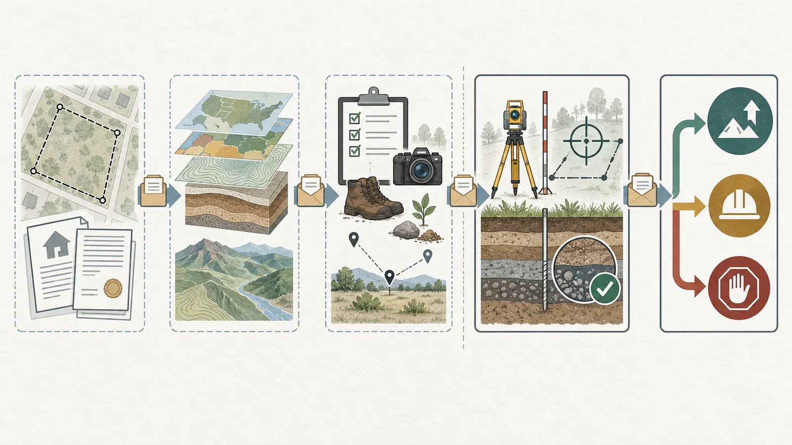
1. Treat fill history as a three-way evidence decision, not a yes-or-no soil question #
The right pre-purchase question is: “What does the current evidence prove about the proposed house area, what remains unknown, who can close each gap, and what must happen before my contingency expires?” A lot should move to Proceed only when the record, location and professional verification align. It should remain in Contingency when a material unknown can still be investigated on a defined schedule. It should move to Stop when the risk cannot be investigated, the cost or redesign is incompatible with the plan, or the seller will not provide the access and records needed to make a responsible decision.
Originality brief
Current answers: Existing results tend to explain cut and fill in generic terms, offer contractor-oriented calculators, publish separate local grading-permit pages, or mention soil reports, slopes and rough earthwork without tracing the buyer’s evidence chain. Missing decision: A homeowner needs to decide whether the evidence about this proposed house area is sufficient to proceed, whether to keep the purchase contingent on defined investigation, or whether to reject the lot before closing. Original contribution: The Fill Evidence Decision Matrix and worksheet connects records, field observations, survey inputs and geotechnical actions by proof, remaining unknown, responsible person, handoff and Proceed/Contingency/Stop outcome. How it can be checked: Reproduce each matrix row from the cited evidence IDs and the buyer’s parcel records; compare the mapped area and dates with the survey and professional report; then rerun the labeled illustrative cut-fill inputs, formulas and sensitivity. A row is not complete until its unresolved question, owner, deadline and action are written down. This is an editorial gap statement and verification method, not a market survey or firsthand investigation.
What “fill,” “engineered fill” and “compaction history” mean in a buyer’s file
Fill is soil or other earth material placed to change the ground surface. It may have been imported from another location, cut elsewhere on the parcel, reused from an excavation, or placed as part of a road, pad, drainage, utility or subdivision project. The word itself says nothing about whether it is suitable under a future house. “Engineered fill” is not a magic quality label either. In a useful record, it is connected to a defined material, a placement method, a target or acceptance criterion, a location, an inspection or testing record, and a professional conclusion about the proposed use.
Compaction is the densification of soil using mechanical energy, often with moisture adjustment. The purpose is generally to improve load-carrying behavior and reduce potential for long-term settlement, but the result depends on the material, water content, equipment, lift thickness, test method and the location tested. That technical distinction is consistent with Federal Highway Administration geotechnical guidance, which separates laboratory moisture-density relationships from field compaction control and explains why the laboratory reference must be related to what was actually placed in the field. FHWA’s geotechnical guidance explains the purpose and limits of compaction control.
For a homeowner, a compaction history is therefore a chain of evidence, not a single number. A report that says “95 percent” without identifying the reference test, material, location, depth and test date is not enough to know what was tested. A permit that was issued without a final inspection is not the same as accepted fill. A clean tax record is not a grading record. A broad soil map is not a statement about a small house pad.
The most useful distinction is between evidence that describes the past and evidence that supports the proposed future use:
| Evidence state | What the buyer can responsibly say | What the buyer cannot say yet | Next handoff |
|---|---|---|---|
| Documented | A named record shows that a particular grading or fill activity was planned, reported or inspected in a stated area and time. | The entire parcel has uniform, suitable support for a future house. | Surveyor and geotechnical professional map the record to the current house concept. |
| Screened | Public soil, elevation, aerial, permit-index or field clues identify a question, pattern or possible constraint. | The screen certifies fill thickness, density, bearing, settlement performance or buildability. | Buyer gives the screen and parcel packet to a qualified local professional. |
| Verified for the decision | A site-specific professional report identifies the tested or observed ground in the proposed area and gives recommendations tied to the concept and local process. | That every future design change or construction condition is covered forever. | Buyer, designer, civil engineer, builder and permitting authority use the stated assumptions and update them when the plan changes. |
This vocabulary prevents a common failure: treating a record about one driveway, a soil map for a whole survey area, or a compaction test at the edge of a pad as proof for a two-story house, retaining wall and utility trench somewhere else. The location relationship is as important as the document’s title.
The original contribution and how to check it
The article’s original contribution is the Fill Evidence Decision Matrix and worksheet. It is a source-backed comparison of record types, field observations, survey inputs and geotechnical actions. It makes the decision auditable by requiring eight fields for every clue: record type, field observation, survey or report input, what it proves, what remains unknown, responsible professional, handoff and Proceed/Contingency/Stop action.
The method is practical rather than empirical: collect the parcel packet; classify each item as documented, screened or verified; map each item to a physical location and a date; assign the person who can close the gap; then use the illustrative cut-fill calculation and sensitivity to test whether an earthwork assumption is robust enough for an offer. The calculation uses cubic feet and cubic yards, labels every modeled input and does not represent a site conclusion. The limitations are important: the matrix is not a survey, geotechnical report, compaction certification, environmental assessment, permit determination or legal advice. Its evidence IDs are nrcs-wss-purpose, nrcs-homebuyer-screen, nrcs-onsite-limit, usgs-3dep-quality, usgs-ql-metrics, fhwa-compaction-purpose, epa-coverage-threshold, epa-operator-responsibility, eldorado-plan-inputs, walnut-creek-triggers, portland-records-warning, danville-grading-triggers and pima-grading-types; each resolves to the claim-level records in evidence.json.
Method: For each evidence type, map its source, location, proof, unresolved uncertainty, responsible professional, handoff and action. The worked cut-fill example uses labeled illustrative inputs, cubic-foot and cubic-yard conversions, and sensitivity to shrinkage and unsuitable material.
Limitations: This is an editorial planning tool, not a survey, geotechnical report, compaction certification, environmental assessment, permit determination or legal advice. Local requirements and site conclusions belong to the buyer's actual city or county and qualified professionals.
Set your decision boundary before you fall in love with the lot
Write down the decision before opening the first PDF. For example: “I will not close unless the proposed house area has either a credible prior fill record accepted by the appropriate authority and reviewed by a geotechnical professional, or a current investigation that defines the remaining treatment and cost.” That is a planning boundary, not a conclusion about the parcel.
Also write down what would be financially or operationally unacceptable. Examples include a likely house-pad relocation, removal and replacement of a large volume of material, a retaining system that consumes the setback, a foundation approach outside the design budget, a schedule delay beyond the loan or rate lock, or an unresolved environmental concern. Do not put a made-up dollar allowance on an unknown simply to keep the offer moving. Put a range or an explicit “not yet priced” entry in the worksheet and ask the relevant professional to define the next investigation.
Your buyer’s agent or attorney should translate that boundary into the purchase agreement and inspection or due-diligence deadlines for the actual transaction. The article can explain the questions; it cannot draft a jurisdiction-specific contingency or tell you whether a seller’s disclosure satisfies local law.
2. Build a parcel-specific record chain before you interpret the ground #
Start with records tied to the exact parcel number, legal description, street address and jurisdiction, then connect each record to a map and a physical area. A seller’s statement, assessor description or old aerial may be a lead, but it is not a complete fill history. The minimum useful packet includes the current parcel identity, prior development or subdivision records, grading and drainage permits, approved plans, inspection or final documents, geotechnical or engineering-geology reports, compaction or soils testing, and notices or corrections that explain what was not completed.
Confirm who regulates the parcel
The same mailing address can involve a city, county, special district, flood-control agency, state environmental agency or another authority. Before requesting records, establish:
- The state, county and incorporated city or town.
- The assessor’s parcel number and any prior parcel numbers.
- The legal description and recorded subdivision or lot number.
- Whether the parcel was created by subdivision, lot line adjustment, merger or a larger development.
- Whether the proposed house area crosses an easement, public right-of-way, drainage corridor or neighboring parcel.
- Which office accepts grading, site-development, building, erosion-control or stormwater applications.
This step is more than administration. A grading plan for a subdivision may be stored under the original development name or a neighboring address. A permit index may show a project number but not the attached final report. A later parcel split can make a plan’s limits difficult to recognize. Ask the authority how the records are indexed, whether archived files are available, and whether a records request needs the parcel owner’s authorization.
Request the record categories that can establish a chain
Ask for records using plain categories and synonyms. A concise request can include “grading,” “earthwork,” “fill,” “cut and fill,” “site development,” “drainage,” “erosion control,” “subdivision improvement,” “soils,” “geotechnical,” “engineering geology,” “compaction,” “density testing,” “special inspection,” “as-built,” “final,” “certificate,” “notice of violation,” “stop work,” “stockpile,” “retaining wall,” “roadway,” “utility,” “septic,” and “stormwater.” The exact vocabulary differs by agency, so include the parcel number and a map with the likely house area.
For each result, save the full document and record:
- The issuing authority and project or permit number.
- The date submitted, approved, inspected, closed or superseded.
- The applicant, owner and professional of record, if shown.
- The plan’s north arrow, scale, benchmark or coordinate reference.
- The area of cut, fill, stockpile, road, drainage and proposed structure.
- The elevations and vertical datum, if stated.
- The material description and any source or disposal location.
- The stated lift thickness, moisture or density criteria, test method and test locations, if present.
- The final status: approved, accepted, inspected, incomplete, expired, withdrawn, corrected or unknown.
- The pages that contain signatures, stamps, test tables, maps and exceptions.
Do not treat “permit found” as “work accepted.” A plan can describe proposed work that was never built, or work can have changed through field revisions. A final compaction report can cover only a road or building pad and not the entire lot. A testing agency’s invoice can show that someone visited without showing the result. The handoff to the geotechnical professional is to compare the record’s stated limits with the current concept and identify the missing proof.
Separate assessor and tax information from permit history
Portland, Oregon’s residential permitting guidance makes a narrow but valuable records point: for a house’s permit history, verify permit records rather than relying on county assessor tax information. That page is about retaining walls and Portland’s process, not a national rule about every vacant lot, but the buyer’s reasoning generalizes safely: an assessor record can help identify parcel identity or tax description; it does not, by itself, prove grading design, fill placement or acceptance. Portland’s guidance specifically warns readers to verify permit records instead of relying on assessor tax information for permit history.
Treat listing language the same way. “Ready to build,” “graded lot,” “pad prepared,” “engineered fill” and “soil tested” are search terms for records and questions. Ask who prepared the report, when, for which parcel, at what locations, under what proposed use, and whether a final or acceptance document exists. If the answer is “the previous owner said so,” record the statement as an unverified lead.
Use a records-request handoff that preserves context
Send the professional a single folder rather than a pile of unlabeled downloads. Use names such as 01-parcel-records, 02-grading-permits, 03-plans, 04-soils-and-compaction, 05-photos-and-observations, and 06-current-concept. Add a one-page index with document title, source, date, page count, location covered and open question. Keep the original file and an unmodified copy; do not crop the only version of a plan or change a PDF’s page order.
On a plan, mark the proposed house footprint, driveway, retaining walls, septic or utility areas only on a working copy and state that the mark-up is the buyer’s concept, not an engineered layout. The surveyor needs the parcel boundary and elevation basis. The geotechnical professional needs the records, planned loads or house type, cut-and-fill concept, expected finished-floor elevation and schedule for access. The designer or civil engineer needs the site constraints and the professional’s recommendations. That sequence makes the next person’s job answerable.
3. Use NRCS and USGS data to screen the question, not to certify the house site #
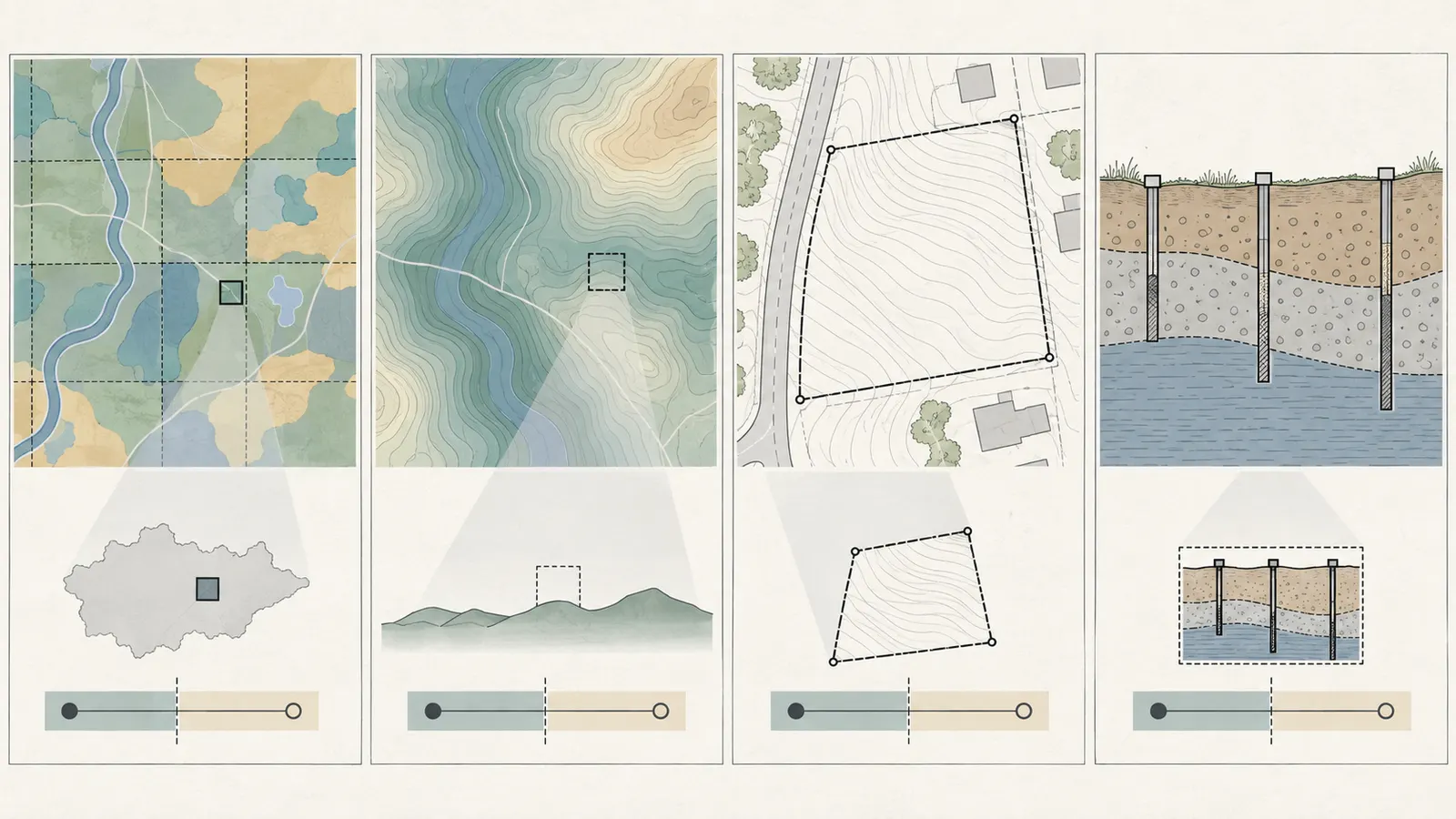
Use NRCS Web Soil Survey and USGS elevation data to decide what to investigate and where, not to conclude that fill is engineered or a foundation is supported. NRCS provides soil data for land-use and management decisions, and says soil surveys can help a homebuyer evaluate soil-related hazards and limitations such as slope, flooding or ponding, restrictive features and subsidence. NRCS describes Web Soil Survey’s data purpose and downloadable map and tabular information here. NRCS also lists the home-site screening uses and limitations of soil surveys.
A disciplined NRCS screen
Use the exact proposed area of interest rather than a county-wide map. If the lot is small, draw a polygon around the parcel and a second polygon around the likely house, driveway and disturbed areas. Save the map, map-unit labels, report settings and access date. Then examine the map units that intersect the concept. Your questions should include:
- What native soil or miscellaneous land type is mapped beneath the surface?
- What slope range and landscape position are described?
- Is there a mapped concern for flooding, ponding, wetness, a restrictive layer, shallow bedrock or subsidence?
- What depth range does the interpretation address, and does it say whether minor components may occur?
- Is the map unit likely to cross the parcel or proposed pad in a way that needs field confirmation?
- Does past construction appear likely to have removed, buried or mixed the mapped native soil?
The output is a screening statement such as: “The proposed pad intersects two mapped units, and the soil-survey interpretation flags a shallow restrictive feature and slope variability; past grading could make the map less representative, so the geotechnical scope should investigate those locations.” It is not: “The soil report says the house is fine.”
NRCS guidance is explicit that final site selection and design criteria for expensive installations may need an on-site investigation because standard soil-survey information is not specific enough. The National Soil Survey Handbook sets that on-site-investigation limit for final site selection and design criteria. That is especially important for a lot with undocumented fill: a map of natural soil may describe what would have been expected before construction, while the buyer’s risk is often the human-made layer above, below or mixed with it.
A disciplined elevation screen
USGS 3DEP products are useful for seeing regional landform, drainage context, slope breaks and broad elevation patterns. USGS says 3DEP data are built under standards and specifications and include bare-earth digital elevation models at several resolutions. USGS explains the standards, elevation products and bare-earth DEM context for 3DEP.
Check the dataset metadata before using a hillshade or contour layer. The published USGS quality-level table shows that QL2, for example, has a 10-centimeter RMSEz value, nominal pulse spacing no greater than 0.71 meters, at least 2 points per square meter and a 1-meter DEM cell size. USGS publishes the QL definitions and metrics in its Topographic Data Quality Levels table. Those figures describe a dataset’s quality characteristics; they do not mean every point on a small parcel is known to that tolerance, nor do they establish property corners, finished-floor elevations, buried fill boundaries or a safe excavation limit.
Use elevation data to ask better questions: Does the lot sit on a terrace, old road bench, drainage swale or apparent cut slope? Does the broad surface differ from nearby parcels? Are contour patterns consistent with the seller’s story? Is the source date old enough that later grading may not appear? If the answer affects the offer, order a current topographic survey. Do not scale a screenshot and insert those elevations into a foundation or drainage design.
Illustrative cut-fill math: useful for sensitivity, not a site conclusion
A rough volume screen can tell you whether the seller’s phrase “minor grading” is plausible enough to investigate. It cannot select a grading plan, prove material suitability or predict a contractor’s price. El Dorado County, California’s grading-plan requirements illustrate why a professional plan may need volume estimates adjusted for anticipated swell or shrinkage; that local requirement is not a national formula. El Dorado County lists material-volume estimates adjusted for anticipated swell or shrinkage among its grading-plan inputs.
The following is an illustrative modeled example, not a measurement of the lot:
| Input | Illustrative value | Formula or reason |
|---|---|---|
| Area requiring cut | 4,000 square feet | Conceptual house-pad area only |
| Average cut depth | 1.5 feet | Simplified average; real grades vary across a surface |
| Area requiring compacted fill | 5,000 square feet | Separate conceptual area |
| Average compacted fill depth | 1.0 foot | Simplified average; real fill is shaped in layers |
| Conversion | 27 cubic feet per cubic yard | 1 cubic yard = 27 cubic feet |
| Assumed unsuitable fraction of cut | 20% | Sensitivity assumption, not a soil test |
| Assumed loose-to-compacted shrinkage | 5%, 10% or 15% | Sensitivity range for the model only |
First calculate the simplified bank cut: 4,000 sf × 1.5 ft = 6,000 cf, or 6,000 ÷ 27 = 222.2 cubic yards. The simplified compacted fill requirement is 5,000 sf × 1.0 ft = 5,000 cf, or 5,000 ÷ 27 = 185.2 cubic yards.
Now model two uncertainties. If 20% of the cut is unsuitable or cannot be reused, the potentially usable cut is 222.2 × (1 − 0.20) = 177.8 cubic yards. If the fill must be imported loose and shrinks during placement, the loose volume needed to yield 185.2 cubic yards of compacted fill is 185.2 ÷ (1 − shrinkage).
| Modeled shrinkage | Loose fill needed | Modeled usable cut | Illustrative imported shortfall |
|---|---|---|---|
| 5% | 195.0 cubic yards | 177.8 cubic yards | 17.2 cubic yards |
| 10% | 205.8 cubic yards | 177.8 cubic yards | 28.0 cubic yards |
| 15% | 217.9 cubic yards | 177.8 cubic yards | 40.1 cubic yards |
The sensitivity changes the apparent import requirement by more than 20 cubic yards without changing the conceptual footprint. That does not tell you that the lot needs 17.2, 28.0 or 40.1 cubic yards. It tells you to ask the civil or geotechnical professional for a surface-based quantity estimate, material classification, suitability assumptions, shrink or swell basis, export handling, compaction criteria and the areas actually included. Averages can hide a deep localized cut or a narrow fill wedge that controls a retaining wall or foundation.
Do not add a made-up “compaction percentage” to the model. Percent compaction compares a field density with a specified laboratory reference and is meaningful only when the material, test method and project specification are known. FHWA notes that the appropriate moisture-density laboratory method should match the material and equipment context, and that coarse or unusual fill may need another control approach. FHWA’s discussion of moisture-density testing and field compaction control shows why a bare percentage is incomplete.
4. Walk the lot for clues while keeping yourself out of hazardous work #
The buyer can safely make a documented visual observation from accessible ground, but cannot prove fill thickness or compaction by poking, digging, driving equipment or entering an excavation. Walk after a dry period and, if possible, after rain, with the seller’s permission and the agent’s access rules. Photograph wide context first, then close detail with a scale such as a marked ruler; record the date, weather, approximate location and direction of view. Do not remove soil, disturb suspected debris, or enter a trench, pit, culvert, unstable slope or confined space.
Set up a simple observation grid
Divide the parcel into a sketch grid or use a current parcel map as a base. For each observation, log:
- Location relative to the boundary, road, drainage feature and likely house pad.
- Surface elevation clue: flat bench, mound, swale, terrace, slope break or depression.
- Surface material: native-looking soil, imported gravel, asphalt, concrete, brick, rubble, mulch or mixed debris.
- Vegetation age and uniformity: mature growth, abrupt change, stressed strip, wet patch or newly disturbed area.
- Water behavior: ponding, rilling, seepage, damp line, erosion, sediment fan or outlet.
- Settlement or movement: low spots, cracked pavement, leaning walls, separated curbs, tilted posts or patched driveways.
- Structures and earthwork: retaining walls, berms, drainage swales, culverts, old foundations, utility trenches and stockpiles.
- Evidence quality: directly observed, seller-reported, shown on a record, or still unknown.
Your photographs should answer “where is this?” rather than merely show that it exists. Include the street, a corner, a permanent feature and a direction arrow in separate context photos. A close-up of uniformly colored gravel does not establish whether it is a shallow driveway base or a deep building fill. A depression may be a drainage design, natural settlement, a utility trench or a temporary tire rut. Record the observation without choosing the cause.
Visual clues that justify more investigation
An abrupt change in vegetation or surface texture can indicate a boundary between disturbed and undisturbed ground, but it can also be landscaping. A flat shelf on a sloped lot may be a graded pad, but it may also be a natural terrace. A linear depression can track a utility trench, while a wide swale can be intentional stormwater conveyance. Rubble, wood, asphalt fragments, glass, dark organic soil or unusual odor justify stopping disturbance and asking the appropriate environmental or geotechnical professional what to do next. Do not sort or carry suspected material yourself.
Signs of water matter because water can change how fill behaves and how earthwork must be sequenced. Ponding may reflect a low point, fine-grained soil, a blocked drain, a perched water condition or recent grading. Seepage at a slope toe may be seasonal or persistent. A dry visit cannot prove that the site stays dry. Note whether the seller’s documents show drainage facilities, easements or maintenance obligations and hand that question to the civil or geotechnical professional.
Settlement clues need location context. A crack in a sidewalk beyond the lot may have no relationship to the proposed pad. A depressed strip crossing the lot may be a utility trench, while a broad irregular depression under the conceptual house area is more consequential. You are not diagnosing from the photograph. You are deciding whether the clue changes the professional scope or contingency deadline.
Hazards that change what you may do
Falls, unstable ground, hidden openings, steep slopes, traffic, buried utilities, contaminated soil, dust and water hazards are credible on a previously disturbed lot. Never enter an abandoned excavation or confined space. Never expose a suspected utility by hand or machine without the applicable utility-locate process. Do not ask a general contractor to “test compaction” with a loader or vehicle as a substitute for a scoped investigation. Heavy equipment, test pits, borings, excavation, trenching and sampling belong to appropriately qualified and insured professionals who can plan access, shoring, utility clearance, spoils handling and site restoration.
The Environmental Protection Agency’s construction-stormwater guidance is a reminder that earth disturbance is also a compliance issue: clearing, grading, excavation and stockpiling can be construction activity, and coverage can be required for qualifying disturbance or a larger common plan. EPA defines the construction-stormwater coverage context for earth-disturbing activities and common plans. A buyer doing a pre-purchase walk is not automatically an EPA permit operator, but the future owner and general contractor may have responsibilities once construction starts. Keep observation separate from earthwork.
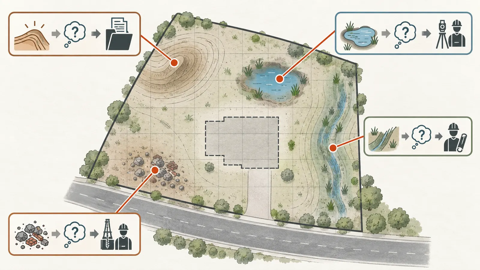
Convert each clue into a question and owner
Do not leave “odd mound” in the notes. Convert it into a handoff:
| Observation | Question to answer | Responsible person | Verification output |
|---|---|---|---|
| Flat bench on a slope | Is this a mapped or documented pad, and where are its fill limits? | Surveyor, then geotechnical professional | Survey surface, record overlay and site-specific recommendation |
| Ponding near the likely driveway | Is drainage temporary, blocked, designed or a sign of poor infiltration? | Civil or geotechnical professional; local authority as needed | Drainage observation and scope recommendation |
| Rubble or unusual material | Is it construction debris, imported aggregate or a possible environmental concern? | Geotechnical or environmental professional | Written material-handling and investigation direction |
| Depression crossing the lot | Does it follow a utility, former road, drain or settlement zone? | Surveyor and utility/records reviewers | Located feature, record match or unresolved investigation item |
| Seller says “engineered fill” | Which report, test locations, limits and final acceptance document support that phrase? | Seller for records; geotechnical professional for current use | Traceable record or contingency item |
The observation is complete when another person can find it, understand why it matters and know what evidence would change the decision. It is not complete when it has a dramatic photograph but no location or requested follow-up.
5. Commission a survey and geotechnical scope that can close the actual gaps #
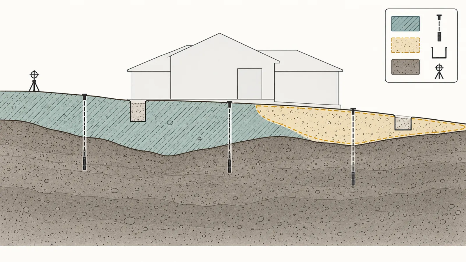
Hire the right professional before the purchase decision becomes irreversible, and give that professional the current house concept plus the full record and observation packet. A boundary or topographic survey answers where the parcel, features and elevations are; a geotechnical investigation answers what subsurface conditions were encountered at selected locations and what design or earthwork actions follow. Neither document is a substitute for the other, and neither can reconstruct missing history perfectly.
Decide what the survey must establish
Ask a licensed surveyor working under the requirements of the actual jurisdiction to state the survey type, control, datum and deliverables. For a fill-history decision, useful inputs may include:
- Boundary evidence, monuments, easements and rights-of-way.
- Existing contours and spot elevations at a scale appropriate to the concept.
- Breaklines such as tops and toes of slopes, walls, berms, swales, ditches and pads.
- Buildings, pavement, drainage structures, exposed utilities and other relevant features.
- A benchmark or control relationship that another professional can use.
- Locations of the observed clues and the proposed house, driveway and retaining work.
El Dorado County, California’s grading page provides a local example of the information a grading plan may require: topographic features and drainage patterns tied to an on-site benchmark, clear boundaries between cut, fill and natural or pre-existing grade, property lines and easements, and cross-sections based on accurate field data. El Dorado County describes those grading-plan inputs and professional certification requirements. That does not mean every U.S. county uses two-foot contours or the same plan size. It shows why a web map or seller sketch is not an interchangeable construction survey.
Tell the surveyor the question is historical and spatial: “Can the current surface and visible features be compared with the prior grading plan, aerial or record?” Ask for an overlay or enough control to allow the geotechnical professional to compare documents. If there is no reliable older surface, say so. A current survey can accurately measure today without proving what happened before today.
Scope the geotechnical question, not just “a soil report”
A useful request describes the decision and asks the professional to recommend the investigation. Include:
- The parcel number, legal description and jurisdiction.
- The proposed house footprint or a range of likely footprints.
- Finished-floor or pad-elevation concepts, clearly labeled preliminary.
- Proposed driveway, retaining walls, pools, septic areas, utilities and major site cuts or fills.
- The records and photos, with suspected fill zones highlighted.
- The intended purchase deadline and the date by which a written recommendation is needed.
- The question: “What evidence is needed to distinguish documented suitable fill from unknown or unsuitable material beneath and adjacent to the proposed work?”
Ask whether the scope will include a records review, reconnaissance, borings, test pits, sampling, laboratory classification, moisture-density testing, field density testing, groundwater observations, slope or retaining-wall considerations, and a written report. The professional decides which methods are appropriate. Do not demand a test count or test depth that you copied from another lot; the parcel’s geology, fill history, access and concept control the scope.
The report should identify the locations actually investigated, the materials encountered, the depth and limits of fill where known, the basis for any engineering parameters, the limitations of access or sampling, and recommendations tied to the proposed concept. If the report says “additional investigation may be required,” ask which event triggers it, who performs it, and when it must occur. An unresolved sentence should become a contingency task, not be hidden in a closing folder.
Understand what tests can and cannot prove
Laboratory moisture-density testing develops a relationship between a material and a compactive effort. A field density test compares an in-place result with the specified laboratory reference or another accepted criterion. A boring or test pit samples or exposes a line through the ground. A proof roll can reveal a soft response under the conditions observed, but is not a universal substitute for subsurface characterization. A visual inspection can identify lift boundaries or material changes where exposed, but it cannot see beneath a continuous surface.
FHWA describes field compaction control as a relationship between the intended material and the process used to densify it; the guidance also explains that method-based, result-based and performance specifications have different meanings, and that coarse rock fill may require a procedure or other control rather than a conventional density reading. FHWA’s earthwork discussion explains why test method, material and specification must travel together.
For buyer due diligence, request the professional’s interpretation in plain terms:
- Does the record or investigation cover the full proposed house footprint or only part of it?
- Are the fill limits horizontal, vertical or both, and how certain are they?
- Is the material identified well enough to assess the proposed load and moisture conditions?
- Are there seams, buried organic layers, debris, voids, perched water or uncontrolled interfaces?
- What settlement, bearing, slope, drainage or excavation issue remains possible?
- What treatment paths are plausible: removal and replacement, reworking, additional fill, drainage, revised layout, alternative foundation design or more investigation?
- Which decision depends on a civil engineer, structural engineer, engineering geologist, environmental professional, building official or testing agency?
Do not convert a professional’s recommendation into a promise that a particular remedy will be cheapest. Ask for the next design input, the assumptions and the verification point during construction.
Assign responsibility for investigation access and observation
The buyer or buyer’s agent usually coordinates permission, schedules and records; the seller controls access under the purchase agreement; the surveyor controls surveying methods; the geotechnical professional controls the technical investigation and interpretation; the testing agency reports its observations or test results; the civil and structural designers apply the recommendations; and the local authority decides permits, reviews and inspections under its jurisdiction. Actual contractual responsibility can differ, so confirm it in the engagement letters and purchase agreement.
If the site investigation needs equipment or excavation, confirm who pays for mobilization, restoration, traffic control, utility locating, access routes, spoil placement and any agency notice. A low-fee desktop review may be valuable as a first screen, but it should not be represented as a subsurface investigation. Conversely, a field visit without a written scope may leave the buyer unable to tell what was and was not examined.
6. Read local grading examples as contrasts, never as a national rule #
The named examples below show why a buyer should not infer fill acceptability from acreage or cubic yards alone: El Dorado County, Walnut Creek, Portland, Danville and Pima County use different triggers and review inputs. The actual city, county, state, tribal or special-district program controls the permit path, and a project can trigger more than one review. Use these examples to identify what to recheck, not to borrow a threshold for another parcel.
El Dorado County, California: detailed grading-plan and erosion inputs
El Dorado County’s grading page says an application may be submitted by the landowner of record, a licensed contractor acting as agent, or an authorized person with written authorization. Its listed plan components include a civil-engineer signature and stamp, topographic features at intervals no greater than two feet unless an alternate interval is authorized, drainage patterns, an on-site benchmark, cut/fill boundaries, property lines and easements, cross-sections based on accurate field data, erosion controls, stockpiles and borrow sites, and an estimate of quantities adjusted for anticipated swell or shrinkage. Read the current El Dorado County grading-plan requirements before relying on this example.
For a buyer, the important handoff is not memorizing the two-foot interval. It is asking whether the prior record contains a location-controlled plan, whether the plan was approved and completed, and whether its field data can be compared with a current survey. The county also describes erosion-control triggers tied to area, exposed soil, watercourses, floodplain and potential sediment discharge. That matters because a fill-history decision can become a drainage and erosion-management decision when the lot is disturbed.
Walnut Creek, California: a site-development permit with numeric triggers
The City of Walnut Creek states that a Site Development Permit is required for grading, drainage and other listed site work. Its page lists grading over 50 cubic yards, fill over 1 foot deep under structures, fill over 3 feet deep outside structures, cuts over 3 feet in vertical height, alteration of a drainage course between properties, and other work among the triggers. The city’s application sequence calls for plans, calculations and supporting documents prepared by licensed professionals, plan check, fees and a preconstruction meeting after approval. Walnut Creek publishes its current Site Development Permit triggers and submittal sequence here.
These Walnut Creek values should not be used as screening cutoffs for a parcel outside Walnut Creek. A Walnut Creek lot with a shallow fill beneath a structure can enter a permit conversation even if the cubic-yard total is modest. A lot in another jurisdiction may use a different threshold, permit name or exemption. If a seller says “it is under the permit limit,” ask “under which code, for which work, measured how, and who confirmed the current rule?”
Portland, Oregon: permit history, engineering and special inspections
Portland’s retaining-wall guidance says a permit-history check should use permit records rather than assessor tax information. It also states that an Oregon-registered engineer must provide stamped drawings and calculations for retaining walls over four feet, that some sites may require a geotechnical report, and that site-development evaluation can address slope and retaining-wall drainage, shallow failures, soil creep, potential settlement, surcharge loads, adjacent-property protection and construction impacts. The page says soils special inspections may be required for complicated foundations, steep slopes, large jobs, retaining walls, landslide remediation or other earthwork-related work, with the geotechnical engineer of record or an approved testing agency performing the inspection. Portland’s page shows how a local review can connect records, engineering and construction inspection.
The scope here is Portland’s retaining-wall process, not a declaration that every vacant lot needs a wall report or that the four-foot value applies elsewhere. For a Portland buyer, however, the page is a direct reason to ask whether prior grading, proposed walls and settlement risk change the permit path and who owns special-inspection work.
Danville, California: fill supporting a structure is itself a trigger
The Town of Danville lists a grading permit requirement for moving more than 100 cubic yards, construction of fill to support a structure, fill on a slope with natural grade steeper than 5:1, cut or fill slopes left steeper than 3:1, and any cut or fill greater than 3 feet at its deepest vertical point. Its submission list includes a grading application, estimated cost and volume, four copies of a grading plan prepared by a registered civil engineer, and, in some cases, geotechnical and engineering-geology reports; the page states hillside projects require those reports. Danville identifies its own grading-permit triggers and possible report requirements.
“Fill supporting a structure” is the buyer-relevant phrase. It shows why a lot can require technical review even if the earthwork quantity is not the largest concern. It also shows why the jurisdiction must be named: Danville’s threshold and report language should not be quoted as a Contra Costa County, California or national rule without checking the actual parcel authority.
Pima County, Arizona: grading area, slope, stockpiles and finished-floor inputs
Pima County lists Type 1 grading-permit circumstances that include a single-dwelling residential development on a single lot with a graded area of 14,000 square feet or more, stockpiling between 100 and 50,000 cubic yards, grading with a permanent cut or fill slope greater than 5 feet high and steeper than 3:1, grading on a slope of 15% or more, and more than 3,000 square feet of new pavement. It lists Type 2 permitting for development requiring a subdivision plat or development plan and separately describes a fugitive-dust permit for certain larger stripping, trenching or blasting activities. Its site-plan checklist calls for the graded area, structures, utilities, existing and proposed elevations, finished-floor elevation, slopes, paving and stabilization methods. Pima County publishes these grading types and administrative submittal inputs.
For a buyer, Pima County’s page reinforces two questions: how large is the total disturbance, not just the footprint, and what finished-floor or drainage concept is being assumed? It also demonstrates that a grading review can involve Regional Flood Control, wastewater, environmental quality or transportation processes depending on scope. Those are Pima County references; your jurisdiction may assign the same questions to different offices or use different triggers.
Use the contrasts to make a local verification call
Call the actual authority with the parcel number and a one-paragraph concept. Ask:
- Which office controls grading, site development, erosion, stormwater and building review for this parcel?
- Is prior fill beneath a future house treated differently from fill in a yard, driveway or landscape area?
- What records are public, and which require a formal request or owner authorization?
- What plan, survey, geotechnical, engineering-geology or soils-inspection documents are normally requested for this scope?
- What thresholds or exemptions are measured by area, volume, depth, slope, structure support or common development plan?
- Does a pre-application meeting provide written direction, and what does it not decide?
- Are separate flood-control, stormwater, dust, septic, utility or right-of-way approvals involved?
Ask for the code or official page link and record the date, staff role and exact parcel scope. A phone answer can guide research but should not be inflated into an approval. EPA also cautions that state-issued NPDES construction-stormwater requirements can differ from EPA-issued requirements and may be more stringent or extensive. EPA explains the relationship between federal and state-issued construction-stormwater permits.
7. Use the Fill Evidence Decision Matrix and worksheet to classify the lot #
Use the Fill Evidence Decision Matrix to force every clue through the same chain: source, location, proof, uncertainty, owner, handoff and action. The matrix is a decision aid, not a grading approval. Complete one row per evidence item and do not upgrade a row from Screened to Verified merely because two weak clues tell the same story.
Fill Evidence Decision Matrix and worksheet
| Record type | Field observation to record | Survey or report input | What it proves | What remains unknown | Responsible professional | Handoff | Action |
|---|---|---|---|---|---|---|---|
| Parcel, subdivision and title records | Parcel corners, lot number, easements, former parcel identity | Boundary survey and legal description | Which land and legal interests the record may cover | Whether the fill crosses an easement or former parcel boundary | Surveyor; title professional for title matters | Give the corrected parcel map to records staff and geotechnical professional | Contingency until the record chain matches the land |
| Grading or site-development permit | Permit number, address, applicant, stated work and status | Current survey overlay with permit limits | That an authority received or reviewed a defined proposal, if status says so | Whether work was built as shown and accepted | Local permitting authority; civil engineer | Compare approved and current surfaces | Proceed only if status and location are clear; otherwise Contingency |
| Approved grading plan | North arrow, scale, contours, cut/fill boundaries, sections, benchmark | Current topographic survey and surface comparison | Intended grades, drainage and limits in the plan | Field changes, buried interfaces and final acceptance | Surveyor and civil engineer | Send marked comparison to geotechnical professional | Contingency until field match is explained |
| Final grading, as-built or acceptance record | Signatures, dates, inspection notes, exceptions | Current survey and agency confirmation | That the named authority or professional recorded a final step, within its scope | Whether the report covered the future footprint and whether conditions changed later | Local authority; civil or geotechnical professional | Confirm status and limits in writing where possible | Proceed only if professional says scope is adequate |
| Compaction or soils test reports | Test location, depth, material, date, method, result and reference | Proposed house and fill-limit overlay | A result at identified locations under stated test conditions | Untested zones, later disturbance, suitability and settlement behavior | Geotechnical professional or testing agency | Geotechnical review of original data and current concept | Contingency if coverage is partial or labels are missing |
| Seller, MLS or assessor information | Exact wording, source and date; no paraphrase | Parcel and permit-record cross-check | A lead or representation to investigate | Reliability, completeness, engineering meaning and current condition | Buyer/agent gathers; professionals verify | Ask seller for underlying records | Never Proceed on this row alone |
| NRCS Web Soil Survey | Map unit, AOI, report settings and mapped constraints | Geotechnical scope and field locations | A regional screening of mapped natural-soil patterns and limitations | Human-made fill, small-scale variation, current conditions and foundation support | Buyer screens; geotechnical professional interprets | Include saved report in investigation packet | Screened; use to target questions |
| USGS 3DEP or other remote elevation | Dataset, date, resolution, hillshade or contour source | Current topographic survey | Broad terrain and drainage-pattern context | Parcel-scale grade, boundaries, buried conditions and construction tolerance | Buyer screens; surveyor verifies | Ask surveyor to resolve decision-critical elevations | Screened; never a pad certification |
| Site walk and photo log | Coordinates or sketch, direction, weather and observation | Survey overlay and professional reconnaissance | Visible clues such as ponding, grade breaks, debris or settlement signs | Cause, depth, continuity and engineering consequence | Buyer observes; geotechnical professional assesses | Send indexed photos before the visit | Contingency when a clue affects the concept |
| Geotechnical reconnaissance | Access limits, exposed conditions and record review | Proposed loads, grades, walls and utilities | A professional opinion on what investigation is appropriate | Subsurface conditions outside observed or tested points | Geotechnical professional | Scope borings, pits, sampling or tests | Contingency until the stated question is answered |
| Borings, test pits or other subsurface exploration | Exact locations, depths, refusal, water and material changes | Survey control and house concept | Conditions encountered at selected points | Conditions between points and later construction changes | Geotechnical professional | Written report with map, logs and limitations | Proceed only for the defined concept and assumptions |
| Current laboratory and field testing | Samples, moisture, density, classification and method | Project specification and design criteria | Measured properties or in-place results under stated methods | Unsampled material, changed moisture, future disturbance and design application | Geotechnical professional and testing agency | Designer applies the recommendations | Proceed or Contingency according to report, never by percentage alone |
| Local pre-application or permit review | Staff direction, authority, date and parcel scope | Current concept and professional reports | How the authority expects the application to be organized | Final plan-check comments, later design changes and other agencies | Buyer, civil engineer and permitting authority | Update the offer and design schedule | Proceed with a documented path, not an assumed approval |
The matrix is deliberately repetitive in one way: every record row asks what remains unknown. That field is the protection against false closure. If the answer is “nothing,” challenge it. Records almost always have scope, date, location or method limits. The professional may conclude that the remaining uncertainty is acceptable for the concept, but the buyer should not manufacture that conclusion in a spreadsheet.
Worksheet A: parcel and record identity
Fill this out before asking for a geotechnical proposal:
- Property street address: ______________________________
- State: __________________ County: __________________ City or town: __________________
- Assessor’s parcel number: ______________________________
- Legal description or subdivision/lot: ______________________________
- Prior parcel numbers or names found: ______________________________
- Proposed house footprint range: ______________________________
- Proposed finished-floor or pad assumption, labeled preliminary: ______________________________
- Driveway, walls, pool, septic and utility areas included: ______________________________
- Purchase due-diligence deadline: __________________ Closing deadline: __________________
- Records office contacted, date and response: ______________________________
Attach the parcel map, title or plat materials, all permit indexes, every plan or report, and a one-page list of missing records. If a document refers to “Phase 2,” “Lot 14,” “Pad B,” “tract improvement,” “roadway,” or another project name, explain how it relates to this parcel rather than assuming the relationship.
Worksheet B: evidence-location ledger
For each item, complete this ledger:
| Evidence ID or filename | Source and date | Area covered | Physical location confidence | State: documented, screened or verified | Open question | Person and due date |
|---|---|---|---|---|---|---|
“Physical location confidence” should be concrete: exact plan coordinates, approximate overlay, parcel-wide, adjacent parcel, or unknown. “Source and date” should name the agency, seller, professional, dataset or observation. “Open question” should describe an answerable action, such as “confirm whether density tests cover the proposed footprint,” not a conclusion such as “probably okay.”
Worksheet C: professional scope handoff
Give the surveyor and geotechnical professional the same short brief:
- Decision to make: Proceed, Contingency or Stop before closing.
- Parcel and jurisdiction: ______________________________
- House concept and likely load or story count: ______________________________
- Proposed pad or finished-floor range: ______________________________
- Anticipated cut, fill, walls, driveway and drainage work: ______________________________
- Records that appear credible: ______________________________
- Records that conflict or are incomplete: ______________________________
- Field clues and exact locations: ______________________________
- Remote-screening results and their limits: ______________________________
- Required report date: ______________________________
- Questions the professional must answer in writing: ______________________________
Ask for a scope that says what is included, excluded and triggered later. If the professional cannot access a zone, have that limitation written into the report. If the house footprint is not fixed, give a range and ask how the recommendation changes across it. If a wall, septic field or driveway may govern the lot, include it even if the house is the emotional focus.
8. Convert the evidence into the offer, the next handoff and the final decision #
Move to Proceed, Contingency or Stop only after the evidence is tied to the proposed work, the remaining uncertainty is written down and the next responsible person is identified. “Proceed” means proceed to the next project commitment under stated assumptions; it does not mean the lot is declared buildable or that a permit is guaranteed.
Proceed: the chain is sufficient for the current decision
Proceed is reasonable when all of the following are true for the proposed concept:
- The parcel and jurisdiction are confirmed.
- Relevant grading, development and permit records were requested from the authority and their status is understood.
- The prior plan or report location can be reconciled to the current survey or is credibly shown to cover the proposed work.
- Fill limits, material descriptions and test or inspection records are specific enough for the geotechnical professional to review.
- Current visible clues do not contradict the records, or the contradiction has been investigated.
- The professional’s written report states the assumptions, limitations, recommended next actions and what must be verified during construction.
- The actual local authority has confirmed the applicable application path or identified the next formal review; the buyer has not confused informal staff guidance with approval.
- The cost and schedule implications fit the project’s written decision boundary.
At this stage, hand the package to the designer, civil engineer and builder. Require the house concept, finished grades, walls and drainage to remain consistent with the geotechnical assumptions. If the design moves the pad, adds a story, changes foundation loads or expands the disturbance, ask whether the report must be updated. Preserve the original records and the professional report as project basis documents.
Contingency: the question is answerable, but not answered yet
Contingency is the correct branch when evidence is incomplete but the seller can provide access, the agency can release records, or a qualified professional can investigate before the contractual deadline. A useful contingency plan names:
- The missing item: for example, final density reports, a current survey or a report covering the proposed footprint.
- The source or responsible person.
- The investigation method or document request.
- The due date and decision date.
- The buyer’s acceptable outcomes.
- The fallback if the work cannot be completed in time.
Your agent or attorney should put the appropriate rights, access, termination, extension and cost language into the purchase agreement. Do not rely on a casual email that says “subject to soil approval” unless your legal adviser confirms the wording does what you need in the applicable jurisdiction. The evidence matrix can provide the factual schedule; it is not the legal instrument.
Do not let a contingency become a promise to solve any problem at any price. Ask the professional to identify investigation-dependent branches and the design or budget decision each branch affects. If a report says removal and replacement “may” be necessary, ask what observation would make that likely, what quantity range is still unknown, and whether the concept can move to another portion of the lot. If the answer requires additional borings after closing, decide whether that timing fits your risk tolerance.
Stop: the evidence chain cannot support the commitment
Stop or withdraw from the lot when a material question cannot be answered within the purchase decision, cannot be investigated safely or lawfully, or conflicts with the project’s boundaries. Examples include:
- The seller will not provide reasonable investigation access or refuses to disclose available records.
- The records appear to cover a different parcel, a different pad or only a road, while the proposed house depends on undocumented fill.
- The proposed footprint sits over a suspected void, debris zone, unstable slope, drainage path or other condition that the available investigation cannot resolve.
- The professional cannot state an acceptable next investigation or the necessary investigation cannot happen before closing.
- The likely treatment changes the home concept, schedule or budget beyond what the buyer can accept.
- The local authority identifies unresolved violations, missing approvals or additional agencies that the buyer is unwilling or unable to manage.
- A possible contamination, hazardous material, utility or excavation concern needs specialist review and that review is unavailable within the decision window.
Stopping is not a technical verdict that the lot can never be developed. It is a decision not to buy under the current evidence and constraints. Keep the reason factual and specific. “Unknown fill under proposed house; no access for scoped investigation before contingency deadline” is more useful than “bad soil.”
Keep stormwater and construction responsibility on the next schedule
Once you move from investigation to construction, the owner, general contractor and other parties may have separate responsibilities depending on who controls plans and day-to-day compliance. EPA describes both operational-control roles and notes that multiple operators may need coverage under the federal CGP where applicable. EPA’s operator guidance explains why the owner and general contractor should assign stormwater responsibilities explicitly.
The buyer should carry the fill decision into the construction documents: approved grading plan, geotechnical recommendations, erosion and sediment controls, inspection hold points, material sources, testing responsibilities, change-order process and recordkeeping. Do not let a builder’s earthwork allowance silently replace the professional’s assumptions. Ask who will notify the geotechnical professional if unexpected fill, water, debris or soft zones are exposed. Ask who records the location and disposition of removed or replaced material.
What to keep after closing
Keep a digital and printed project record with the parcel identity, signed purchase documents, agency records, survey, geotechnical report, approved plans, changes, testing reports, inspection reports, material tickets, photographs of exposed conditions and final as-built information. Future owners, designers and repair professionals may need to know which zones were cut, filled, undercut, reworked or supported by a particular system.
The record is also a maintenance input. Drainage paths, swales, retaining walls, outlets and slopes are not background scenery. The owner should know what must remain clear, what vegetation or surface protection is expected, whether water should be kept away from a slope or wall, and which signs require professional review. The current article does not create those maintenance instructions for your parcel; the approved plans and professional recommendations should.
The next decision is therefore not “Does the internet say this vacant lot is buildable?” It is “Which evidence is strong enough for this house concept, which gap remains, who owns the handoff, and what will I do if the answer changes?” If you want to continue the journey, use Brictale’s land-planning path for adjacent site questions and the Brictale homeowner blog for the broader build sequence. Recheck your actual jurisdiction and have the appropriate local professionals turn this evidence surface into a site-specific decision.
Cite this guide
Brictale. “How to Verify a Vacant Lot’s Fill and Compaction History Before Buying.” Published 2026-09-23; updated 2026-09-23.
https://brictale.com/build/land/verify-vacant-land-fill-compaction-history-before-buying · Read the Markdown version
Original contribution: Fill Evidence Decision Matrix and worksheet. A reusable evidence chain that separates records, screening data, observations, survey inputs and geotechnical verification before a homeowner commits to a vacant lot.
Sources and scope
Evidence behind this page
- USDA NRCS Web Soil Survey provides electronic soil data and related information for land-use and management decisions, with map, tabular and thematic data that can be downloaded.
Web Soil Survey | Natural Resources Conservation Service
United States; NRCS Web Soil Survey data access and general land-use planning, not site-specific foundation certification.
Accessed · Link to this claim - NRCS says soil surveys can help a homebuyer evaluate soil-related hazards and limitations affecting home sites, including slope, flooding or ponding, depth to a restrictive feature and subsidence.
Soil Surveys Can Help You | Natural Resources Conservation Service
United States; general soil-survey screening for home-site planning.
Accessed · Link to this claim - NRCS guidance states that final site selection and design criteria for expensive installations may need an on-site investigation because a standard soil survey is not sufficiently specific.
NRCS soil-survey interpretation guidance; the article applies this limitation to a proposed residential house site without treating it as a building-code rule.
Accessed · Link to this claim - USGS says the quality and accuracy of 3DEP elevation datasets are governed by standards and specifications, and the products include bare-earth DEMs at several resolutions.
3D Elevation Program Standards and Specifications | U.S. Geological Survey
United States; national elevation-product standards and dataset characteristics, not a parcel boundary or construction survey.
Accessed · Link to this claim - USGS 3DEP quality levels describe dataset vertical accuracy, pulse spacing or density and DEM cell size; for example, the published table lists QL2 at 10 cm RMSEz, no more than 0.71 m nominal pulse spacing, at least 2 points per square meter and a 1 m DEM cell size.
Topographic Data Quality Levels (QLs) | U.S. Geological Survey
USGS 3DEP dataset quality-level table; values describe airborne or derived elevation data and do not certify a house pad.
Accessed · Link to this claim - FHWA geotechnical guidance describes compaction as densifying soil with mechanical energy, often with water-content adjustment, to improve load-carrying behavior and reduce long-term settlement potential; it distinguishes laboratory moisture-density testing from field compaction control.
Chapter 8, NHI-05-037 Geotech | Federal Highway Administration
FHWA earth-structure and earthwork guidance; principles are technical context, not a residential project specification or universal compaction percentage.
Accessed · Link to this claim - EPA says construction activity that will disturb one or more acres, or is part of a common plan that will ultimately disturb one or more acres, and discharges stormwater to waters of the United States generally needs NPDES construction-stormwater coverage where EPA is the permitting authority; state-issued requirements may differ or be more stringent.
Construction General Permit Frequent Questions | U.S. Environmental Protection Agency
Federal NPDES construction-stormwater framework and EPA-permitting-authority areas; not a national substitute for the applicable state, tribal or local program.
Accessed · Link to this claim - EPA identifies operators by operational control over construction plans and specifications and by day-to-day operational control needed for permit compliance; in many cases those roles are the site owner and general contractor, and multiple operators may have responsibilities.
Construction General Permit Frequent Questions | U.S. Environmental Protection Agency
Federal EPA CGP FAQ; responsibility depends on the permit and project facts.
Accessed · Link to this claim - El Dorado County, California grading-plan requirements include qualified professional certification, topographic features tied to an on-site benchmark, cut/fill limits, property lines and easements, cross-sections based on accurate field data, erosion controls and material-volume estimates adjusted for anticipated swell or shrinkage.
Grading Permit | El Dorado County, California
El Dorado County, California; county grading-plan submittal requirements, not a rule for other jurisdictions.
Accessed · Link to this claim - El Dorado County, California states that a grading-permit application may be submitted by the landowner of record, a licensed contractor acting as agent, or another authorized person with written authorization.
Grading Permit | El Dorado County, California
El Dorado County, California; applicant eligibility on the county grading-permit page, not a rule for other jurisdictions.
Accessed · Link to this claim - El Dorado County, California describes erosion-control triggers associated with factors including disturbed area, exposed soil, watercourses, floodplain conditions and potential sediment discharge.
Grading Permit | El Dorado County, California
El Dorado County, California; erosion-control trigger descriptions on the county grading-permit page, not a rule for other jurisdictions.
Accessed · Link to this claim - Walnut Creek, California lists a Site Development Permit trigger for grading over 50 cubic yards, fill over 1 foot deep under structures, fill over 3 feet deep outside structures or cuts over 3 feet high, along with drainage-course alterations and other listed work; its application process calls for plans, calculations and supporting documents prepared by licensed professionals.
Site Development Permits | City of Walnut Creek, California
City of Walnut Creek, California; municipal site-development permit page and listed thresholds.
Accessed · Link to this claim - Walnut Creek, California describes a Site Development Permit application sequence that includes plans, calculations and supporting documents prepared by licensed professionals, followed by plan check and fees, with a preconstruction meeting after approval.
Site Development Permits | City of Walnut Creek, California
City of Walnut Creek, California; the application and post-approval sequence stated on the municipal site-development permit page.
Accessed · Link to this claim - Portland, Oregon advises checking permit records rather than relying on county assessor tax information for permit history, and its retaining-wall guidance notes that some sites may need geotechnical reports or soils special inspections for earthwork-related work.
Retaining Wall | Portland, Oregon
City of Portland, Oregon; retaining-wall permitting guidance used for the narrow records and earthwork-review points stated in the article.
Accessed · Link to this claim - Portland, Oregon states in its retaining-wall guidance that an Oregon-registered engineer must provide stamped drawings and calculations for retaining walls over four feet.
Retaining Wall | Portland, Oregon
City of Portland, Oregon; retaining-wall guidance and its four-foot threshold, not a rule for other jurisdictions.
Accessed · Link to this claim - Portland, Oregon identifies site-development evaluation topics that can include slope and retaining-wall drainage, shallow failures, soil creep, potential settlement, surcharge loads, adjacent-property protection and construction impacts, and says soils special inspections may be required for listed complicated or earthwork-related conditions.
Retaining Wall | Portland, Oregon
City of Portland, Oregon; site-development evaluation and soils-inspection topics described in the municipal retaining-wall guidance, not a universal site-review checklist.
Accessed · Link to this claim - The Town of Danville, California lists grading-permit triggers including moving more than 100 cubic yards, fill supporting a structure, fill on a slope steeper than 5:1, slopes steeper than 3:1 and cut or fill deeper than 3 feet; it asks for a civil-engineer-prepared grading plan and may require geotechnical and engineering-geology reports, with hillside projects requiring them.
Grading Permit | Town of Danville, California
Town of Danville, California; municipal grading-permit page and its stated application thresholds.
Accessed · Link to this claim - Pima County, Arizona lists Type 1 grading-permit circumstances including a single-dwelling development with a graded area of 14,000 square feet or more, certain stockpiles, slopes of 15% or more, and permanent cut or fill slopes over 5 feet high and steeper than 3:1; its site-plan checklist includes existing and proposed grades, finished-floor elevation, structures, slopes and stabilization methods.
Grading Requirements | Pima County, Arizona
Pima County, Arizona; county grading requirements and administrative submittal checklist.
Accessed · Link to this claim - Pima County, Arizona describes Type 2 grading permits for development requiring a subdivision plat or development plan, separately describes a fugitive-dust permit for certain larger stripping, trenching or blasting activities, and notes that project scope can involve Regional Flood Control, wastewater, environmental quality or transportation processes.
Grading Requirements | Pima County, Arizona
Pima County, Arizona; Type 2, fugitive-dust and related-agency statements on the county grading-requirements page, not a rule for other jurisdictions.
Accessed · Link to this claim