How to Verify a Boulder County Conservation Easement Still Allows a House
A Boulder County, Colorado pre-purchase workflow to reconcile the recorded easement, building envelope, access, utilities, clearing, zoning, and approvals.
The short answer
Do not treat a listing, GIS layer, or seller statement as proof that a Boulder County parcel is buildable. Obtain the recorded conservation easement and every amendment, plot its exhibit with a Colorado-licensed surveyor, test the house, driveway, utilities, septic or water plan, clearing, and future changes against the document, then get written responses from the easement holder and Boulder County before your title and inspection deadlines expire.How to Verify a Boulder County Conservation Easement Still Allows a House
Before buying, treat the parcel as a candidate—not a buildable lot—until the recorded conservation easement, every amendment, its exhibit, the title record, a survey overlay, and Boulder County’s current land-use path all agree. Test the house, driveway, water, sanitation, utility corridors, grading, vegetation work, and future changes separately. Put unresolved items into the purchase contract, and obtain written responses from the easement holder, qualified Colorado counsel, a surveyor, and the county before deadlines expire.
Originality brief
Current answers usually explain what a conservation easement is, describe preservation or tax purposes, or point to a county map. The missing decision is whether one specific Boulder County vacant parcel has a documented house site and a complete path for access, utilities, clearing, sanitation, and future changes after the easement is mapped.
The original contribution in this guide is the Boulder County parcel constraint crosswalk. It is a reusable worksheet that makes each dependency produce a source, a map or measurement, a responsible reviewer, a status, and a next action. You can check it by asking whether another reader, using the same recorded instruments and proposed site plan, would reach the same stop, conditional, or go result. It is a decision aid, not a legal or buildability determination.
1. Make the decision a recorded-document and buildable-route test #
The right pre-purchase answer is not “the parcel has a conservation easement” or “the listing says it is buildable.” The right answer is: “The proposed house and each necessary supporting action fit the recorded restrictions, have a defensible location on a survey, and have a documented county and professional path, subject to named conditions.”
That distinction matters because a conservation easement can leave the land privately owned while limiting what the owner may do. Boulder County describes the owner as retaining use subject to the agreed conservation-easement conditions and specifically identifies possible residence-size limits, vacant-land restrictions, and transferable-development programs. Boulder County’s conservation-easement overview is a useful starting point, but it is not the deed for the parcel you are considering.
Colorado law treats a conservation easement in gross as an interest in real property. The 2026 statute says it is perpetual unless the instrument creating it states otherwise, and that its particular characteristics are those granted or specified in the instrument. It also requires instruments creating, assigning, or transferring such easements to be recorded in the public records affecting ownership. Read the current statute with a Colorado real-estate attorney; do not substitute a general description for the recorded instrument. Colorado Revised Statutes 2026, Title 38, §§ 38-30.5-103 and 38-30.5-106.
What “still permits a house” must include
For this decision, define “house” as a system, not just a rectangle. Your candidate must account for:
- the legal parcel and the party with authority over the land;
- a residence footprint, floor area, height, number of stories, basement, garage, decks, patios, retaining walls, and accessory structures;
- the building envelope or reserved building area, including its dimensions, bearings, monument references, and exhibit scale;
- a lawful route from a public road to the house, including driveway width, culverts, bridges, gates, turnaround, construction access, and emergency access;
- water supply, well location and permit path or water tap, tanks, lines, and any water-right or ditch easement;
- wastewater treatment, septic tank, soil treatment area, replacement or reserve area, sewer route, and maintenance access;
- electric, gas, telecommunications, and other utility corridors, including temporary construction disturbance;
- grading, drainage, erosion control, rock removal, retaining walls, excavation, construction staging, and spoil storage;
- vegetation removal, defensible-space work, wildfire mitigation, agriculture, fencing, and access for maintenance;
- future additions, replacement after damage, guest or accessory units, solar, outbuildings, pools, animals, and driveway changes; and
- any TDR, TDC, restrictive covenant, development-right severance, or other history that changed what the parcel can support.
If one dependency fails, the house may be physically possible but not legally or contractually usable. A residence envelope that has no route for a permitted septic field is not a complete envelope. A driveway that crosses the conservation area may be possible only with holder consent and county access approval. A county zoning category that allows a dwelling does not override a private recorded restriction. The crosswalk below forces those facts to be assessed together.
The four outcomes
Use four labels while researching, even though the final worksheet uses stop, conditional, and go.
| Research label | Meaning | What you may do next |
|---|---|---|
| Not found | You do not yet have the controlling record or a reliable answer. | Request the missing document or response; do not price the parcel as buildable. |
| Conflict | Two sources disagree, or a required use appears prohibited. | Stop the purchase path until counsel, the easement holder, or the county resolves it in writing. |
| Conditional | The use may fit but needs consent, an amendment, a waiver, a permit, a survey, or a professional design. | Put the condition and deadline into the contract and assign an owner. |
| Verified for this concept | The current concept fits the identified documents and responsible authorities have confirmed the path, while normal permitting remains. | Proceed only with the named conditions and a written record of what was verified. |
“Verified for this concept” is deliberately narrower than “buildable.” A county planner can explain the review path without promising approval. An easement holder can say a concept appears consistent without waiving every future approval. A survey can locate a boundary without proving a driveway permit. The result belongs to this site concept, this document set, and this date.
Who owns the answer
The buyer owns the decision and the evidence folder. The buyer’s broker may help manage contract deadlines and document requests, but a broker is not a substitute for a title attorney, land-use attorney, surveyor, engineer, or county decision-maker. The seller must provide documents and disclose known matters according to the contract, but a seller’s confidence is not independent verification.
Assign these roles before you ask questions:
- Buyer: defines the minimum home and future-use brief, pays for appropriate due diligence, records assumptions, and decides whether a failed condition is acceptable.
- Title company and Colorado real-estate attorney: review the title commitment, recorded instruments, exceptions, off-record disclosures, rights of way, and contract deadlines.
- Colorado-licensed surveyor: identifies boundary evidence and places the easement exhibit, building envelope, access, utility, water, septic, and disturbance geometry on a defensible site base.
- Easement holder: interprets and administers the private restriction, confirms what the instrument requires, and identifies consent, notice, waiver, monitoring, or amendment steps.
- Boulder County Community Planning & Permitting: confirms jurisdiction, zoning, land-use review, site-plan requirements, access and building-permit path for unincorporated county land.
- Public health, water, utility, access, wildfire, and civil professionals: confirm their own technical or permit requirements; none can waive another party’s restriction.
The sequence is important. Do not pay for a detailed architectural plan before knowing whether the deed allows a residence. Do not ask the county to bless a sketch whose building envelope has not been tied to the parcel. Do not ask an easement holder to approve a route that a survey cannot locate.
2. Establish jurisdiction, parcel identity, and the complete record set #
Start by proving which land you are evaluating and who has authority over each constraint; a parcel number, marketing address, or GIS outline is only an index to the real research. First confirm whether the property is in unincorporated Boulder County or inside a municipality, because Boulder County’s Community Planning & Permitting Department has planning, building, and zoning jurisdiction in unincorporated areas, not in cities and towns. Boulder County’s Ask a Planner page gives the jurisdiction boundary and directs municipal questions to the relevant city or town. The page is the support for this jurisdiction check; the parcel-specific answer still has to be confirmed for the property you are evaluating.
Build the identity sheet before reading the easement
Create a one-page identity sheet with the following fields:
| Field | Record to capture | Why it controls the next handoff |
|---|---|---|
| County and municipality status | Unincorporated Boulder County, or named city/town | Identifies the planning, building, access, and public-health authority. |
| Parcel number | Current assessor or county parcel identifier | Lets you cross-check maps and public files; it is not a survey boundary. |
| Legal description | Full metes-and-bounds or plat description from title | Connects the title search to the exact land. |
| Common address | Address and any mountain road or mile-point address | Useful for visits and county contacts, but not a substitute for legal identity. |
| Owner and seller | Names exactly as shown in title records | Supports grantor/grantee searches and contract delivery. |
| Plat, subdivision, and lot | Recorded plat name, lot, block, exemption or parcel history | Reveals plats, rights of way, building lots, and possible subdivision restrictions. |
| Candidate transaction | Offer date, inspection deadline, record-title deadline, off-record deadline, closing | Creates the schedule for professional review and objections. |
| Proposed home brief | Floor area, footprint, garage, decks, height, bedrooms, water, septic, access, clearing | Prevents a vague “house” from hiding the actual restricted actions. |
Use the legal description from the title commitment and recorded deed, then compare it to the county property search and seller documents. Boulder County says its Recording Division allows searches by document type, recording information, grantor, grantee, or legal description, and that searchable records include amendments, covenants, deeds, plats, and maps. Use the Boulder County public-records search as an index, then download readable copies and give the full set to title counsel.
Search from the parcel outward, not only from the seller’s folder
Ask the seller for the title commitment, recorded easement, exhibit, amendments, holder correspondence, prior approvals, conservation management plan, TDR or TDC records, surveys, plats, and any county docket. Then independently search the county record by the current owner, prior owners, easement holder, legal description, document number, and approximate recording period.
At minimum, look for these document families:
- deed creating the conservation easement;
- legal description and exhibit map attached to that deed;
- amendments, partial releases, boundary adjustments, assignments, ratifications, consents, waivers, and subordination agreements;
- restrictive covenants or development-right certificates recorded separately from the conservation easement;
- access, road, utility, ditch, drainage, water, trail, and mineral easements;
- plat, replat, exemption plat, boundary-line adjustment, or subdivision documents;
- prior county land-use approvals, site plans, variances, special reviews, access approvals, and permit records;
- well, septic, sanitation, water-tap, and utility correspondence; and
- surveys, improvement-location certificates, and legal descriptions in the seller’s possession.
A map layer can show that a conservation easement is associated with a parcel, but it may not show the operative building envelope or a later amendment. Conversely, a deed may say a building area is reserved but point to an exhibit whose bearings, scale, or monument references are unclear. Treat any gap as “not found,” not as permission.
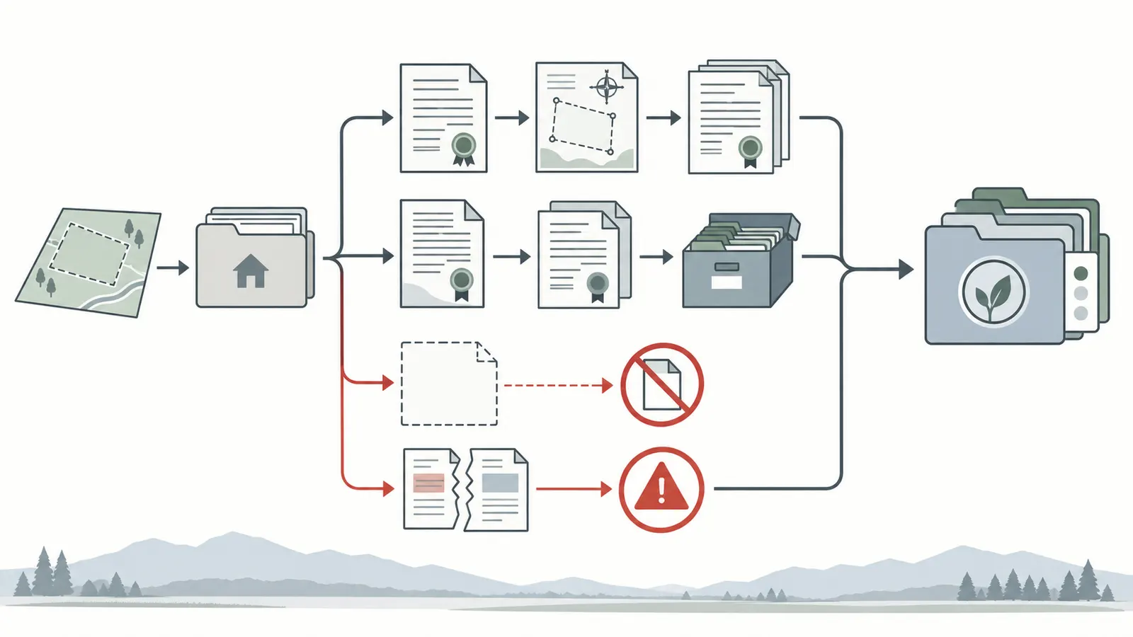
The record set is best treated as a chain rather than a stack of interchangeable files. The title commitment identifies exceptions to be reviewed, the recorded instrument states the private restriction, the exhibit locates its special areas, amendments can change the original terms, and county records may reveal a separate development-right covenant or prior approval. A missing link changes the confidence of every later map and conversation. Keep the recording numbers, versions, source dates, and unresolved questions together so the surveyor, attorney, holder, and planner are reviewing the same premise.
Read the title contract deadlines as a control system
The Colorado Division of Real Estate’s CBS4 land form was adopted August 5, 2025 for mandatory use on January 1, 2026. It distinguishes record title from off-record matters and addresses title documents, surveys, known unrecorded easements, review, objection, and resolution deadlines. Read the current Colorado land-contract form for use on or after January 1, 2026 with your broker and Colorado attorney; forms and deadlines can change, the executed contract controls, and the form is not personalized legal advice.
Make a deadline table with the exact contract date, the person responsible, the document expected, and the action if it is late or unsatisfactory. A title commitment received one day before closing is not useful if you have no time to analyze a 100-page easement and its exhibits. A survey ordered after the objection deadline may document the problem without preserving a contractual exit. A county email obtained after closing may be informative but not a substitute for a negotiated condition.
If the seller says the easement is “old,” “already approved,” or “only for open-space purposes,” ask for the recorded instrument and the named holder’s current contact. The age of the document does not answer whether the reserved building area is still available, whether amendments changed it, or whether the proposed improvements are within the granted rights.
3. Reconstruct the easement: deed, exhibit, amendments, and holder response #
Read the conservation easement as the controlling private rule for the land, then map every permission, prohibition, exception, and approval condition that can affect a house. A general Boulder County explanation or a neighboring parcel’s approval cannot replace the exact instrument because Colorado law makes the instrument’s specified characteristics important and Colorado State University Extension warns that Boulder County easement language is tailored to individual properties. The Boulder County rural-living guide is educational context, not a legal interpretation of your parcel.
Read the document in a fixed order
Do not begin with the exhibit image alone. Use this order so definitions and exceptions are not missed:
- Parties and purpose. Identify the fee owner, holder, any third-party beneficiaries, conservation purposes, and whether the holder is Boulder County, another public body, or a land trust.
- Property description. Confirm the legal description matches the title commitment, deed, parcel map, and survey research. Note excluded areas, reserved parcels, rights of way, and retained interests.
- Prohibited and permitted uses. Search for “residence,” “dwelling,” “building,” “structure,” “development,” “impervious,” “commercial,” “agricultural,” “mining,” “road,” “driveway,” “utility,” “well,” “septic,” “water,” “vegetation,” “timber,” “grading,” “excavation,” “fence,” and “fire.” Read the entire section around each term.
- Reserved building area. Find the exact name used for the house site. It may be a building envelope, residential development area, reserved area, development zone, or another defined term. Capture the permitted number, size, location, and type of structures.
- Dimensional limits. Record floor area, footprint, height, number of stories, basement treatment, accessory-structure limits, and whether the limit applies to a residence only or the combined development.
- Access and utility rights. Identify whether roads, driveways, water lines, sewer lines, power, communications, drainage, fire access, and construction access are expressly allowed, allowed only inside corridors, or subject to written consent.
- Vegetation and ground disturbance. Record rules for clearing, defensible space, wildfire mitigation, fuels treatment, tree removal, grading, excavation, rock removal, drainage, erosion control, fences, and construction staging.
- Approval mechanics. Identify notice, advance written consent, plan review, monitoring, restoration, indemnity, construction-period restrictions, fees, inspection rights, and the signatory with authority to approve.
- Future change rules. Look for expansion, replacement, reconstruction, accessory dwelling, solar, pools, agricultural structures, new wells, driveway relocation, utility upgrades, and post-fire reconstruction.
- Amendment and release language. Determine who may amend, whether a minor consent differs from an amendment, what approvals are required, and how a change becomes effective and recorded.
Do not infer that an unmentioned improvement is allowed merely because it is common for homes. A driveway may be an allowed use only where an existing access easement lies. A utility route may be allowed only along a mapped corridor. Vegetation work may be allowed for conservation management but not for a house site. A house may be allowed but not a detached garage, guest unit, fence, pool, or future addition.
Separate three kinds of permission
Every row in your notes should identify which permission is being tested:
- Recorded permission: what the deed, exhibit, amendment, covenant, or other recorded instrument says may occur.
- Holder permission: whether the easement holder must approve, waive, notice, inspect, or consent to the particular plan.
- Public permission: whether Boulder County or another authority will approve zoning, site plan, access, building, floodplain, grading, wildfire, water, sanitation, or utility work.
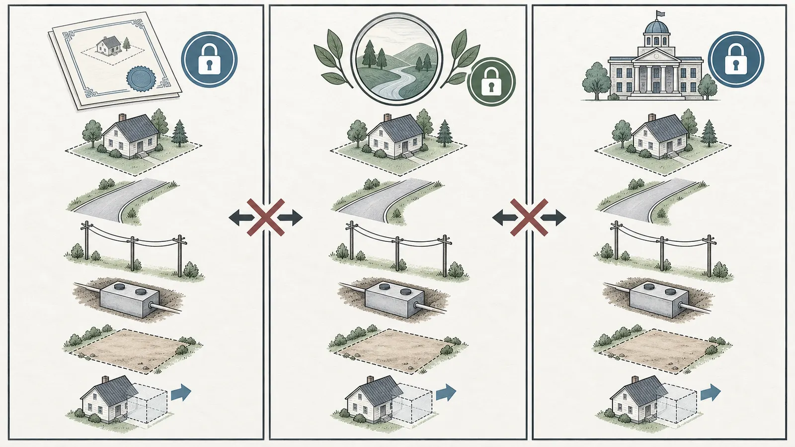
These permissions are cumulative. County approval does not amend a private easement. Holder consent does not issue a county permit. A title company’s absence of an exception does not prove a proposed utility corridor is physically or legally usable. The crosswalk should have separate columns for each.
Use the three columns as a handoff control. The buyer or attorney should quote the recorded clause, the easement holder should identify any required consent or monitoring step, and the county or municipality should identify the public review path. A row is not complete when one party says “yes.” It is complete only when the response is scoped to the same drawing, measurement, location, and proposed use, and when a different approval is not being silently assumed. This separation also shows who must be contacted next when answers conflict.
Ask the holder questions that can be answered against the plan
Send the easement holder a concise package, preferably through the seller while you copy your attorney, containing:
- parcel number and legal description;
- recorded easement document number and all known amendments;
- survey or base map with the exhibit georeferenced as an overlay, clearly labeled preliminary;
- candidate house footprint, floor area, height, basement, garage, decks, and accessory structures;
- driveway centerline, width, culverts, bridges, turnaround, gates, emergency access, and construction access;
- water source, well or tap location, storage, and lines;
- septic tank, primary treatment area, reserve area, or sewer route;
- power, communications, gas, and other utility corridors;
- grading, drainage, retaining walls, excavation, rock removal, staging, and spoil areas;
- proposed vegetation removal and wildfire mitigation; and
- future-use questions, including additions, replacement, outbuildings, solar, and access maintenance.
Ask for a written response that labels each item permitted as shown, permitted subject to consent or conditions, requires amendment or waiver, not permitted, or needs more information. Ask who may sign, whether the response binds the holder, whether it must be recorded, and what submission drawings or survey standard is required.
Do not ask a vague question such as “Can I build a house?” It invites a general answer that may omit the driveway, septic field, temporary construction route, clearing, or future changes. Ask: “Does the attached concept place all proposed permanent and temporary disturbance within the areas and uses allowed by Document X, Exhibit Y, as amended by Documents A and B? If not, identify each conflict and the required approval.”
Treat TDR and TDC history as a separate title investigation
Boulder County describes TDR conservation easements in which a sending property grants an easement and a development right is used on a receiving property. It also describes countywide TDC arrangements where an owner may restrict residence size or leave property vacant in exchange for credits. Review the county’s conservation-easement program description and then locate the parcel-specific certificate or covenant.
The county’s TDC FAQ says these restrictions are recorded and can restrict future development in perpetuity. It also says TDCs cannot be used later to restore residential development on a vacant property from which TDCs were severed, while a narrower building limit may have a specific path involving an amended restrictive covenant and a residence up to 2,000 square feet. Read the TDC FAQ directly; do not generalize that example to every conservation easement.
The practical question is not “Were development rights sold?” It is:
- What rights, if any, were severed from this parcel?
- Was the parcel restricted to vacant land, a smaller residence, or another use?
- What certificate, covenant, amendment, or easement records the restriction?
- Does the proposed house exceed a size limit or use a right that no longer exists?
- Is there a current county process for the exact condition, and is the process available before closing?
Until those questions have documentary answers, treat the development-right history as a stop or conditional item.
4. Draw the candidate house site and every dependent corridor #
Use a preliminary concept plan to test whether the entire home system can fit, then have a Colorado-licensed surveyor convert the relevant boundaries and easement exhibit into a defensible site base. A county GIS layer, aerial image, tax map, or listing diagram is useful for orientation but cannot establish the precise location of the easement or building envelope.
Start with a clean base map
Your base map should show, with a source and date for each layer:
- surveyed or title-derived property boundary;
- legal access from the public road and the road right-of-way;
- conservation-easement boundary and exhibit features;
- reserved building envelope and all dimensional labels;
- other access, utility, ditch, drainage, trail, water, mineral, and public easements;
- zoning and applicable land-use overlays;
- floodplain, wetlands, streams, steep slopes, wildfire zones, and other known hazards;
- existing roads, driveways, structures, fences, wells, septic systems, utility lines, poles, and hydrants;
- contour or topographic information appropriate to the concept; and
- a north arrow, scale, coordinate reference, source notes, and a revision date.
Boulder County’s published zoning map expressly says its features are approximate and that more site-specific studies may be required for accurate conclusions. Use the county map as orientation, not proof. The same discipline applies to an easement map that is not tied to monuments, bearings, distances, and a surveyable coordinate system.
Ask the surveyor to identify what is known, what is scaled from an exhibit, what was located from field evidence, and what remains approximate. If the recorded exhibit uses an old aerial, an unmonumented line, or a bearing that cannot be reconciled, write that limitation into the crosswalk. A visually plausible overlay can be wrong by enough to put a house, septic area, or driveway on the wrong side of a restriction.
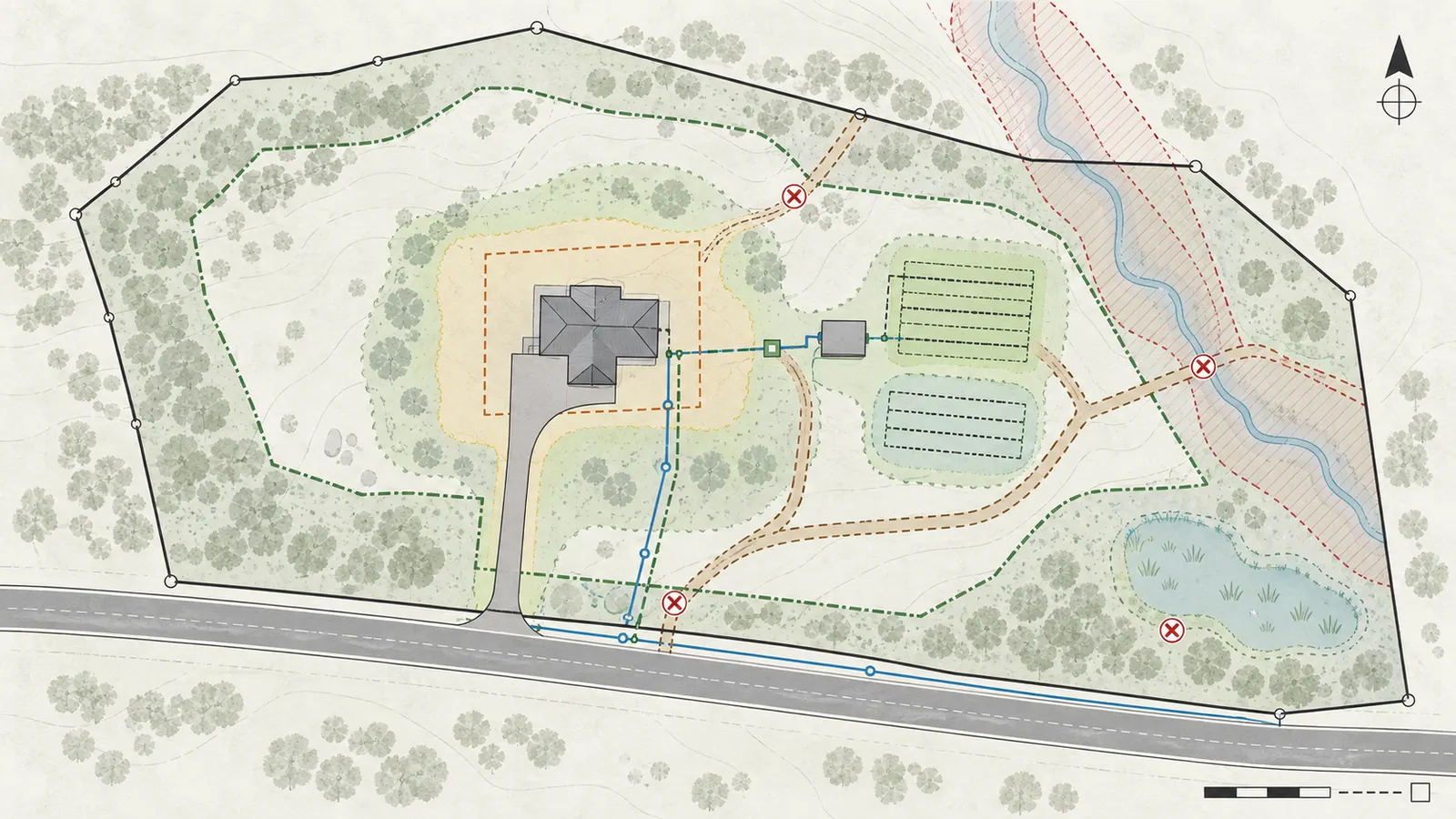
The overlay should be a working coordination drawing, not an architectural rendering. Give every line a source, date, unit, and confidence note. Use one revision for the house brief and all dependent routes, then send that same revision to the title reviewer, surveyor, easement holder, planner, access reviewer, water or wastewater professional, and utility providers. When one route moves, update the drawing and the crosswalk together; otherwise an approval may remain attached to an obsolete driveway or septic layout.
Once the overlay identifies a concept worth testing, carry the measured footprint, access route, utility corridors, and future-use brief into Brictale’s design and layout journey. The next decision is not which room looks attractive; it is whether the home brief can stay inside the verified envelope while preserving the routes and clearances that made the land candidate viable.
Draw the house as a footprint and as floor area
A house has at least two different measurements:
- Footprint: the area of the foundation or ground-level projection, including attached garages and covered elements where the easement defines them that way.
- Residential floor area: the sum of defined interior or conditioned areas across floors, basements, additions, and other spaces according to the applicable county or easement definition.
Do not compare a 2,400-square-foot floor-area plan to a 2,400-square-foot envelope as though they are the same measurement. A two-story house could have a 1,400-square-foot footprint but 2,800 square feet of floor area. A deed may cap one, the other, or both. A garage, basement, porch, deck, or accessory unit may be counted differently. Ask the holder and county which definition applies before relying on the number.
Label each geometric component separately:
- foundation and covered footprint;
- garage and parking surfaces;
- decks, patios, stairs, retaining walls, and outdoor structures;
- excavation, basement, crawlspace, and foundation-drain work;
- driveway, culvert, bridge, turnaround, and emergency access;
- well, water tank, pump, and water line;
- septic tank, soil treatment area, reserve area, sewer line, and maintenance access;
- electric, gas, telecommunications, and other utility trenches;
- construction staging, crane or delivery access, spoils, stockpiles, and temporary roads; and
- clearing, defensible space, drainage, erosion control, revegetation, and post-construction restoration.
This list is not a claim that every item is regulated the same way. It is a prompt to ask whether each item is inside, outside, or crossing an allowed area, and whether the holder or public authority counts temporary disturbance.
Test access before architecture
Legal access has at least three separate questions:
- Title access: Does the parcel have a recorded right to cross the route from a public road or another parcel?
- Physical access: Can the route be built and used at the required width, grade, turning geometry, drainage, bridge or culvert design, and emergency standard?
- Approval access: Will Boulder County and any affected landowner or easement holder approve the connection, improvements, construction period, and maintenance?
Boulder County says a property that does not front on an official county road may need recorded access easements or other proof of legal access as part of building-permit documentation. It also identifies access permits for private access to county roads. Check the building-permit documentation guidance and the county’s access and right-of-way permit page. These requirements do not prove that your proposed driveway is approved; they tell you which handoffs must be investigated.
Put the driveway centerline on the same overlay as the conservation area. Mark the exact crossing points, width, cut and fill, drainage structures, vegetation work, and whether construction equipment needs to cross an area that the finished driveway may not. Ask whether the easement permits maintenance and replacement, not only original construction. A route that works for a passenger vehicle may fail for fire apparatus, septic maintenance, utility installation, or winter access.
Test water and sanitation as land-use dependencies
The house cannot proceed on the assumption that water and wastewater will be solved later. Boulder County’s new-home guidance identifies water evidence, sanitation evidence, and access documentation as part of the permit package. The county’s building-permit page describes a water tap or letter of commitment, or an approved well permit, and sanitation evidence such as a sewer tap, sanitation commitment, or septic approval.
For a parcel with an easement, locate the water and sanitation improvements on the crosswalk even if the county will review them later. Ask:
- Is a well allowed in the proposed location, and does the easement require consent for drilling, casing, pump equipment, power, or maintenance?
- Is the water tap or service route inside a recorded utility corridor, and does the provider require a separate easement?
- Can a septic tank, primary treatment area, replacement area, and maintenance access fit in permitted areas without conflict with the house, well, waterways, slopes, or conservation values?
- Does a sewer line cross another parcel or the conservation area, and who can authorize construction and future repairs?
- Does the proposed plan include enough room for redesign if the first soil or utility result fails?
Have the appropriate water professional, septic designer or soil professional, utility provider, and county health authority respond to their own part of the question. Do not interpret a desktop map as proof that a well will be permitted or that a septic system will pass. Do not excavate test pits, drill, clear trees, or trench on a property merely to investigate without owner authorization, safety planning, and the required professional or public approvals.
Include disturbance that occurs before occupancy
An easement review often fails because the finished house appears compliant while the construction route does not. Draw temporary construction access, delivery laydown, equipment turning, crane reach, excavation, spoil storage, concrete washout, utility staging, erosion-control work, and revegetation. Ask which temporary activities need written consent, advance notice, monitoring, or restoration.
Vegetation removal is another common gap. A conservation restriction may permit management work for conservation purposes but not clearing for a view, driveway, defensible space, or house. Wildfire mitigation may be required by public rules and still require holder consent under a private easement. Have the holder and the relevant county or fire authority state how they want conflicts handled; never assume the stricter rule can be ignored because a different authority wants the work.
5. Test Boulder County’s land-use and permitting path separately from the easement #
After the easement and survey concept are coherent, ask Boulder County to identify the current public approval path for the exact parcel and concept; county confirmation is a separate gate and does not amend the private instrument. For unincorporated Boulder County, the county says Site Plan Review is required for development requiring a building permit on vacant parcels and for development on conservation-easement parcels when the holder has not waived the requirement. See the current Site Plan Review requirements.
Confirm the jurisdiction and zoning in writing
Start with the parcel’s jurisdiction. If it is inside Boulder, Louisville, Longmont, Lyons, Nederland, Erie, Superior, Lafayette, or another municipality, Boulder County’s unincorporated process is not the governing land-use approval. Ask the municipality for its own zoning, access, building, floodplain, water, sanitation, and conservation-easement process. A mailing address that says “Boulder” does not alone prove county jurisdiction.
If it is unincorporated, use the zoning map and property search to identify the apparent district, then request a formal zoning-compliance verification letter if the decision depends on a zoning fact. Boulder County says the letter can include current zoning, previous reviews and permits, and known unresolved zoning or building-code complaints. Use Boulder County’s zoning page and request path.
Ask the planner to answer in the terms of your concept:
- Is a single-family residence a potential use on this parcel under the current zoning and parcel history?
- Is the parcel a legal building lot, and are there lot-size, merger, exemption-plat, subdivision, or development-right issues?
- What residential floor-area, height, setback, or accessory-structure rules apply?
- Does the conservation easement trigger Site Plan Review, and has the holder waived anything?
- What reviews apply to access, grading, floodplain, wildfire, natural hazards, wetlands, wildlife, agriculture, or drainage?
- Does the concept require a pre-application conference, Site Plan Review, Special Review, variance, amendment, waiver, or other approval before a building permit?
- Which approvals must be obtained before the building permit, and which must be recorded or supplied by the easement holder?
Ask for docket names, forms, current checklists, submittal materials, and the county department responsible for each answer. A verbal “it should be okay” is a research lead, not a recorded decision.
Use the pre-application conference as a scope check
Boulder County describes the pre-application conference as a way to determine project scope and discuss site conditions before an application. It says the planner explains procedures and required materials and that the applicant should bring a conceptual site plan. Review the county’s pre-application conference guidance.
Prepare a concise conference packet rather than a polished sales rendering. Include the identity sheet, title exceptions, conservation easement and exhibit, amendments, survey base, house and floor-area schedule, driveway and utility corridors, water and sanitation concept, grading and clearing limits, and a list of unresolved questions.
At the meeting, ask the planner to distinguish:
- an applicable rule from a staff suggestion;
- a required review from a possible review;
- a completeness requirement from an approval standard;
- a county permit from a private easement consent;
- a concept-level answer from a determination that requires formal application; and
- information the county possesses from information the buyer must obtain independently.
Write the answers down, identify the speaker and date, and send a short follow-up asking whether your understanding is accurate. Keep the email in the evidence folder. If the planner says a question belongs to Public Works, Public Health, a municipality, the State Engineer’s Office, or the easement holder, transfer the question rather than treating the referral as an answer.
Identify every public permit that affects the crosswalk
The county’s site-plan and building pages are starting points, not a complete parcel determination. For the proposed house, ask about:
- Site Plan Review for a vacant parcel;
- building permit and current county building-code amendments;
- access or right-of-way permit for the public-road connection;
- utility permit for work in the right of way;
- grading, excavation, fill, drainage, or stormwater review;
- floodplain development review;
- water supply, well, or tap evidence;
- onsite wastewater or sewer approval;
- wildfire-zone, defensible-space, emergency-access, and exterior-material requirements;
- driveway, bridge, culvert, and construction-access approvals;
- wetlands, streams, wildlife, agricultural, or natural-area referrals; and
- any required covenant, development credit, TDR/TDC certificate, holder waiver, or recorded agreement.
Boulder County’s permit guidance says plans must show proposed work and compliance details, and for new homes it calls for water, sanitation, and access documentation. It also says soils reports are required for new-home construction in the plains east of U.S. Highway 36. Treat these as evidence inputs and schedule risks, not as proof that the easement allows the work.
Build a responsibility and handoff table
| Question | Primary responsible reviewer | Buyer’s input | Verification to save | Next handoff |
|---|---|---|---|---|
| Does the recorded deed permit a residence? | Colorado real-estate attorney and easement holder | Deed, definitions, exhibit, proposed home brief | Written interpretation or holder response; unresolved clauses listed | Surveyor and planner |
| Where is the envelope on the ground? | Colorado-licensed surveyor | All instruments and exhibits | Survey overlay with assumptions and control points | Easement holder |
| Is the proposed use eligible in this jurisdiction? | City/town or Boulder County planner | Parcel identity, zoning records, concept plan | Written zoning or review-path response | Design and permit team |
| Can the driveway reach a public road? | Surveyor, access engineer, county Public Works, title counsel | Access instruments, grades, crossing details | Legal-access and permit-path memo | Easement holder and fire authority |
| Can water be supplied? | Water provider or qualified well professional; county/state authority as applicable | Tap or well concept, easements, location | Commitment, permit path, or written limitation | Site and house design |
| Can wastewater be handled? | Boulder County Public Health or sewer agency and qualified designer | Soil, slope, house bedroom count, reserve area | Septic or sewer feasibility response | Planner and easement holder |
| Can clearing and grading occur? | Easement holder plus county and qualified civil or environmental professional | Disturbance map, vegetation and grading limits | Conditions, consent, and permit list | Contract and budget |
| Can future changes occur? | Easement holder, planner, and attorney | Future-use schedule | Written limits and approval path | Buyer’s long-term decision |
The purpose of this table is to prevent an answer from being lost at a handoff. If the surveyor says the exhibit cannot be located, the holder needs to respond to the uncertainty. If the holder says a driveway is conceptually allowed, Public Works still needs to address the county-road connection. If the county says a review is available, the attorney still needs to test whether the contract preserves time to complete it.
6. Use the Boulder County parcel constraint crosswalk to reach a defensible result #
Use the crosswalk to force every proposed house dependency to have a document, a map or measurement, a responsible authority, a status, and a next decision. The crosswalk is useful only if you fill it with parcel-specific inputs; a blank row is not a pass.
Boulder County parcel constraint crosswalk
Method: Read the recorded instrument and every indexed amendment, translate its exhibit into survey coordinates, overlay the proposed house and dependent corridors, then request written confirmation from the easement holder and Boulder County for each unresolved constraint.
| Row | Source input | Test and measurable output | Responsible reviewer | Stop / conditional / go evidence |
|---|---|---|---|---|
| Instrument identity | Recording number, deed, legal description, holder, amendments | All documents match the title legal description and parcel; document index has no unexplained gap | Title company and attorney | Stop if the deed or amendment chain is missing or mismatched |
| Reserved building envelope | Recorded exhibit, bearings, distances, monuments, survey overlay | Envelope polygon and uncertainty band are plotted; candidate footprint is inside with documented clearance | Surveyor and holder | Conditional until the holder accepts the overlay or resolves the boundary |
| Residence size | Deed definitions, floor-area and footprint limits, TDC/TDR history | Proposed footprint, floor area, height, basement, garage, and accessory structures are measured in the applicable units | Attorney, holder, planner | Stop if the plan exceeds a recorded cap; redesign or obtain a lawful amendment path |
| Driveway and public access | Access easement, road right of way, county map, grades, crossing details | Legal route, centerline, width, grade, culvert or bridge, turnaround, and construction route are shown | Surveyor, access engineer, Public Works | Conditional until legal and physical access are both documented |
| Water supply | Tap commitment or well-permit path, water-line easement, location | Source, line, equipment, maintenance access, and holder consent are identified | Provider or well professional, county/state authority, holder | Stop if no lawful supply path fits the allowed area |
| Wastewater | Sewer commitment or OWTS feasibility, tank, primary and reserve areas | House bedrooms/flow, tank, treatment area, reserve, line, and maintenance access are plotted | Public health or sewer agency and qualified designer | Conditional until the selected system and disturbance are acceptable |
| Utility corridors | Recorded utility rights, provider standards, trench route, temporary access | Electric, gas, telecom, and water/sewer corridors are shown with crossings and disturbance | Providers, surveyor, holder | Stop or conditional where a corridor needs a new right or consent |
| Clearing and grading | Easement management clauses, wildfire requirements, contour and disturbance plan | Trees, defensible space, cuts, fills, retaining walls, drainage, staging, and restoration are quantified or bounded | Holder, county, qualified civil/forestry professional | Conditional until private and public permissions align |
| County zoning and review | Jurisdiction, zoning verification, Land Use Code, pre-application notes | Review names, forms, conditions, and prerequisites are written for this concept | County or municipality | Stop if jurisdiction is wrong or use is not an available path |
| Future-use path | Easement future-change clauses, amendment rules, certificates, county rules | Addition, replacement, accessory structure, solar, pool, farm use, and utility replacement each have a known rule | Holder, planner, attorney | Conditional if a future use requires unknown consent or amendment |
| Written authority responses | Holder letter, county email or meeting notes, utility and health responses | Each unresolved row has an owner, date, expiration or recheck trigger, and next action | Buyer maintains record | Go only for the defined concept, with all conditions in contract |
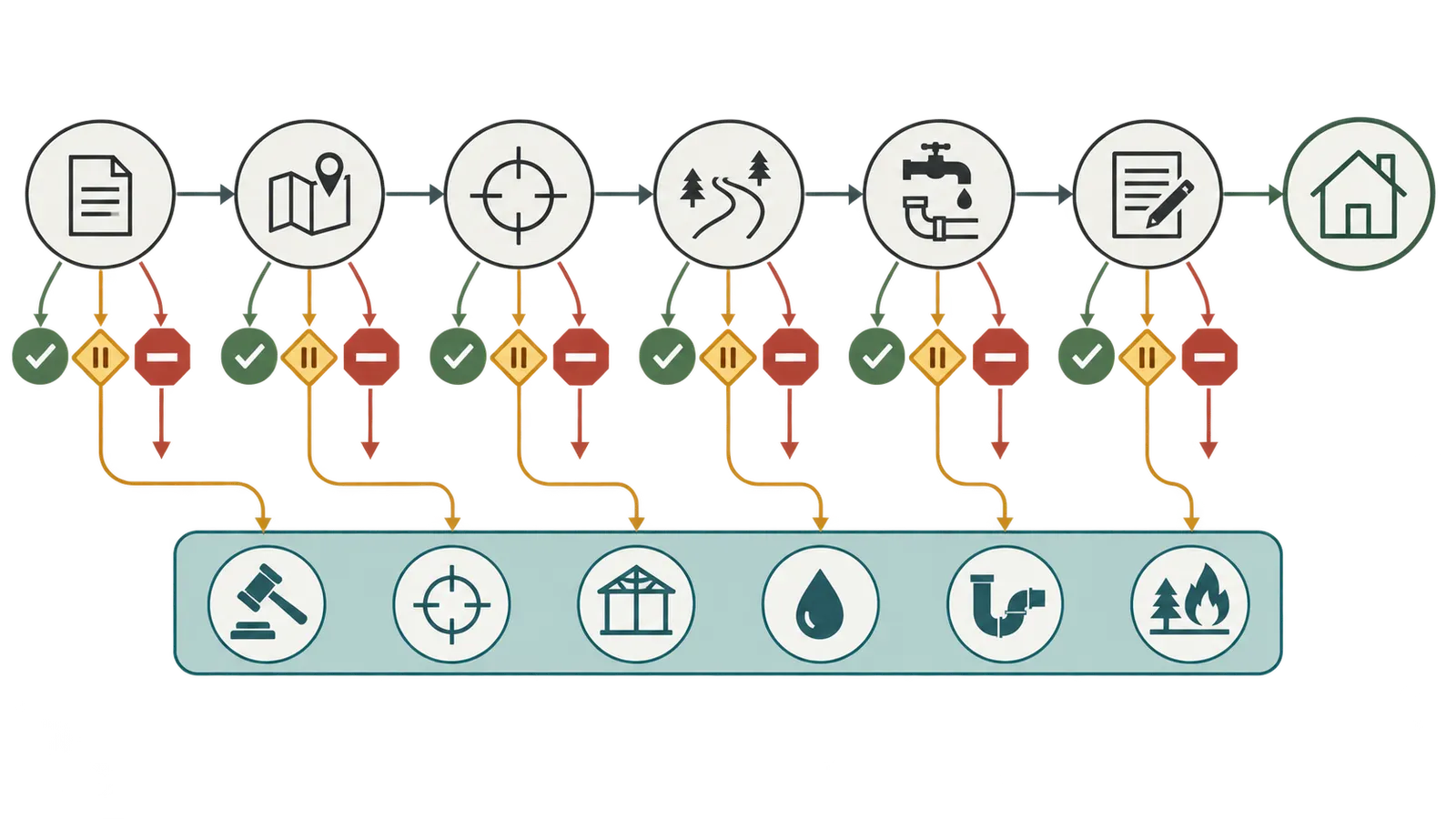
The crosswalk deliberately has no single “buildable” column. Instead, the result is earned row by row. You may create a summary line after the last row: GO for this concept only if all required rows are verified or contractually protected; otherwise CONDITIONAL; STOP if any required row is prohibited, materially unknown, or cannot be resolved before the buyer’s deadline.
This gate sequence is intentionally conservative. It prevents a favorable answer about the residence from masking a failed access route, a missing utility right, an unlocatable envelope, or an expired contract remedy. Mark the first blocking gate, name the person who can resolve it, state the document or field result required, and set the next review date. If the issue is resolved, retain the earlier stop or conditional record and append the new evidence so the decision history remains auditable.
Illustrative worked example: how to show inputs, units, and sensitivity
The following is an illustrative modeled example, not a real Boulder County parcel, survey, measurement, code threshold, or professional opinion. It shows the arithmetic a buyer can use to expose hidden dependencies. It does not prove that any area is allowed or that any authority uses the same area-counting method.
Assume the concept has these inputs:
- proposed house footprint: 60 feet × 40 feet = 2,400 square feet;
- detached garage and covered connection: 24 feet × 24 feet = 576 square feet;
- driveway: 14 feet wide × 500 feet long = 7,000 square feet;
- utility trench: 6 feet wide × 500 feet long = 3,000 square feet;
- septic primary and reserve areas: 1,200 square feet each = 2,400 square feet;
- turnaround: 60 feet × 60 feet = 3,600 square feet; and
- utility trench overlap with driveway: 350 feet × 6 feet = 2,100 square feet.
The gross sum before accounting for overlap is:
2,400 + 576 + 7,000 + 3,000 + 2,400 + 3,600 = 18,976 square feet.
If the 2,100-square-foot trench overlap is counted once in a simple union estimate:
18,976 − 2,100 = 16,876 square feet.
Convert to acres:
16,876 square feet ÷ 43,560 square feet per acre = 0.387 acres.
That 0.387-acre figure is not a conservation-easement allowance, a zoning limit, or a permit result. It is only a transparent estimate of the mapped concept footprint under the stated assumptions. The drawing may need to distinguish permanent footprint from temporary disturbance, and the easement may measure disturbance, structures, floor area, or another defined quantity. The surveyor and holder must tell you what controls.
Now test sensitivity rather than hiding the assumptions. If the house changes from 60 × 40 feet to 70 × 45 feet, its footprint becomes:
70 × 45 = 3,150 square feet.
That adds 750 square feet. The simple union estimate becomes:
16,876 + 750 = 17,626 square feet; 17,626 ÷ 43,560 = 0.405 acres.
If the driveway grows from 500 to 650 feet, the added driveway area is:
14 feet × 150 feet = 2,100 square feet.
If that added section has no shared utility trench, the union estimate becomes:
16,876 + 2,100 = 18,976 square feet; 18,976 ÷ 43,560 = 0.436 acres.
If the recorded instrument permits a residence only up to 2,000 square feet of applicable residential floor area, the 2,400-square-foot example fails even though the footprint arithmetic is small. If the instrument permits 2,400 square feet but prohibits grading outside the envelope, the house may fit while the driveway or septic work fails. If the envelope is 120 feet × 160 feet, its gross rectangle is:
120 × 160 = 19,200 square feet = 0.441 acres.
That comparison still proves nothing about setbacks, irregular boundaries, slope, conservation values, or whether the envelope is measured in the same coordinate system. It only tells you which questions to resolve. Sensitivity is valuable because it shows whether a small design change, a longer access route, a larger bedroom count, or a revised wastewater area turns a conditional candidate into a stop.
How to score the crosswalk without pretending to calculate certainty
Do not assign arbitrary points that make an unknown look like a pass. Use a gate approach:
- Identity gate: the legal description, title, easement deed, exhibit, and amendments match.
- Permission gate: the holder or attorney identifies a lawful residence use and any size or future-use limit.
- Location gate: a surveyor can place the envelope and all dependent corridors with stated uncertainty.
- Public-path gate: the county or municipality identifies the applicable zoning and review route.
- Infrastructure gate: access, water, wastewater, utilities, and construction disturbance have a plausible documented path.
- Contract gate: the buyer has time and rights to object, terminate, renegotiate, or extend while unresolved items are investigated.
If any gate is stop, the parcel is not a viable candidate for this concept. If any gate is conditional, the buyer should not remove the condition or treat the parcel as buildable until the condition has a responsible owner, a required document, and a date. A “go” result means the gates are satisfied for the defined concept; it does not guarantee a permit, financing, construction price, or future approval.
Review the actual contribution before relying on it
The crosswalk is original because it connects documents that are often reviewed separately: the easement deed, exhibit, title exceptions, survey, zoning response, access path, utility corridors, sanitation concept, and future-use questions. Check it in three ways:
- Source check: every row names the document, authority, or professional input that supports its status.
- Geometry check: the house and dependencies are plotted on the same base with units, assumptions, overlaps, and uncertainty shown.
- Handoff check: every unresolved item has a responsible person, a next action, a deadline, and a contract consequence.
Limitations: This worksheet is not a legal opinion, survey, title commitment, engineering design, or county buildability determination; it cannot reveal unrecorded rights or guarantee approval of a future proposal.
If you cannot complete those checks, the artifact is still useful: it has identified why the parcel is not yet ready for a go decision. Do not remove a row to make the result cleaner.
7. Put unresolved risk into the purchase contract and professional handoffs #
Keep the parcel conditional in the contract until the evidence needed for your decision has been delivered and reviewed by the responsible professionals. The current Colorado CBS4 land form addresses record-title and off-record matters, survey deadlines, and title review and objection paths, but the exact deadlines and remedies depend on the executed contract; ask a Colorado real-estate attorney and your licensed broker to negotiate language that matches this parcel’s research sequence. The CBS4 land form for use on or after January 1, 2026 is a reference point, not a substitute for advice.
Convert the crosswalk into contract conditions
A useful condition names the deliverable, the reviewer, the deadline, and the consequence. Examples to discuss with counsel include:
- delivery and acceptable review of the complete title commitment and all title documents, including the conservation easement and exhibits;
- delivery of all recorded amendments, consents, waivers, releases, covenants, TDR/TDC certificates, and development-right history;
- buyer approval of a survey or surveyor overlay that locates the easement, building envelope, access, and utility corridors;
- written easement-holder response to the defined concept, including house size, access, utilities, septic, grading, clearing, temporary construction disturbance, and future changes;
- county or municipal written confirmation of jurisdiction, zoning, review path, and required pre-application or Site Plan Review process;
- documented access and utility feasibility, including any third-party consents and public-road permits needed for the route;
- water and wastewater feasibility or permit-path documentation from the relevant provider, professional, or authority;
- a defined period to object, terminate, renegotiate, or extend if a material condition is prohibited, materially different, or unresolved; and
- seller cooperation with access to records, the easement holder, county meetings, survey work, and professional site visits.
Counsel should draft the condition. The buyer should not copy a generic “subject to due diligence” sentence and assume it preserves every right. The contract needs to reflect the transaction’s actual deadlines and the fact that a private easement, public permit, and technical feasibility are separate risks.
Send each professional the same controlled package
Different reviewers need different questions, but inconsistent inputs create contradictory answers. Keep a versioned folder with:
- identity sheet and legal description;
- current title commitment and exceptions;
- recorded easement deed, exhibit, amendments, covenants, and development-right documents;
- survey, plat, county map exports, and an assumptions log;
- proposed house and floor-area schedule;
- access, utility, water, sanitation, grading, and clearing overlays;
- written questions and responses with dates;
- contract deadlines and responsible person; and
- a change log showing which concept revision each response addresses.
Name files with the recording number, source, date, and revision, such as 2004-012345_CE-deed.pdf, 2026-09-08_concept-v2.pdf, and 2026-09-08_holder-response.pdf. Do not overwrite a prior response. An amendment or revised plan can change the meaning of an earlier “yes.”
Use Brictale’s planning and budget journey to carry each unresolved condition into an allowance, deadline, and decision trigger. A survey revision, access improvement, utility extension, septic redesign, holder review, or county application can change both the project scope and the buyer’s exposure; record those dependencies instead of burying them in one undifferentiated due-diligence allowance.
Know when a remote review has reached its limit
You can safely do a large part of the document collection, indexing, arithmetic, and question preparation from your desk. You cannot use a remote review to establish an exact boundary, verify a monument, confirm soil conditions, assess a bridge or road grade, certify a septic design, approve a well, determine structural safety, or authorize tree clearing.
Brictale’s boundary is non-diagnostic: remote guidance in this article is limited to safe document review and observation from a lawful location. Do not open electrical panels, test energized wiring, disconnect or reconnect utility equipment, open pressurized water lines, disturb potentially contaminated soil, handle or expose yourself to wastewater, enter a tank, pit, excavation, crawlspace, or other confined space, or dig, trench, drill, cut vegetation, sample, or perform site work. Stop and escalate any testing, opening, entry, digging, sampling, or site work to the qualified local professional or authority responsible for that hazard. The homeowner may collect documents and photographs when safe and authorized, but must not treat that collection as a diagnosis, clearance, permit, or engineering conclusion.
Stop and hand off when:
- the exhibit cannot be reconciled to the legal description or survey evidence;
- a boundary, access line, utility corridor, or building-envelope edge is within the plan’s uncertainty band;
- the easement uses undefined or conflicting terms such as “reasonable,” “compatible,” or “incidental” for a material improvement;
- the proposed house exceeds or approaches a size limit;
- a driveway, septic area, well, utility trench, or grading area crosses a restricted zone;
- an easement holder says approval is discretionary or requires an amendment;
- the county response is limited to a formal application rather than a concept answer;
- the parcel is in a municipality or overlay with a different authority;
- a water, wastewater, wildfire, floodplain, slope, or geotechnical issue affects the site; or
- the contract deadline arrives before the required answer is documented.
Qualified professionals should perform boundary surveying, legal interpretation, land-use representation, access and civil design, soil or septic evaluation, well and water work, utility design, structural design, and hazardous clearing or excavation. Do not enter restricted land, dig test pits, cut trees, trench, drill, or cross a ditch or road corridor without authorization and appropriate safety controls.
When the evidence folder shows that the parcel is worth advancing, use Brictale’s choosing-your-team journey to make the handoffs explicit: define the surveyor’s deliverable, the attorney’s document question, the planner’s jurisdictional question, and each technical professional’s site-specific scope before requesting a proposal.
Keep a failure log instead of just collecting approvals
For each failure or uncertainty, write:
- what was tested;
- the exact document or map layer;
- the observed conflict or missing input;
- whether the issue is private, public, physical, financial, or contractual;
- who can resolve it;
- the required deliverable;
- the latest useful date;
- the redesign or alternative route; and
- the buyer’s decision if it remains unresolved.
This avoids a common failure mode where a buyer receives a later email saying “the house may be possible” and forgets that the answer excluded the driveway, septic reserve area, clearing, or future addition. Record the scope of every answer.
8. Decide, document, and preserve the next-use path #
Make the final decision only after the parcel has a complete evidence folder and a written status for each required row: proceed for this defined concept, proceed only with named conditions, redesign and re-check, or walk away. Do not call the property buildable merely because the house rectangle fits an apparent envelope.
The final buyer decision tree
Stop and do not remove the contract condition when:
- the recorded easement or covenant prohibits a residence, the proposed size, or a required dependency;
- the document chain or exhibit is incomplete and cannot be resolved before the contract deadline;
- the seller’s description conflicts with the recorded instrument or title commitment;
- the building envelope cannot be located well enough to test the concept;
- legal access, water, wastewater, or a utility route has no documented path;
- the county or municipality identifies no available land-use route for the parcel; or
- the required consent or amendment is discretionary, expensive, or time-uncertain and the buyer is unwilling to carry that risk.
Proceed conditionally when:
- the concept appears to fit but the holder requires written consent, a waiver, monitoring plan, or amendment;
- the county requires Site Plan Review, a pre-application conference, access approval, grading or floodplain review, or another process not yet completed;
- water, wastewater, utility, geotechnical, wildfire, or access work is plausible but still requires professional verification;
- the survey has an uncertainty that does not yet overlap the concept but could change it; or
- future uses such as an addition, accessory structure, solar, pool, farm building, or reconstruction remain unresolved.
Proceed for this concept only when the document set is complete, the survey overlay is accepted for the present test, the easement holder and county have addressed the needed permissions, the infrastructure path is documented, and the contract protects the buyer through the remaining professional and public reviews. Even then, say “for this concept,” not “the property is unconditionally buildable.”
Preserve the next decision after closing
If you buy the parcel, the crosswalk becomes the control document for design and construction handoffs. Give the architect, designer, builder, civil engineer, surveyor, septic or water professional, utility providers, and project manager the same approved concept and restriction set. Add a change-control rule: no one moves the house, widens the drive, adds a deck, clears trees, changes the utility route, adds bedrooms, or enlarges a septic system without checking the easement, county approval, and contract or lender requirements.
Maintain a register with:
| Future change | Original evidence to re-check | New responsible reviewer | Stop trigger |
|---|---|---|---|
| House addition or enclosed porch | Floor-area and footprint limits, envelope, county review | Architect, planner, holder, attorney | Any increase exceeds the recorded or county limit |
| Garage, studio, or accessory dwelling | Structure definition, number and size limits, utility and access path | Planner, holder, designer | It is treated as a separate residence or lies outside the permitted area |
| Driveway relocation or widening | Access easement, county access permit, grading and vegetation clauses | Surveyor, Public Works, holder | New route crosses a restricted or third-party area |
| New well, tap, or utility replacement | Utility corridor, water authority, maintenance rights | Provider or qualified professional, holder | New disturbance or right of way is needed |
| Septic repair or expansion | OWTS layout, reserve area, easement and maintenance rights | Qualified designer and public health authority | The existing area cannot meet the new flow or access need |
| Tree clearing or wildfire work | Vegetation clauses, wildfire rules, restoration plan | Qualified forestry or wildfire professional, holder, county | Work is outside an allowed management purpose or area |
| Post-fire replacement | Reconstruction clauses, current county rules, insurance and lender terms | Attorney, planner, holder, design team | A replacement is treated as new development |
The benefit of this register is practical: an easement that allows today’s house may still constrain tomorrow’s maintenance, safety, expansion, or recovery. A future-use note written before closing is cheaper than discovering after closing that a “simple” change needs a recorded amendment or is prohibited.
Keep evidence current without cosmetic freshness
This guide is reviewed on September 8, 2026, but a date does not make a parcel answer current. Recheck the county land-use code, review pages, permitting requirements, public-record index, utility requirements, and easement-holder contact when the parcel, concept, or contract changes. Recheck any written response if:
- the title company issues a revised commitment or new exception;
- a recorded amendment or new covenant appears;
- the survey changes the envelope, access, or utility geometry;
- the house footprint, floor area, bedrooms, height, garage, or future-use brief changes;
- the county changes the review path, code, map, fee, or form;
- the seller supplies a different easement exhibit or development-right history; or
- the contract deadlines are extended into a new review period.
Do not “refresh” the article or the worksheet merely to display a newer date. Update the parcel file when a substantive input changes, record what changed, and make the next decision from the revised evidence.
The handoff package to carry forward
Before making the offer non-contingent or closing, aim to have these items in one folder:
- current title commitment and complete title documents;
- recorded conservation easement, exhibit, amendments, covenants, releases, consents, and development-right records;
- legal description, plat, parcel identity, jurisdiction confirmation, and zoning response;
- survey or surveyor overlay with coordinate, scale, source, and uncertainty notes;
- house, floor-area, garage, accessory, deck, height, and basement schedule;
- driveway, access, emergency access, utility, water, sanitation, grading, clearing, and temporary-disturbance plan;
- easement-holder response with scope, conditions, signatory, and expiration or recheck trigger;
- county or municipal planner response and review-path notes;
- water, wastewater, utility, access, wildfire, floodplain, and geotechnical professional inputs as applicable;
- crosswalk status for every row; and
- contract notices, deadlines, extensions, objections, and counsel’s decision memo.
If an item is not available, put “not found” in the folder with an owner and deadline. That is more useful than leaving a blank cell that looks accidentally complete.
Bottom line
A Boulder County conservation easement can coexist with a house, but the answer belongs to the parcel’s recorded documents and the exact proposal—not to the general concept of conservation easements, a countywide map, a listing, or a neighbor’s approval. Reconcile the deed and exhibit with a survey, test every dependency, ask the holder and the actual jurisdiction for written direction, and preserve contract time to act. If one essential row remains prohibited or materially unknown, the safest decision is to stop, redesign, or keep the parcel conditional.
Cite this guide
Brictale. “How to Verify a Boulder County Conservation Easement Still Allows a House.” Published 2026-09-20; updated 2026-09-20.
https://brictale.com/build/land/verify-vacant-land-conservation-easement-building-envelope-before-buying · Read the Markdown version
Original contribution: Boulder County parcel constraint crosswalk. A reusable crosswalk that tests a proposed house site and its access, utility, clearing, and future-use dependencies against the recorded conservation easement and Boulder County approval path.
Sources and scope
Evidence behind this page
- Colorado treats a conservation easement in gross as an interest in real property; it is perpetual unless the instrument creating it states otherwise, and the instrument controls the particular characteristics of the easement.
Colorado Revised Statutes 2026, Title 38, §§ 38-30.5-103 and 38-30.5-106
Colorado statutory framework; apply the parcel's own recorded instrument and current law rather than assuming a standard easement form.
Accessed · Link to this claim - Boulder County says land under a conservation easement remains privately owned, while the owner's retained use is limited by the agreed conservation-easement conditions; the county describes residence-size restrictions, vacant-land restrictions, and TDR/TDC programs as possible forms of restriction.
Conservation Easements - Boulder County Parks & Open Space
Boulder County program overview; it is not the parcel-specific easement deed or a buildability determination.
Accessed · Link to this claim - Boulder County's Recording Division says public records can be searched by document type, recording information, grantor, grantee, or legal description, and searchable records include amendments, covenants, deeds, plats, and maps.
Search Public Records - Boulder County Recording Division
Boulder County recorded-property research workflow; a title company or attorney should confirm the complete chain and exceptions.
Accessed · Link to this claim - For unincorporated Boulder County, Site Plan Review is required for development requiring a building permit on a vacant parcel, and it also applies to development on a conservation-easement parcel when the easement holder has not waived the requirement.
Site Plan Review - Boulder County Community Planning & Permitting
Current Boulder County administrative review page for unincorporated county land; municipalities inside Boulder County have their own jurisdiction.
Accessed · Link to this claim - Boulder County's pre-application conference is used to determine project scope and site conditions; the planner explains procedures and required materials, and the applicant is expected to bring a conceptual site plan.
Land Use Review Pre-Application Conference - Boulder County
Boulder County planning process before an application; staff guidance is not an approval or vested development right.
Accessed · Link to this claim - Boulder County's new-home building permit guidance calls for plans showing proposed work and code compliance, and identifies water evidence, sanitation evidence, access documentation, and a recorded warranty deed among additional documentation for new homes; it also states that soils reports are required for new homes in the plains east of U.S. Highway 36.
Building Permits - Boulder County Community Planning & Permitting
Boulder County building-permit submittal guidance; it does not establish that a proposed site will pass planning, easement, soils, access, water, or sanitation review.
Accessed · Link to this claim - Boulder County says its Community Planning & Permitting Department oversees zoning for unincorporated areas and that a formal zoning-compliance verification letter can report current zoning, previous reviews and permits, and known unresolved zoning or building-code complaints.
Unincorporated Boulder County zoning jurisdiction; city and town parcels require the municipality's response.
Accessed · Link to this claim - Boulder County identifies access permits for private access to county roads and utility or right-of-way permits for regulated utility work, and its permit guidance says a driveway connection to a county right-of-way needs a permit.
Permits and Requests - Boulder County Public Works and Community Planning & Permitting
Boulder County right-of-way and access permitting; private recorded access rights, easement-holder consent, and utility-provider requirements remain separate questions.
Accessed · Link to this claim - Boulder County's TDC FAQ says conservation easements and restrictive covenants can restrict future development and use in perpetuity and are recorded in county real-property records; it also says TDCs cannot later restore residential development on a vacant property from which TDCs were severed.
Transferable Development Credit FAQ - Boulder County
Boulder County TDC program guidance; determine the parcel's exact covenant, easement, credit, and certificate history before relying on a seller's explanation.
Accessed · Link to this claim - Boulder County's published zoning map labels its features approximate and says more site-specific studies may be needed for accurate conclusions, so a GIS or zoning display cannot replace a boundary and easement-exhibit survey overlay.
Countywide illustrative zoning map disclaimer; use parcel-specific records and a licensed survey for the proposed house site.
Accessed · Link to this claim - The Colorado Division of Real Estate's CBS4 Contract to Buy and Sell Real Estate (Land), adopted August 5, 2025 for mandatory use on January 1, 2026, separates record-title and off-record matters and lists record-title, off-record-title, survey, review, objection, and resolution deadlines; the executed contract and transaction-specific advice control.
Colorado Real Estate Commission CBS4 land form for Colorado transactions involving land with no residences or the applicable residential addendum; confirm the executed contract, current form, and transaction-specific advice with a Colorado real-estate attorney or licensed broker.
Accessed · Link to this claim - Colorado State University Extension's Boulder County rural-living guide explains that conservation easement language is tailored to individual properties and may remove or limit building rights and residence or accessory-structure size; it warns that the specific existing easement must be read individually.
Boulder County educational overview, not a parcel-specific legal or planning decision; use it to identify questions, then read the recorded instrument.
Accessed · Link to this claim - Boulder County Community Planning & Permitting has planning, building, and zoning jurisdiction in unincorporated Boulder County, not in cities and towns; properties inside a municipality require that municipality's planning and building contact.
Ask a Planner - Boulder County
Boulder County jurisdiction guidance for land-use, planning, building, and zoning questions; a parcel-specific jurisdiction check is still required, and municipal parcels follow the relevant city's or town's process.
Accessed · Link to this claim