How to Verify Texas Vacant Land Mineral Rights Before Buying
Trace Texas surface and mineral title, leases, easements, agency records, and local restrictions against your proposed house site before closing.
The short answer
Before buying Texas vacant land, obtain a title commitment and survey, trace surface and mineral ownership separately, and identify the county clerk records and historical parent-tract records that the legal description and title review make relevant. Collect leases, pooling documents, easements, plats, restrictions, RRC well and permit records, and local approvals. Overlay them on the proposed house site. Stop or renegotiate conflicts and have a Texas attorney review unresolved items.How to Verify Texas Vacant Land Mineral Rights and Surface-Use Restrictions Before Buying
Before buying Texas vacant land, obtain a title commitment and survey, trace surface and mineral ownership separately, and identify the county clerk records and parent-tract records that the legal description and title review make relevant. Collect leases, pooling documents, easements, plats, restrictions, Railroad Commission well and permit records, and local approvals. Overlay them on the proposed house site. Stop or renegotiate when an instrument conflicts or ownership is unclear, and have a Texas oil-and-gas or real-estate attorney review the items.
Decide what “safe to buy” means for your actual house site #
You can decide whether to proceed only after the parcel’s legal identity, separate surface and mineral interests, recorded burdens, agency activity, and local restrictions have been compared with a defined building envelope; a listing, tax map, or “no known minerals” statement cannot answer that decision by itself.
The decision is not simply “Does the buyer own the minerals?” It is a sequence of narrower decisions:
- Is the parcel described in the contract the same land you think you are evaluating?
- Who owns the surface estate, and who owns each mineral interest that was reserved or conveyed away?
- What rights were granted to mineral owners, lessees, pipeline operators, road users, utility providers, homeowners’ associations, or other easement holders?
- Are there wells, permits, leases, units, pipelines, disposal facilities, or environmental records that change the practical site plan?
- Does a recorded or adopted restriction actually affect this parcel, and which public body has jurisdiction over it?
- Can a house, driveway, septic field, well, outbuilding, pool, garden, and future additions fit without depending on a disputed interpretation?
- What must be corrected, insured, negotiated, surveyed, or reviewed before the option, feasibility, due-diligence, or closing deadline expires?
Texas has two different kinds of uncertainty here. The first is evidence uncertainty: a document, map, label, or location is missing, hard to read, or not tied to the current legal description. The second is rights uncertainty: the instrument is found, but its words, priority, duration, surface-use scope, release status, or interaction with another instrument needs legal interpretation. Your ledger should preserve both. “We found nothing online” is an evidence result, not a conclusion that the right does not exist.
Texas law recognizes separate surface and mineral estates. The Texas Railroad Commission’s explanation of surface ownership says that severance can occur when an owner sells the surface while retaining minerals, or sells minerals while retaining the surface. It also explains the general Texas rule that the mineral estate is dominant and that a mineral owner or lessee may use the surface to the extent reasonably necessary for exploration, development, and production, subject to the language of the severing deed, lease, ordinances, and limited doctrines. That is a scope statement, not a prediction that anyone will drill your parcel.
The word “dominant” therefore matters to a homeowner because a surface deed may not give the owner the last word about every future surface activity. A recorded deed can reserve minerals. A later mineral lease can grant operational rights. A pipeline or road easement can occupy a strip even when no well exists. A local ordinance may apply in one municipality but not in an adjacent unincorporated area. A building envelope that ignores any one of those may look feasible until an architect, surveyor, title examiner, or attorney places the missing document on the plan.
Compact originality brief
Current answers commonly define mineral and surface estates and warn that Texas mineral lessees may have broad surface-use rights. The missing decision is the homeowner’s pre-contract sequence: how to move from surface-only listing language to a county-record chain, active or dormant lease review, corridor check, house-site overlay, and deadline-based escalation.
The original contribution in this guide is the Texas split-estate record ledger and house-site conflict matrix. It preserves the exact instrument, source location, affected estate, mapped area, responsible reviewer, unresolved risk, and next decision. You can check it by asking whether every conclusion points to a retrieved instrument, an identified agency record, a survey or map reference, or a named professional who still must decide it. The method is a record sequence followed by a spatial comparison; it is not a title opinion or empirical study.
What not to infer at the start
Do not infer title from the county appraisal district owner name. In this guide’s workflow, treat appraisal records as parcel and account cross-references only; use the title commitment or title search and the underlying county clerk instruments for the title evidence set. The Texas Department of Insurance title FAQ explains that title agents check public records such as deeds, tax records, liens, encumbrances, and maps, so ask what was searched and retrieve the instruments that support each ledger row. Do not infer that “surface estate” means the surface is free of leases, easements, restrictions, or access obligations. Do not infer that an apparently inactive well is permanently dead, that a plugged well has no surface consequence, or that no well symbol means no mineral right.
Do not infer that “minerals convey” in a purchase contract means all minerals convey. The legal description, reservations, prior severances, fractional ownership, leases, and exceptions control what the seller can convey. Do not infer that a title commitment’s issuance means the title company has resolved mineral ownership. The Texas Department of Insurance title FAQ says a commitment comes before closing, lists requirements and potential exceptions, and does not guarantee that no current issue exists or that none will arise. Read the actual schedules and requirements with the title agent and a lawyer when needed.
The first go/no-go gate
Set a written gate before spending on a house design. Proceed to detailed feasibility only if you have, at minimum, a reliable legal description; a current title commitment or equivalent title search; a survey or a clearly labeled preliminary boundary plan; a documented proposed house and infrastructure envelope; and a plan for resolving mineral, lease, pipeline, road, and local-rule questions. If a seller or broker will not provide enough information to identify the tract or permit review before your deadline, treat that as a transaction risk rather than filling the gap with assumptions.
The result can be one of four decisions:
| Status | Evidence condition | House-site meaning | Next decision |
|---|---|---|---|
| Proceed to design review | Surface and mineral chain is documented; known corridors and restrictions are mapped; no unresolved red conflict | The site is not proven risk-free, but the next design work has a defensible base | Give the packet to the surveyor, designer, and local permitting contact |
| Proceed only with conditions | One or more amber items remain, such as an unclear lease clause, missing release, or corridor needing field confirmation | The site may work, but price, termination, seller delivery, title exception, or professional opinion is required | Put exact deliverables and dates in the contract or option |
| Redesign or relocate envelope | A mapped or documented right intersects the proposed house, septic area, driveway, well, or access route | The current plan depends on an unproven exception or permission | Have the designer test another envelope and have the relevant professional interpret the right |
| Stop or do not close | Ownership, legal description, priority, enforceability, or surface-use conflict remains material at the deadline | You cannot responsibly price or plan the home | Use the contract remedy or walk away after legal advice |
The categories are Brictale’s decision labels, not Texas legal classifications. “Amber” does not mean a risk is small; it means the evidence or interpretation is incomplete. “Green” in your private worksheet should mean only “the assigned reviewer found no current conflict in the reviewed materials,” never “future operations are impossible.”
Lock down parcel identity and the Texas recording jurisdiction #
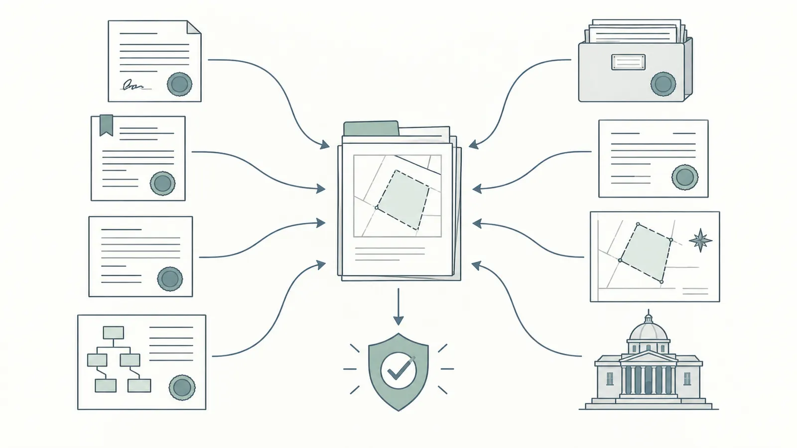
Start with the legal description and the county clerk, not the listing map: Texas Property Code §11.001 generally identifies the county where part of the property is located as the place of recording for an instrument relating to real property. Searching each county for a tract that crosses a county line, and checking parent-tract or historical records, is a conservative title-research workflow when the legal description, referenced instruments, boundary history, or title examiner’s scope makes those records relevant; it is not a universal command created by §11.001.
Ask the seller, title company, or broker for the complete legal description exactly as it will appear in the contract and commitment. Capture the county, survey name, abstract number, original grantee or patent reference if shown, block and lot if platted, acreage, tract number, metes-and-bounds calls, parcel or account numbers, and any prior names used for the property. A street address is an index key, not a legal description. Rural land may have no reliable street address, and a single address can be used for a larger parent tract than the lot being sold.
Build an identity packet
Create one folder or record with these inputs:
- the proposed contract and every exhibit;
- the seller’s vesting deed and the legal description copied without retyping;
- the title commitment’s Schedule A legal description;
- a current boundary survey, if available, showing monuments, fences, roads, structures, water features, apparent easements, and improvements;
- the county appraisal district parcel identifiers used only as cross-references;
- subdivision plats, replats, dedication plats, restrictions, and amendments;
- a sketch of the house, driveway, septic reserve, well, utilities, outbuildings, pool, and future expansion;
- the names of every county, municipality, special district, and utility service area that may touch the land; and
- a deadline calendar showing inspection, objection, option, feasibility, title-objection, financing, and closing dates.
The purpose is to prevent a common failure: the title examiner searches Tract A while the listing or survey depicts a neighboring Tract B, or the buyer searches a parcel number that was split from a parent tract without tracing the parent’s reservations. If the commitment, deed, survey, and appraisal record disagree in acreage or boundaries, do not average the numbers. Mark the identity as unresolved and ask the title company and a Texas-licensed land surveyor to reconcile it.
Search the right county records
Under Texas Property Code §11.001, the ordinary recording location for an instrument relating to real property is the county in which part of the property is located. The statute states where an instrument may be effectively recorded; it does not by itself require a buyer to search every county or every parent tract. As a conservative workflow, identify the county or counties in which the tract lies today, then ask the title examiner whether the contract, legal description, referenced instruments, prior parent tract, boundary changes, or search scope make records in each county or an older tract relevant. If the land spans two counties, do not assume the county containing the address or largest acreage covers the other county when the title facts point to a broader search.
The statute is a recording rule; it does not promise that a website’s index is complete, that every private agreement was recorded, or that a modern online search reaches every historical image. Ask the county clerk for the official-records search method, index conventions, image access, and certified-copy process for the named county. The clerk can explain how to retrieve a record; the clerk is not your title examiner or lawyer. A title company can search through its plant and provide the commitment; an attorney can determine what a document means and whether a risk is acceptable.
If the parcel was created by a subdivision, add the plat and all referenced declarations, restrictions, amendments, access dedications, maintenance agreements, and replat records. If it was cut from a ranch or larger farm, search the parent tract rather than stopping at the current deed. Mineral reservations often originate before the current lot existed. A later deed may refer to “less and except” language or prior instruments by volume and page, clerk’s file number, or recording reference. Retrieve every referenced document before deciding that an exception is harmless.
Assign the identity work
The buyer owns the question and deadline. The title company or abstractor owns the organized title search and commitment deliverables. The county clerk owns the public recording system, not the interpretation. The surveyor owns boundary and field-location work within the survey scope. A Texas oil-and-gas or real-estate attorney owns legal interpretation when the documents raise a material issue. A designer or civil professional owns the practical test of whether a documented corridor, access route, septic area, and building envelope can coexist.
Give each person the same legal-description packet. If each professional receives a different sketch, address, acreage, or tract name, disagreements may be coordination errors rather than substantive conclusions. Put the version date on the sketch and keep a change log whenever the house location moves.
Verify before moving on
The parcel-identity gate passes only when the following match closely enough for professional work:
- the legal description in the contract;
- the legal description in Schedule A of the title commitment;
- the tract shown on the survey or preliminary plan;
- the county or counties responsible for recording; and
- the building envelope used for the conflict review.
“Close enough on the map” fails this gate. A one-line difference in a metes-and-bounds call, a missing exception, or an acreage mismatch can move a pipeline, mineral reservation, or access easement from one tract to another. The safest next step is a written title-company or surveyor correction before the buyer authorizes a nonrefundable design, clearing, engineering, or closing commitment.
Build the split-estate record ledger from the vesting deed backward #
Trace the seller’s vesting deed backward through every referenced conveyance and reservation, then forward through leases, assignments, pooling or unit documents, releases, easements, plats, and restrictions; every row must say what estate or use right it affects, where it applies, who must interpret it, and what decision remains.
Texas’s surface/mineral split is the reason a one-line title answer is inadequate. The Railroad Commission explains that severance can happen when the surface is sold while minerals are retained, or when minerals are sold while the surface is retained. Start at the current seller’s vesting deed, but do not stop when the deed says “surface estate.” That phrase can identify the interest being conveyed while pointing to earlier mineral reservations that control the practical risk.
Separate the rights into columns
Use separate ledger columns for:
- surface estate ownership;
- mineral estate ownership by mineral or fractional interest, where the documents distinguish them;
- executive or leasing authority, if stated;
- royalty, nonparticipating royalty, overriding royalty, or other economic interests;
- leasehold or working interest;
- rights to enter, drill, produce, store, inject, use water, build roads, or install pipelines;
- easement or right-of-way ownership and purpose;
- restrictive covenants, plat notes, HOA or subdivision provisions;
- public permits, notices, violations, and operating records; and
- unresolved interpretation or spatial-location questions.
Do not collapse all of these into “mineral rights.” The Texas Supreme Court distinguishes a nonparticipating royalty interest from mineral-fee ownership: a royalty interest is non-possessory and tied to production, while mineral-fee ownership includes rights to possess oil and gas in place, extract it, and lease those property rights. A royalty interest may therefore affect payments without carrying the same operational rights as a possessory mineral interest. A pipeline easement may be held by a utility or operator and may burden the surface even if the mineral estate is not severed. A road easement may be private access rather than an oil-and-gas right. The exact document and legal interpretation control.
Recommended ledger fields
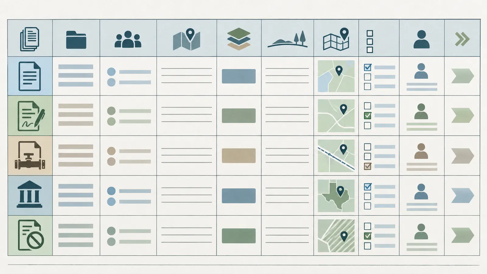
The following is the core artifact. Copy it into a spreadsheet or project record, but preserve the original instrument and a stable retrieval reference alongside each row.
| Field | What to record | Why it changes the decision |
|---|---|---|
| Row ID | L-001, L-002, and so on | Lets the contract, survey, and attorney memo refer to the same issue |
| Source type | Deed, lease, assignment, release, easement, plat, commitment, agency record, ordinance, permit | Prevents a map or listing from being mistaken for a title instrument |
| Recording or agency reference | County clerk file number, volume/page, instrument date, RRC API or permit number, TCEQ program ID, or official URL | Makes the conclusion checkable |
| Parties | Grantor, grantee, lessor, lessee, operator, easement holder, agency | Shows who may need to confirm, release, or negotiate |
| Effective and recorded dates | Both when available; also expiration, term, release, or renewal language | A lease date is not automatically its current status |
| Legal description | Tract, survey, abstract, lot/block, calls, unit, or described strip | Determines whether it actually touches the parcel |
| Estate or use right | Surface, minerals, leasehold, access, road, pipeline, utility, restriction, permit | Keeps unlike rights from being blended |
| Surface-use words | Entry, roads, wells, pipelines, water, injection, restoration, damages, locations, setbacks, consent | Identifies the clauses that can conflict with the house plan |
| Map reference | Survey sheet, station, coordinates, corridor width, field marker, or “not located” | Connects text to the proposed site |
| Status | Confirmed, unresolved, released, expired on its face, active in agency record, or needs legal opinion | Makes uncertainty visible without overclaiming |
| Responsible reviewer | Title examiner, surveyor, attorney, local planner, RRC contact, operator, buyer | Assigns the handoff |
| Next action and due date | Retrieve, survey, clarify, amend contract, relocate, obtain consent, or stop | Turns research into a purchase decision |
Record sequence
Follow the sequence below, saving the actual images or downloads where permitted and recording a retrieval date.
1. Current vesting and conveyance deeds. Identify the seller’s interest and every “subject to,” “less and except,” reservation, exception, and reference. Check whether the deed conveys the surface only, the surface and minerals, a fraction, or an interest subject to a prior severance.
2. Parent and predecessor deeds. Work backward far enough to find the first mineral reservation or conveyance affecting the tract. The title company’s search period and underwriting scope may not equal the historical research an unusual split estate needs. Ask what period was examined and which mineral exceptions remain.
3. Mineral deeds and reservation instruments. Record the mineral description, fractional share, depth or formation language, leasing rights, surface-use language, and references to future documents. Do not decide that a reservation is “small” from a percentage alone; a small undivided interest can still participate in mineral ownership and may be handled differently from a nonpossessory royalty.
4. Leases and lease-related instruments. Search for the original lease, memorandum, amendments, ratifications, assignments, extensions, pooling or unit declarations, designation of pooled unit, production or shut-in provisions, surface-use agreements, waivers, releases, and recorded notices. A lease’s existence, term, production status, and exact surface language require document review. Agency records can identify an operator or well; they do not replace the county-record lease search.
5. Easements and rights-of-way. Retrieve pipeline, gathering-line, road, ingress/egress, utility, drainage, water, telephone, electric, conservation, and access easements. Record the centerline or described strip, width, construction rights, repair rights, temporary workspace, access gates, vegetation limits, building restrictions, relocation rights, and who maintains the route.
6. Plats and restrictions. Search subdivision plats, replat instruments, declarations, restrictive covenants, amendments, HOA records, and private development agreements. A restriction that limits wells, drilling, structures, commercial activities, access, or outbuildings may operate differently from a public ordinance. Record the exact affected lots or tract and the enforcement or amendment language for counsel to evaluate.
7. Probate, entity, and authority records. If a party died, merged, changed names, or conveyed through an entity, check the chain and authority documents. A signature mismatch is a title issue for the title company and counsel, not something a buyer should cure by guessing that names are equivalent.
8. Current commitment and survey exceptions. Reconcile the ledger to Schedule B exceptions, requirements, survey matters, and requested endorsements. The TDI title insurance FAQ explains that Schedule B exceptions can become exclusions or exceptions under the policy. The Texas title manual’s mineral rule states that a company may except or exclude minerals and has no obligation to determine mineral ownership; its model language also warns that mineral leases, grants, exceptions, or reservations may not be listed. This is exactly why a commitment is an input to the ledger, not the ledger’s conclusion.
Common ledger failure cases
The deed is clean but the commitment has a mineral exception. Treat the exception as material until the title company explains the coverage, the documents are retrieved, and counsel decides whether the remaining risk is acceptable. “Clean deed” and “insured title” do not mean the same thing.
A lease appears expired by date. Check production, extension, renewal, shut-in, pooling, ratification, release, and later assignments. Ask an attorney to evaluate status; a spreadsheet date calculation cannot determine whether rights terminated.
A release names the parent tract but not the current lot. Add the release and all referenced descriptions to the ledger. The surveyor and attorney must determine whether the released land includes this parcel.
The operator name differs from the lessee name. Record both. Operators, lessees, working-interest owners, pipeline companies, and mineral owners can have different roles. Ask the title examiner and attorney to reconcile the instruments rather than deleting the row as a name mismatch.
The seller says the minerals were never leased. Preserve the statement as seller-provided information, but still search the records. A seller statement can prompt a document request; it cannot supersede the instruments.
The online index has no result. Record the search terms, county, date range, and index limitations, then ask the title company or county clerk how older records are indexed. An empty web result is not a negative title opinion.
Translate the ledger into a house-site conflict matrix #
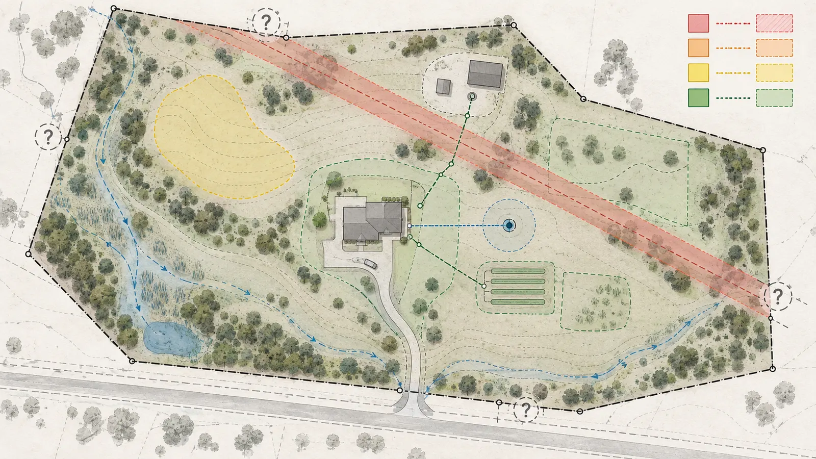
Map the legal description, survey, proposed building envelope, access route, septic or wastewater area, private water supply, utilities, outbuildings, and future expansion together; then flag a document as a conflict whenever the described right intersects a needed area or its location is too uncertain to design around.
The house site is larger than the foundation. Before buying, draw at least these polygons or lines:
- primary house footprint and a construction workspace;
- driveway, turnaround, parking, and emergency access;
- septic tank, absorption or dispersal field, reserve area, and replacement access if applicable;
- private well, water line, storage, and treatment area if applicable;
- electric, telecom, propane, or other service routes;
- detached garage, shop, pool, retaining wall, fence, garden, and future addition areas;
- drainage routes and low areas that must remain open; and
- a planning envelope for construction access and future maintenance.
These are planning geometry, not legal setbacks. Do not assign a universal “pipeline buffer,” “well setback,” or “drilling distance” without identifying the actual instrument, agency rule, municipal ordinance, county order, permit condition, utility standard, or professional design requirement that creates it. If you use a temporary buffer to test alternatives, label the number as an assumption and send it to the responsible reviewer.
Conflict levels
Use this matrix to make the handoff explicit.
| Flag | Evidence pattern | What you may safely say | Required owner and next action |
|---|---|---|---|
| Red: stop | A recorded or confirmed right intersects the house footprint, required access, septic reserve, or utility route; or the legal description/priority is materially unresolved | The current plan is not verified and should not be priced as buildable | Buyer pauses or conditions the transaction; attorney and surveyor interpret; designer tests relocation |
| Amber: resolve | Document touches the parcel but location, width, status, or surface-use scope is incomplete; agency record suggests activity but title link is missing | The parcel may work, but the risk is unpriced | Title examiner, surveyor, operator or agency record custodian, and attorney resolve specific questions |
| Yellow: design constraint | Easement or restriction is confirmed outside the current envelope but limits future expansion, access, vegetation, drainage, or construction method | Current site may fit, but the plan has a durable constraint | Designer and civil professional preserve the corridor and record it in the site plan |
| Green for reviewed scope | The assigned reviewers found no conflict in the documents and map material reviewed | No reviewed conflict was found; future activity is not ruled out | Retain the source set and continue permitting and design checks |
These labels are not legal conclusions. They are a project-control layer that answers “who decides next?” A red item can become amber if a survey precisely locates it and counsel finds a lawful design path; an amber item can become red when a missing instrument is produced.
If the tract will rely on a private well, keep that water decision separate from the mineral-title decision: the Brictale homeowner guide index is the working route for related water and home-planning guides, while this ledger covers land rights and surface-use conflicts. If a well is proposed rather than existing, the well location, access, water-line route, and any drilling or abandonment requirements still belong on the site overlay.
Worked illustrative example with sensitivity
The following is a modeled example, not a Texas parcel, survey, measurement, or legal conclusion. It shows how to expose assumptions rather than claiming that a particular corridor is allowed or prohibited.
Assume a buyer is considering a 12.4-acre tract. The preliminary house envelope is 140 feet by 100 feet, so its footprint area is:
140 ft × 100 ft = 14,000 sq ft
14,000 sq ft ÷ 43,560 sq ft per acre = 0.321 acres
The buyer also reserves a 40-foot-wide, 300-foot-long driveway and utility corridor:
40 ft × 300 ft = 12,000 sq ft
12,000 sq ft ÷ 43,560 = 0.275 acres
A retrieved easement describes a 50-foot-wide strip crossing the likely house area, but the preliminary sketch does not locate the centerline. The correct first conclusion is not “subtract 0.344 acres and continue.” The correct conclusion is amber or red depending on the intersection, because the missing centerline and easement purpose could affect construction, access, restoration, or future maintenance.
For a transparent sensitivity test, the buyer asks the surveyor to show three planning bands around a located centerline: 20 feet, 50 feet, and 100 feet total width. These are illustrative design-test assumptions, not legal restrictions. For a 300-foot segment, the screened area would be:
| Illustrative assumed total corridor width | Calculation | Screened area | Interpretation |
|---|---|---|---|
| 20 ft | 20 × 300 = 6,000 sq ft; ÷ 43,560 | 0.138 acres | Narrow planning test; may miss access, workspace, or maintenance needs |
| 50 ft | 50 × 300 = 15,000 sq ft; ÷ 43,560 | 0.344 acres | Middle planning test only; not a legal setback |
| 100 ft | 100 × 300 = 30,000 sq ft; ÷ 43,560 | 0.689 acres | Conservative design test; may reveal whether the parcel has alternate envelopes |
If the 50-foot test strip overlaps the 0.321-acre house footprint by 4,000 square feet, the overlap is 4,000 ÷ 43,560 = 0.092 acres. That overlap is not automatically unusable; the legal instrument, survey, operator rights, construction restrictions, and professional interpretation determine what can occur there. The value of the calculation is that the buyer can see the decision’s sensitivity: a location error or a different planning band changes the envelope, so the buyer should not approve a home budget on the preliminary sketch.
Overlay procedure
Use a survey or GIS-capable plan as the base, but preserve source provenance. A practical order is:
- Load the legal boundary and label the source and date.
- Add the survey monuments, apparent fences, roads, structures, and visible markers.
- Add the proposed house footprint and all required infrastructure areas.
- Add each recorded easement from its legal description, survey exhibit, plat, or retracement. If the document cannot be located, draw the uncertainty as a question area, not a precise line.
- Add well surface locations, permitted locations, pipeline lines, and other agency features from official records, with the agency source and its limitations visible.
- Add local restriction areas, plat notes, or operations sites only after identifying the actual county or municipality and the document that creates the restriction.
- Number each intersection with its ledger row ID.
- Ask the surveyor to locate or retrace disputed corridors and the attorney to interpret whether the right conflicts with the proposed use.
A screenshot with no scale, legal description, date, or source is not a defensible overlay. A map can help you ask the right question, but it cannot transform an approximate point into a boundary or easement.
What to bring to professionals
Give the surveyor the full deed, easement exhibits, plats, and a dimensioned site concept. Ask for a written list of what was located, what was inferred, what was not found, the coordinate or monument basis, and which lines require private utility locating or operator confirmation.
Give the attorney the current commitment, every mineral and lease instrument, releases, pooling or unit documents, easements, restrictions, seller representations, the proposed site plan, and the decision deadline. Ask targeted questions: Who owns the surface? Which mineral interests are severed? Who has present possessory or operational rights? What surface uses are granted or limited? Is the lease or easement released, expired, amended, pooled, or still effective? What is the legal consequence of each conflict? Can it be cured, insured, negotiated, relocated, or only accepted?
Give the designer or civil professional the reviewed conflict matrix, not only a verbal warning. Ask them to test a second envelope and identify which program element is the controlling constraint: the house, septic, access, utility, construction staging, or future expansion.
Check agency records, pipelines, permits, and local rules without treating maps as proof #
Use agency maps and permit systems to discover wells, pipelines, facilities, and regulatory records, then verify each meaningful result against the county-record instruments, survey, exact permit file, and responsible authority; an empty or approximate map result is not proof of no private burden or no future activity.
Railroad Commission screening
The RRC Public GIS Viewer can display oil, gas, and pipeline data and offers search tools for leases, surveys, pipelines, and wells. Use it to search by county, survey, lease, API number, coordinates, and nearby radius. Save the query date, search terms, map scale, layer names, and record identifiers. The RRC says the viewer is not intended to be an authoritative public record for any geographic location and has no legal force or effect. That limitation should appear in your ledger.
Use the viewer to create questions such as:
- Is a well surface location inside or near the tract?
- Does a lease or survey name match the deed or parent tract?
- Is there a pipeline or removed pipeline record near the proposed driveway or house?
- Is the mapped well point a surface-hole location or a bottom-hole location?
- Does the record identify an operator, lease name, API number, permit, plugging report, or production history to retrieve?
Do not use the map to decide the exact location of a horizontal well’s surface hole. The RRC’s GIS guidance explains that coordinates shown for a well can be the bottom-hole location and should not be used as the surface-hole location for a deviated or horizontal well. Put that distinction in the map notes and ask the surveyor or RRC record contact for the relevant surface-location documentation.
Wells, permits, and historical records
The RRC oil-and-gas well-records page says records can include W-1 applications and location plats, completion reports, plugging reports, P-4 producer’s transportation authority records, and related documents. The RRC drilling-permit query lets you search by county, operator, lease, API number, status, wellbore profile, and other fields. Retrieve the underlying record instead of relying on a search-result line.
For each nearby or intersecting record, record:
- API or permit number;
- county, survey, abstract, lease, and well number;
- surface-hole coordinates and bottom-hole coordinates when both are available;
- operator and lease names;
- permit status and approved or amended dates;
- completion, production, plugging, and abandonment information;
- pipeline, gathering, injection, disposal, or storage clues;
- whether the record is on the parcel, an offset, or merely in the search radius; and
- the exact question a title examiner, surveyor, or attorney must answer.
An RRC permit is evidence of an agency filing or authorization within the permit’s scope. It is not evidence that the operator owns the surface, that the lease is enforceable against this parcel, that a well will be drilled, or that a house is prohibited. Conversely, lack of a permit in the result set is not proof that there is no recorded lease, no dormant right, or no private easement.
Pipeline screening and its blind spots
Search the RRC pipeline layer and the related county records. If a transmission or hazardous-liquid line may be nearby, also use the PHMSA National Pipeline Mapping System public viewer. PHMSA states that its viewer covers facilities under PHMSA jurisdiction but does not contain distribution or gas-gathering pipelines and restricts map scale. Therefore, absence from NPMS is not a negative finding. It is one screen with known omissions.
The pipeline question has two separate parts:
- Where is the physical line or facility? Use agency records, operator confirmation, a survey or locating professional, visible markers, and later Texas 811 procedures.
- What right permits it to be there and what can happen in the corridor? Retrieve the recorded easement, right-of-way, lease, assignment, amendment, construction or maintenance language, and any restrictions on buildings, trees, excavation, access, grade, and restoration.
Do not walk a suspected line and treat a marker as a boundary. Do not dig, probe, expose, or move a marker during a pre-purchase visit. When the project moves to any excavation, Texas pipeline-damage-prevention guidance says homeowners must contact 811 two business days before digging, including on private property; see the RRC homeowner guidance. Texas811 explains that participating utility members may not mark private or non-member utilities, including some lines between a meter and a building, and that separate private locating may be needed; see Texas811’s locate-process guidance. Therefore, 811 is a construction-safety step, not a complete private-line inventory and not an interpretation of the easement.
Environmental and facility records
The Texas Commission on Environmental Quality provides a map-based search and Central Registry searches for regulated facilities and permits. Search by the tract’s address, coordinates, county, nearby operator or facility names, and relevant program identifiers. Save the record number, facility boundary or location description, permit type, status, owner/operator, enforcement or compliance material, and agency contact.
Use TCEQ results to screen for regulated activity that could affect planning, access, odor, noise, storage, waste handling, water protection, or environmental review. Do not convert a facility point into a parcel boundary, and do not decide from the map that a permit authorizes activity on your land. Read the exact permit and ask the responsible TCEQ program or an environmental professional when a facility, discharge, waste, tank, remediation, or groundwater issue is relevant.
Local jurisdiction: name the place before naming the rule
The applicable local rule is the rule adopted by the actual municipality, county, special district, or other authority with jurisdiction over the parcel. Do not copy a setback, drilling restriction, plat requirement, zoning label, road standard, or septic process from another Texas county or city.
Texas’s statutory framework itself is divided. Local Government Code Chapter 232 addresses county regulation of subdivisions and property development, while Chapter 212 addresses municipal regulation of subdivisions and property development. The parcel’s city limits, extraterritorial jurisdiction, county location, interlocal agreements, plat status, and adopted ordinances determine which office and rule set to check.
Write the jurisdiction in your ledger with the actual names taken from the parcel records and the responsible offices, not a generic “Texas” label. State whether the tract lies inside the corporate limits of a named municipality, outside those limits in a named county, or in a named municipality’s extraterritorial jurisdiction. If it is in an ETJ, record the municipality, county, and any interlocal allocation that controls plat or development review. These are workflow fields, not local-rule claims, until the actual office confirms them.
Ask the named county and municipal offices for written confirmation of whether the land is platted, whether a building permit or site-plan review is required, who approves access and driveway work, whether municipal ordinances reach the site, and which authority handles on-site sewage, private wells, roads, drainage, and utility crossings. Record the ordinance or order number and effective date. This guide cannot name a parcel-specific local rule because the approved opportunity does not identify a particular county or municipality; the buyer must complete that jurisdiction step for the tract under contract.
Qualified subdivision path under Texas law
The RRC’s surface-ownership explanation points to a qualified-subdivision restriction path under Chapter 92 of the Texas Natural Resources Code. The current Chapter 92 text describes conditions involving tract size, county population or a barrier island, residential/commercial/industrial subdivision, operations sites, and road and pipeline easements. It also says the subdivision plat must be approved by the Railroad Commission and filed with the clerk of the county in which the subdivision is located.
Treat this as a conditional research branch, not a default protection. Ask whether the actual plat is a qualified subdivision under the statutory definitions, whether the RRC approved it, where it was filed, what operations sites and easements it designates, and whether the proposed lot is covered. A subdivision plat that merely looks residential is not enough. A buyer should have Texas counsel evaluate whether Chapter 92 affects the specific proposed use and how it interacts with mineral interests, leases, and other instruments.
Make the pre-contract decision and assign escalation before deadlines #
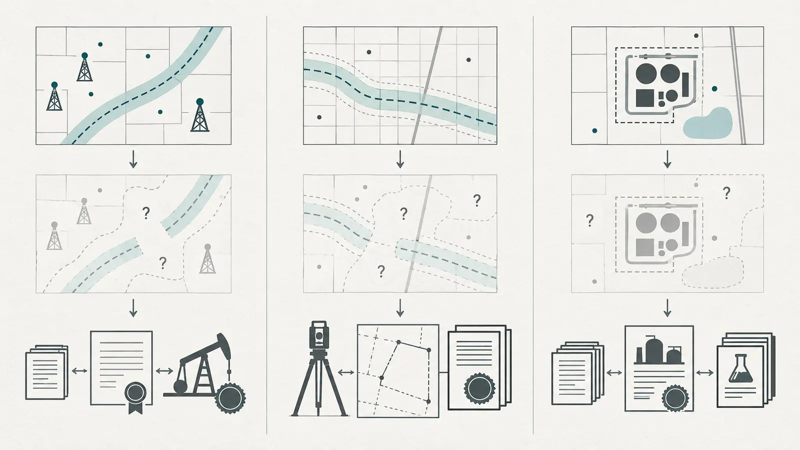
Proceed with a Texas vacant-land purchase only when each material conflict has a named owner, a source, a decision deadline, and an acceptable remedy; unresolved mineral ownership or surface-use conflicts should be handled by a Texas attorney before the buyer is locked into the transaction.
Use a deadline-driven evidence packet
Build the packet in this order:
Before an offer or option. Obtain the legal description, seller’s title information, known surveys and plats, listing representations, mineral disclosures if any, proposed site sketch, and a written request for leases, easements, restrictions, and prior reports. Make the offer or option reflect the time needed for title, survey, legal, and local checks. A short feasibility window is itself a risk if the records are old, the tract was split from a parent parcel, or the house site is not fixed.
Immediately after contract. Order the title commitment and survey. Give the title company the exact questions: surface and mineral reservations; mineral exceptions; leases and memoranda; pipeline and road easements; access; restrictions; unreleased liens; missing releases; parent-tract documents; and any inconsistency between Schedule A, Schedule B, the deed, and the survey.
During title review. Retrieve every referenced document and update the ledger. Do not simply ask “is this okay?” Ask the title agent to identify what is insured, what is excepted, what must be satisfied, and what the company will not determine. Ask counsel to interpret the exceptions that affect the house site.
During spatial review. Have the surveyor overlay easements, roads, visible improvements, wells, pipeline evidence, and the proposed building and infrastructure areas. If a line cannot be located from the records, show an uncertainty band and assign field investigation. Have the designer test an alternate envelope so the purchase decision is not dependent on one exact house orientation.
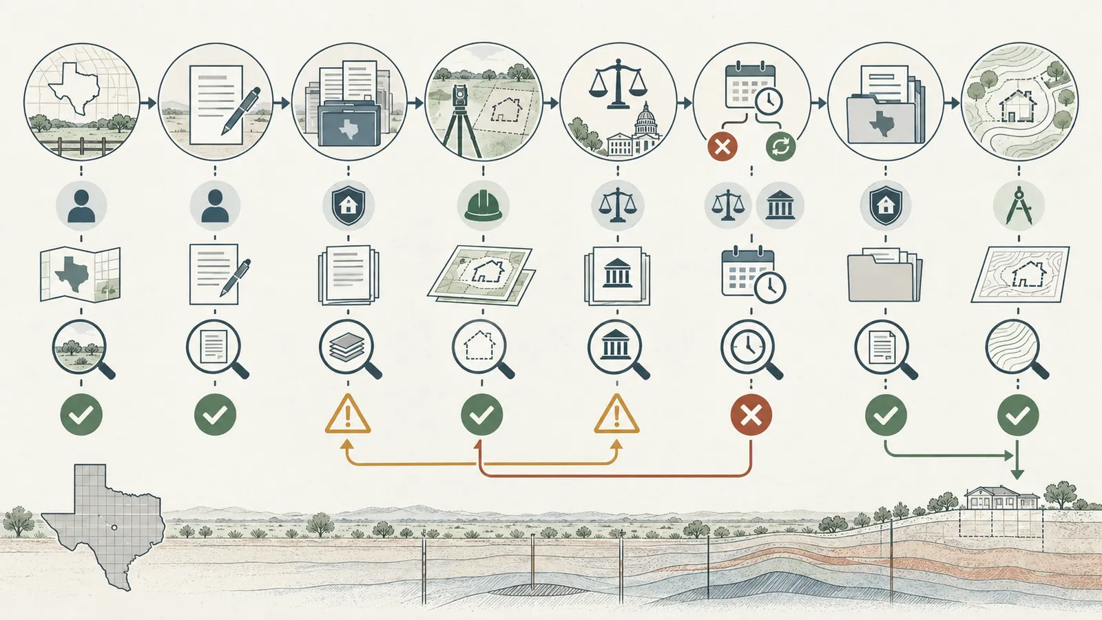
Before the objection or termination deadline. Convert each unresolved row into one of four contract outcomes: seller delivers a document or release; title company changes or endorses coverage; buyer receives a written legal conclusion and accepts the risk; or buyer exercises the available remedy. Do not let a verbal “we think it is fine” consume the deadline.
Escalation triggers
Ask for Texas oil-and-gas or real-estate attorney review when any of the following occurs:
- the current deed conveys surface only or contains a mineral reservation;
- the title commitment excepts or excludes minerals or says mineral ownership is not determined;
- a lease, memorandum, pooling document, unit designation, assignment, ratification, shut-in provision, release, or surface-use agreement is found;
- an easement crosses the proposed house, septic reserve, well, driveway, utility route, or future expansion;
- the documents use broad rights such as “all necessary uses,” “ingress and egress,” “pipelines,” “water,” “injection,” or “surface damages” and the practical scope is disputed;
- a seller or title company proposes an indemnity or “insure over” solution without explaining what is actually covered;
- ownership is fractional, names are inconsistent, an estate or entity is involved, or a release does not clearly cover the parcel;
- local restrictions, Chapter 92, a plat, or an ordinance may alter surface operations;
- RRC or TCEQ records show activity that cannot be reconciled to the county instruments; or
- the buyer would proceed only if drilling, access, construction, restoration, or future surface use does not occur.
The RRC itself says its surface-ownership page is general information and not legal advice, and recommends an experienced oil-and-gas or real-estate attorney for specific situations. Keep that RRC limitation and recommendation with the escalation record. The attorney is not being asked to certify that the parcel is safe; they are being asked to state what the reviewed instruments appear to permit, what remains uncertain, and what remedy or negotiation is available.
A practical conflict worksheet
Complete one row per issue; do not use one row called “mineral rights.”
| Row | Input and question | Evidence to attach | Responsible reviewer | Decision or remedy |
|---|---|---|---|---|
| C-01 | Does the seller own the surface estate described in the contract? | Vesting deed, commitment Schedule A, legal-description comparison | Title examiner; attorney if inconsistent | Correct description, cure title, or stop |
| C-02 | What minerals were reserved or conveyed away? | Mineral deed, reservation, predecessor deeds, commitment exception | Texas oil-and-gas attorney | Accept, buy/obtain interest, negotiate, or stop |
| C-03 | Is there a current or disputed lease? | Lease, memorandum, amendments, assignments, releases, agency records | Attorney and title examiner | Interpret status and surface rights; condition closing |
| C-04 | Can a lease or mineral right use the surface where the house is planned? | Surface-use clauses, survey overlay, site plan | Attorney, surveyor, designer | Relocate, negotiate, document consent, or stop |
| C-05 | Does a pipeline or road easement intersect the plan? | Recorded easement, exhibit, survey retracement, operator confirmation | Surveyor and attorney | Preserve corridor, relocate plan, seek agreement, or stop |
| C-06 | Are wells, permits, units, or disposal records nearby? | RRC API, W-1, W-3, P-4, maps, permit files | RRC record review; attorney/surveyor | Verify exact location and relationship; do not predict activity |
| C-07 | Is a public or private restriction applicable? | Plat, restrictions, ordinance/order, Chapter 92 records | Named local authority and attorney | Confirm jurisdiction and enforceability |
| C-08 | Can the home and all required site systems fit? | Survey, soils/septic/water inputs, overlay, alternate envelopes | Designer, civil, well/septic professionals | Redesign or reject if no resilient envelope |
What an acceptable answer sounds like
A useful professional answer is specific: “Instrument 2018-1234 reserves an undivided mineral interest under Tract 2; the lease recorded as 2019-5678 is assigned to Operator X; the easement in 2007-8910 crosses the east third; the survey locates its centerline 180 feet from the proposed foundation; the current plan preserves the described corridor; counsel identifies a remaining surface-use issue requiring seller delivery before closing.”
An unhelpful answer is categorical and source-free: “There are no problems,” “the minerals are probably worthless,” “the map shows nothing,” or “the operator cannot build there.” The first three omit evidence; the last may be legally wrong or incomplete. Ask for the instrument, the location basis, the uncertainty, and the next decision.
Price and negotiation consequences
This guide does not assign a dollar value to severed minerals or predict a discount. The economic effect depends on ownership, production, lease terms, market conditions, local development, design alternatives, financing, insurance, and the buyer’s tolerance for future conflict. But the ledger tells you what to price or negotiate:
- the cost and time of title and attorney review;
- a boundary or easement retracement survey;
- an alternate house or driveway design;
- private utility locating or operator coordination;
- extra access, drainage, or site-work design;
- a surface-use or damages agreement if a mineral owner or lessee is willing to negotiate;
- an insurance exception or endorsement that remains acceptable; and
- the cost of walking away if the risk cannot be resolved before the deadline.
Do not pay a premium for “mineral rights included” until the title and attorney review establishes which interest is actually conveyed and what operating rights accompany it. Do not assume a seller can promise “no drilling” unless the promise is documented by a party with authority and counsel explains its effect. Do not assume a surface-use agreement binds future owners or operators without reviewing its recording, parties, assignment, and enforcement terms.
Carry the verified constraints into design, closing, and ownership #
The purchase review is complete only when the accepted constraints travel into the closing file and the home design: preserve the source documents, surveyed corridors, local jurisdiction, unresolved assumptions, and maintenance or access consequences so a future designer, builder, lender, or owner does not unknowingly place work in a reserved area.
Closing handoff
Before closing, freeze a reviewed version of the ledger. Include:
- the final contract legal description and title commitment;
- the final survey and any revisions;
- each accepted Schedule B exception and its plain-language project note;
- the mineral, lease, pooling, release, pipeline, road, utility, and restriction instruments;
- the attorney’s written scope and unresolved items, if retained;
- the local offices contacted, named jurisdiction, ordinance/order references, and dates;
- the RRC, PHMSA, TCEQ, and 811 screening records with their limitations; and
- the final building-envelope drawing showing preserved corridors and “do not infer” notes.
Ask the title agent what changed between the initial and final commitment. A new exception, updated survey matter, unreleased lien, or corrected legal description can change the decision. Ask counsel to review material changes rather than assuming they are administrative.
If the buyer accepts a known burden, write the acceptance accurately. “Buyer understands the 50-foot pipeline easement recorded in Instrument X and will preserve its described area pending survey retracement” is more useful than “buyer accepts all easements.” The precise statement helps a designer and builder avoid converting a legal exception into a field mistake.
Design handoff
Give the architect, designer, civil engineer, septic designer, well professional, and builder the same plan layers. Put the corridor and conflict IDs on the plan set. Identify which lines are legally described, which are surveyed, which are approximate, and which require a field locate or operator confirmation. Preserve access for the easement holder if the instrument requires it. Do not place a foundation, retaining wall, deep landscaping, pool, septic reserve, or utility trench in a corridor merely because the current aerial image looks empty.
For a home in a rural or suburban area, also keep future ownership in mind. A future owner may not know why an unused strip crosses the yard, why a gate must remain accessible, why a well pad or pipeline marker matters, or why an expansion was placed on the opposite side of the house. Add a short “site rights and restrictions” sheet to the owner’s project record, with the exact instruments and dates.
Construction safety boundary
Do not excavate to verify a line, expose a pipeline, enter a well site, remove a marker, open a valve, operate an oil-and-gas facility, or alter an easement during due diligence. Use qualified survey, utility-locate, pipeline, environmental, well, and construction professionals. When actual excavation is planned, follow Texas 811 requirements; the RRC homeowner resource states that Texas homeowners must contact 811 two business days before digging, including on private property.
This article’s remote workflow cannot see buried lines, verify a monument, measure an easement, inspect a well, test soil or water, assess structural conditions, or determine whether a private right is enforceable. A map overlay is a coordination tool. It is not a survey, utility locate, environmental assessment, engineering design, title examination, or legal opinion. If the site contains a suspected well, pipeline, chemical facility, unstable ground, contaminated area, open excavation, energized equipment, or unknown underground structure, keep people away and assign the investigation to qualified professionals.
Ownership maintenance
After purchase, update the ledger when you receive a lease notice, operator contact, pipeline notice, permit notice, survey, replat, road change, utility installation, or design revision. Record who contacted you, the date, document number, affected area, and response. Do not discard an old instrument because the land appears quiet; it may explain access, restoration, future maintenance, or a restriction that matters years later. Keep water-quality records with the relevant guide reached from the Brictale homeowner guide index when the property uses a private well; a clean water sample does not answer a mineral or surface-use question.
At each major design milestone, ask:
- Did the foundation, driveway, septic field, well, utilities, or additions move?
- Did a new survey or site plan reveal an intersection?
- Did a new owner, operator, assignment, or local jurisdiction appear?
- Did a title commitment update add, remove, or change an exception?
- Did an agency record change the status or location of a well, permit, or facility?
- Does the current plan still preserve every known easement and access obligation?
If the answer to any question is yes, reopen the affected conflict rows. Do not “version” the map by overwriting the old one; retain the prior plan and note the decision that changed.
Original contribution: Texas split-estate record ledger and house-site conflict matrix
The contribution is a Texas split-estate record ledger and house-site conflict matrix that turns a broad title concern into inspectable work. Its source inputs are the parcel’s legal description, seller’s vesting deed, predecessor deeds, mineral reservations and conveyances, leases and lease-related instruments, pooling or unit documents, pipeline and road easements, restrictions and plats, title commitment, RRC and other agency records, named local rules, survey, and proposed building envelope.
Method. Sequence the county-record chain from the seller's vesting deed backward, isolate surface and mineral interests, reconcile leases and easements, overlay their described corridors on the survey and building envelope, then flag each conflict as clear, unresolved, or stop until the responsible professional verifies it. In practice, that means following the chain forward through leases, assignments, releases, easements, plats, and restrictions; reconciling each item to the title commitment; adding agency records as a separate evidence layer; and overlaying the described or surveyed locations on the house, access, septic, well, utilities, construction workspace, and future-expansion areas. Assign a red, amber, yellow, or green-for-reviewed-scope flag, name the responsible reviewer, preserve the uncertainty, and write the next decision and deadline.
The method is reproducible because another reviewer can inspect the same row ID, recording reference, legal description, map layer, and decision owner. The illustrative area calculations earlier show how to expose units, formulas, assumptions, and sensitivity. They do not estimate actual legal setbacks or prove any parcel is buildable.
Limitations. This is an illustrative homeowner workflow, not a title examination, survey, engineering study, legal opinion, or promise that drilling or surface activity will or will not occur; public maps and agency pages cannot establish private title, exact field locations, or enforceability. The RRC specifically limits the legal force of its GIS Viewer, PHMSA’s viewer omits distribution and gas-gathering pipelines, TCEQ search results are screening records, and a Texas title commitment may exclude or fail to determine mineral interests. A Texas attorney, title professional, surveyor, local authority, and relevant technical professional must decide the site-specific questions.
Final decision checklist
Do not mark the parcel “verified” until the answer is yes, no, or explicitly unresolved for every line:
- The contract, title commitment, survey, and parcel identifiers refer to the same legal tract.
- The title reviewer has identified each county in which any part of the tract lies and documented which county records, parent-tract records, or historical records were searched and why.
- The current vesting deed and parent-tract documents have been retrieved and reconciled.
- Surface ownership is documented separately from mineral ownership.
- Mineral reservations, mineral deeds, fractional interests, and referenced instruments are listed.
- Leases, memoranda, assignments, amendments, pooling or unit documents, releases, and surface-use agreements have been requested and reviewed within the responsible scope.
- Pipeline, road, utility, water, drainage, and access easements have been retrieved and mapped or marked as uncertain.
- The title commitment’s Schedule A, requirements, Schedule B exceptions, mineral language, and survey matters have a written disposition.
- RRC wells, permits, well records, and pipeline layers have been screened, with bottom-hole versus surface-hole limits noted.
- PHMSA and TCEQ screens were used where relevant, with their coverage limits preserved.
- The actual city, ETJ, county, special district, and subdivision jurisdiction are named, and the responsible offices confirmed the applicable local process.
- Chapter 92 was checked as a possible qualified-subdivision branch when the facts could fit, rather than assumed to apply.
- The house, construction workspace, driveway, septic reserve, well, utilities, outbuildings, and future expansion were overlaid against every known or uncertain conflict.
- A qualified Texas attorney reviewed every material unresolved mineral, lease, surface-use, priority, or enforceability question.
- The contract or option contains enough time and remedies to receive the required documents and decisions.
- The final accepted constraints are in the closing and design handoff packet.
- No one will excavate or disturb suspected underground infrastructure during due diligence; future excavation will follow Texas 811 requirements.
The next decision is not “Are mineral rights good or bad?” It is “Given this tract, this house site, these documents, these mapped conflicts, these named jurisdictions, and these unresolved questions, is the buyer willing to proceed at this price and on these contract conditions?” If that answer depends on an unreviewed instrument, an approximate map, a seller’s assurance, or a hoped-for absence of drilling, the parcel is not yet verified.
Cite this guide
Brictale. “How to Verify Texas Vacant Land Mineral Rights Before Buying.” Published 2026-09-21; updated 2026-09-21.
https://brictale.com/build/land/verify-texas-vacant-land-mineral-estate-surface-use-before-buying · Read the Markdown version
Original contribution: Texas split-estate record ledger and house-site conflict matrix. A parcel-specific ledger connects every title instrument, lease, easement, agency record, and local restriction to the proposed house site and assigns an evidence status and next decision.
Sources and scope
Evidence behind this page
- Texas treats surface and mineral estates as distinct ownership interests; when severed, the mineral estate is generally dominant and may use the surface to the extent reasonably necessary for exploration, development, and production, subject to lease, deed, ordinance, and other limits.
Oil & Gas Exploration and Surface Ownership
Texas Railroad Commission general information for Texas surface and mineral owners; not a parcel-specific legal opinion and not a prediction of drilling.
Accessed · Link to this claim - The Texas Supreme Court distinguishes a nonparticipating royalty interest from ownership of the mineral fee: a royalty interest is a non-possessory interest in production, while mineral-fee ownership includes the rights to possess oil and gas in place, extract it, and lease those property rights to others.
Hahn v. ConocoPhillips Company, Texas Supreme Court opinion
Texas Supreme Court treatment of nonparticipating royalty and mineral-fee interests; the opinion does not classify a particular parcel without reviewing its instruments.
Accessed · Link to this claim - Texas Property Code §11.001 identifies the county in which part of a property is located as the place of recording for an instrument relating to that property; it does not itself prescribe a universal search of every county or every parent tract, so broader searching is a conservative title-research response to the tract’s legal description, references, boundary history, and title-review scope.
Texas Property Code, Chapter 11, §11.001 Place of Recording
Texas state recording rule; the article tells the buyer to confirm the current county boundaries and search with the title company and county clerk.
Accessed · Link to this claim - The Texas Department of Insurance says title agents check public records for title problems, including deeds, mortgages, wills, divorce decrees, court judgments, tax records, liens, encumbrances, and maps; a buyer should therefore use the title search and underlying instruments as the title-review evidence set rather than treating a single public index as the conclusion.
Texas Department of Insurance consumer explanation of title-agent public-record review; it does not replace the actual commitment, county records, or legal advice for a parcel.
Accessed · Link to this claim - A Texas title commitment comes before closing, lists requirements and potential exceptions, does not guarantee that no current or future issue exists, and should be discussed with the title agent and potentially a lawyer.
Texas Department of Insurance consumer explanation of title commitments and title policies; coverage depends on the actual commitment, policy, exceptions, and endorsements.
Accessed · Link to this claim - Texas title-insurance rules permit a mineral exception or exclusion and state that a title company has no obligation to determine ownership of a mineral interest; the form warns that mineral leases, grants, exceptions, or reservations may not be listed.
Texas Title Insurance Basic Manual, Procedural Rule P-5.1
Texas title-insurance underwriting rule; it explains why a buyer must read mineral exceptions and obtain separate legal review rather than treating title insurance as a mineral-title opinion.
Accessed · Link to this claim - The Texas Railroad Commission Public GIS Viewer displays oil, gas, and pipeline data, but the Commission states that the viewer is not an authoritative public record for any geographic location and has no legal force or effect.
Texas Railroad Commission map-tool limitation; use the viewer for screening and record retrieval, then verify private rights against instruments, survey work, and qualified review.
Accessed · Link to this claim - Texas Railroad Commission research tools provide drilling-permit queries and well records that can include W-1 applications and location plats, completion reports, plugging reports, P-4 records, and related documents; the records are agency records rather than proof of private title or a future operation.
Oil and Gas Well Records and RRC Online Research Queries
Texas Railroad Commission records guidance, including the stated availability of records and the distinction between agency records and private property instruments.
Accessed · Link to this claim - The Texas Railroad Commission Public GIS Viewer states that the coordinates shown for a well are the bottom-hole location and must not be used as the surface-hole location for a deviated or horizontal well; the viewer separately describes cursor coordinates as a way to obtain a surface-hole reference.
Using the RRC Public GIS Viewer
Texas Railroad Commission GIS guidance for interpreting well coordinates; it is a mapping instruction, not a survey, title conclusion, or construction clearance.
Accessed · Link to this claim - The Texas Railroad Commission Drilling Permit (W-1) Query provides search criteria including permit or status number, API number, district, county, operator, lease, well number, field, survey, well type, status, wellbore profile, well location, completion status, and approved or submitted date ranges; when multiple criteria are selected, all selected criteria must be true for a W-1 record to appear in the result list.
Texas Railroad Commission public W-1 query interface as accessed on September 14, 2026; fields and interface behavior may change, and a query result is an agency record rather than proof of private title or future operations.
Accessed · Link to this claim - Texas Natural Resources Code Chapter 92 defines a qualified subdivision with acreage, county-population or barrier-island, residential/commercial/industrial subdivision, operations-site, and road/pipeline-easement conditions; §92.003 requires an approved plat to be filed with the clerk of the county where the subdivision is located.
Texas Natural Resources Code, Chapter 92
Texas statutory path for a qualified subdivision; it is conditional and does not mean every Texas subdivision or vacant parcel has these protections.
Accessed · Link to this claim - Texas Local Government Code Chapter 232 provides a county subdivision-regulation framework, including county authority and plat filing requirements that apply according to the statute and the parcel’s facts; the chapter does not identify the applicable county or local rule without first establishing the parcel’s jurisdiction.
Texas Local Government Code Chapter 232 (official statute PDF)
Texas county subdivision framework; the parcel’s actual county, city limits, ETJ, interlocal arrangements, plat status, and adopted ordinances must be confirmed with the named local authorities.
Accessed · Link to this claim - Texas Local Government Code Chapter 212 provides a municipal subdivision-regulation framework, including municipal authority over plats within a municipality and its extraterritorial jurisdiction subject to statutory and interlocal limits; the applicable office and rules depend on the parcel’s actual jurisdiction.
Texas Local Government Code Chapter 212
Texas municipal and extraterritorial-jurisdiction subdivision framework; the parcel’s actual city limits, ETJ, interlocal arrangements, plat status, and adopted ordinances must be confirmed with the named local authorities.
Accessed · Link to this claim - The federal PHMSA National Pipeline Mapping System public viewer covers pipelines and facilities under PHMSA jurisdiction but does not contain distribution or gas-gathering pipelines and limits map scale; absence from that viewer is not proof that no line or easement exists.
Federal PHMSA map coverage and access limitations; Texas deed records, operator information, survey evidence, and 811 procedures remain separate checks.
Accessed · Link to this claim - The Texas Commission on Environmental Quality provides a map-based search and Central Registry searches for regulated facilities and permits, which can screen for nearby regulated activity but do not replace title, easement, survey, or permit-condition review.
Texas Commission on Environmental Quality homepage and Central Registry search
TCEQ public search tools; the article limits their use to screening and directs the buyer to inspect the actual record and responsible local or state program.
Accessed · Link to this claim - Texas pipeline-damage-prevention guidance says a homeowner must contact 811 two business days before digging, including on private property; the locate process is a construction-safety step, not a substitute for researching recorded easements or building restrictions.
Resources for Homeowners: Pipeline Damage Prevention Program
Texas call-before-you-dig requirement as described by the Railroad Commission; applies when excavation is planned and does not establish private title or final construction clearance.
Accessed · Link to this claim - Texas811 says the one-call system notifies participating utility members, which may not mark private or non-member utilities; private utility lines such as lines between a meter and a building may require separate locating arrangements and cost.
What To Expect When You Contact Texas811
Texas811 process guidance for excavation planning; it is a locate-process boundary, not title evidence, an easement interpretation, or a substitute for qualified private locating.
Accessed · Link to this claim