Does Your Vacant Lot Qualify for a Small Residential Erosion-Control Plan?
Use North Carolina, Virginia, Oregon, Guilford County, and Richmond plan-fit gates to choose simplified controls, a site-specific plan, or professional review.
The short answer
Maybe—but acreage alone cannot answer. First identify the actual approving authority and whether the lot belongs to a subdivision or other common plan. Then measure the complete proposed disturbance, including access, staging, utilities, stockpiles, and grading. A simplified path is only a candidate when that authority’s slope, water, grade, overlay, and stabilization assumptions fit and the authority confirms the path before work starts.Does Your Vacant Lot Qualify for a Small Residential Erosion-Control Plan?
Maybe—but acreage alone cannot answer. First identify the actual approving authority and whether the lot belongs to a subdivision or other common plan. Then measure the complete proposed disturbance, including access, staging, utilities, stockpiles, and grading. A simplified path is only a candidate when that authority’s slope, water, grade, overlay, and stabilization assumptions fit and the authority confirms the path before work starts.
This guide is for a United States homeowner planning a vacant-lot home build before clearing or grading. It is a planning and handoff method, not a permit, survey, wetland delineation, soil investigation, engineering design, legal opinion, or statement that the lot is buildable. North Carolina, Virginia, Oregon, Guilford County, and the City of Richmond are used as named examples because their published materials make the decision gates visible. Your county, city, state, watershed, and delegated program may use different terms, lower thresholds, additional buffers, or a different application path.
Use this decision alongside Brictale’s land and feasibility planning route, then carry unresolved costs into project budgeting and site constraints into home design. The links are journey handoffs, not substitutes for the named authority’s current direction.
The safe decision is not “my lot is under an acre, so I can start.” The safe decision is “I have documented the authority, the complete limit of disturbance, the common-plan context, the physical assumptions, the responsible parties, and the confirmation I still need.” Until that record is complete, do not authorize clearing, mass grading, excavation, utility trenching, access construction, or stockpiling on the assumption that a builder’s phrase such as “small lot” is a permit category.
A small lot qualifies only when the authority’s entire plan-fit set of assumptions is true #
A vacant lot is a candidate for a simplified residential erosion-control path only when the named authority accepts the relevant simplified process and the proposed work satisfies every condition that process assumes. “Small” is a useful starting description, not a nationwide eligibility test. The controlling comparison is between your proposed disturbance and the authority’s rule, sample plan, permit form, or written direction for that parcel.
The distinction matters because an erosion and sediment control plan is about temporary and permanent treatment of disturbed land. It does not establish that a house can be built, that a driveway can cross a ditch, that a septic area is approved, that a wetland is absent, or that the soil will support a foundation. A vacant parcel can fail a plan-fit screen even when it looks spacious and dry from the road. It can also pass an acreage screen while failing because the lot is inside a larger development, the proposed slope is too steep, the final grade is not established, or runoff would reach a protected water resource.
North Carolina DEQ makes this visible in its sample E&SC plan set for small residential lots. The sample is written for an individual disturbed area of 1.00 acre or less and total disturbance of not more than 1.0 acre for an individual dwelling, but it also assumes finished lots or no mass grading, disturbed slopes no steeper than 10 percent, no jurisdictional waters within 100 feet, no High-Quality Water Zone, no discharges into impaired waters, no onsite equipment washing, no off-site material storage, waste disposal, or borrow areas, and permanent ground cover on disturbed areas that are not built upon. North Carolina DEQ also says it may require a site-specific plan even when someone begins with the sample.
That is a plan-fit set, not a promise that any lot below one acre qualifies. A homeowner should treat each assumption as a gate with one of three states:
- Confirmed: the record or responsible professional supports the answer for this parcel and proposed work.
- Unknown: the answer has not been verified, so the simplified path cannot yet be relied on.
- Failed: the proposal clearly does not fit, so it needs a different review path or a design change.
The distinction between unknown and failed is important. A wooded lot with no visible stream may be unknown, not “clear.” A subdivision lot with a tiny house pad may be part of a larger common plan, not “individual.” A lot that was graded years ago may be finished, or it may have unstable fill and incomplete stabilization that require a current professional assessment. If a fact matters to the authority’s plan assumptions and you cannot document it, carry it forward as an open gate.
The decision surface has four layers:
- Authority: Which state, county, city, delegated program, or other agency reviews the land-disturbing activity?
- Project boundary: What land will be cleared, graded, excavated, accessed, stored on, crossed by utilities, or otherwise affected?
- Context: Is this an individual lot, a subdivision, a phased project, a common plan of development or sale, or a previously mass-graded development?
- Site fit: Do slope, grade, water, buffer, watershed, soil, discharge, access, and stabilization conditions fit the named path?
Only after those layers are documented should you compare the likely path: a local simplified or agreement-based process, a standard/site-specific plan, or a stop-and-escalate review. The output is a next conversation, not an approval.
The approving authority and common-plan status come before the acreage calculation #
The correct first step is to name the authority that will decide the permit or plan path and to determine whether the home site is part of a larger development. A parcel number and tax map are useful inputs, but the controlling project may include adjoining lots, roads, utilities, shared grading, or phased work that is not obvious from the deed.
Build the authority record
Ask the planning, grading, erosion-control, stormwater, or land-quality office the same bounded question in writing:
For parcel [parcel ID and address], I propose [describe home, driveway, utility, clearing, grading, staging, and stockpile work] within the attached limit of disturbance. Is the parcel inside a common plan of development or sale, subdivision, phased grading approval, watershed or buffer overlay, or other program that changes the applicable erosion-control path? Which plan, permit, agreement, inspection, and responsible-person requirements apply before any land disturbance begins?
Attach a simple exhibit and ask the authority to identify the current form, threshold, and plan set. Do not ask only, “Do I need a silt fence?” That question assumes the outcome and can produce a construction detail without resolving whether the work is authorized.
Record:
- Jurisdiction name and office, such as North Carolina DEQ, Guilford County Soil Erosion Section, Oregon DEQ or its delegated agent, Virginia DEQ/VESMP authority, or City of Richmond Department of Public Utilities.
- Staff contact, date, case or email reference, and the exact parcel identifier.
- The authority’s terms for the proposed path: sample plan, individual-lot plan, agreement in lieu of plan, standard E&SC plan, Erosion and Sediment Control Plan, VESMP permit, RESMP permit, NCG01 coverage, 1200-C coverage, or another local label.
- Whether the authority wants a survey, contours, grading plan, wetland or stream delineation, soil information, stormwater calculations, bond, responsible land disturber, or other professional submittal.
- Which facts remain unresolved and who is responsible for resolving each one.
This record protects the handoff. A designer can use it to shape the site plan. A builder can price the actual controls and sequence. A developer can confirm whether roads or utilities are already covered by an approved plan. The homeowner can see whether “the permit is included” means a permit already exists, a builder will apply later, or the builder expects the owner to accept financial and maintenance responsibility.
Common-plan rules defeat the small-lot shortcut
North Carolina DEQ says its NPDES Construction Stormwater Program applies to construction disturbing one acre or more, or less than one acre when the work is part of a larger common plan of development of that size. The program page states that NCG01 applies when projects are subject to the North Carolina DEMLR Sediment Program. That is why the acreage of only your house pad is not enough if a subdivision, road, utility, or phased development supplies the larger project context. See the North Carolina NPDES Construction Program for the state program scope.
Guilford County, North Carolina makes its local consequence explicit: a homebuilding lot inside a subdivision or common plan of development must have an approved erosion-control plan, grading permit, and NCG01 coverage. For an individual lot outside a subdivision or common plan, Guilford County says plan approval and a grading permit are required at one acre or more, while under one acre the county recommends controls such as a construction entrance and silt fence to prevent sediment leaving the site. The county’s page is local guidance for Guilford County; it does not make an under-one-acre approach valid in another North Carolina county. Compare your parcel against Guilford County’s residential-lot guidance.
Virginia’s regulation is structured around the development, the use, and the locality—not only the owner’s isolated house pad. The Commonwealth’s 9VAC25-875-470 applicability rule treats less-than-one-acre disturbance as regulated when it is part of a larger common plan of development or sale that reaches one acre. For the ordinary non-CBPA case, the rule describes 10,000 square feet or more when the activity is less than one acre and not part of a common plan; a locality may reduce that threshold. But subsection (A)(2) separately says that, for land-disturbing activity for single-family detached residential structures, Article 2 and water-quantity technical criteria apply to any land-disturbing activity of 2,500 square feet or more, whether or not the site is in a CBPA; the locality may also require water-quality technical criteria. A 2,500–10,000-square-foot detached-home disturbance therefore cannot be screened out as “below Virginia’s threshold.” The City of Richmond still has its own local route: Richmond says 4,000 square feet, or 2,500 square feet in a Chesapeake Bay Protection Area, triggers its separate RESMP permit. The City’s local rule and process must be applied to a Richmond parcel in addition to checking the Commonwealth applicability gates.
Oregon DEQ describes the same broad project logic for its 1200-C permit: coverage applies when a project disturbs one acre or more or is part of a larger common plan of development totaling one acre or more. Oregon DEQ also lists clearing, grading, excavation, staging, stockpiling, demolition, and vertical construction in the activities covered once the criteria are met. Its 1200-C housing guidance says some cities and districts administer the permit on DEQ’s behalf, so the homeowner must identify both the state program and the actual local intake office.
Questions for a developer or prior owner
If the lot is in a subdivision, ask for the approved erosion-control and stormwater plans, the lot-specific sheet, the approved limits of disturbance, the current permit or coverage number, inspection records, stabilization status, and written instructions for transferring responsibility. Ask where the subdivision plan ends and your home-building disturbance begins. Ask whether a shared road, entrance, utility extension, sediment basin, or drainage feature is still active and who maintains it.
If the lot was sold as “finished,” ask what finished means in the approved documents. It may mean final grade and permanent stabilization; it may instead mean rough grading that still expects the homebuilder to cut a foundation, extend utilities, or repair drainage. North Carolina DEQ’s sample plan specifically assumes a finished or final-grade lot and says mass grading with full stabilization has already occurred or mass grading is not to occur. A sales description is not equivalent to that technical condition.
If the land was divided recently, ask whether roads, common areas, adjacent lots, or future phases were reviewed as one plan. In Virginia, the regulation says the plan is filed for a development and the buildings constructed within it regardless of phasing, and related building disturbance on individually developed lots must be covered by a plan or agreement in lieu of a plan signed by the property owner. Read the Virginia plan-requirements section and ask the authority, not the seller, how that applies to your site.
The limit of disturbance must include the work people forget to count #
Count the complete proposed limit of disturbance before comparing it with any threshold. The usable input is not the house footprint. It includes every area where soil, vegetation, drainage, or access will be changed for the project, including off-footprint work and temporary work.
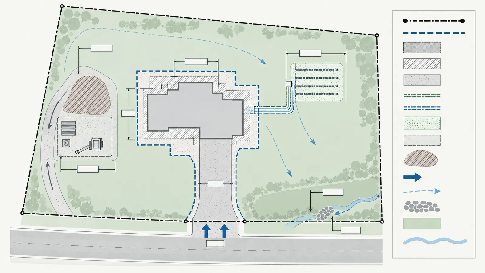
Draw one exhibit, even if the first version is rough
Use a current survey or parcel exhibit when available. On it, mark:
- Proposed house footprint, porches, decks, steps, retaining structures, crawlspace or basement excavation, and foundation overdig.
- Driveway, turnaround, parking, delivery path, construction entrance, and any temporary access that will be widened or surfaced.
- Well, septic, reserve drainfield, utility trenches, service connections, stormwater facilities, outfalls, swales, culverts, and drainage crossings.
- Clearing for equipment swing, tree removal, fire access, crane setup, material delivery, dumpster placement, and worker parking.
- Soil stockpiles, imported fill, export soil, mulch, aggregate, concrete washout, fuel or chemical storage, waste handling, and staging areas.
- Areas that will be restored, seeded, mulched, paved, built upon, left wooded, or temporarily stabilized.
- The proposed limit of disturbance, with a labeled buffer around the exact work rather than a vague line around the lot.
The exhibit is a planning document until a qualified surveyor, civil designer, engineer, or authority accepts it. It should not be used to justify moving a line in the field. If equipment, a stockpile, or a utility crew needs room outside the line, that area is either included in the approved limit or the plan must be revised before use.
Use one unit system and show the formula
Use square feet for local thresholds commonly stated in square feet and acres for state and federal programs that use acres. The conversion is:
disturbed acres = disturbed square feet ÷ 43,560
disturbed square feet = disturbed acres × 43,560
Useful reference conversions are:
| Area | Equivalent | Why it matters |
|---|---|---|
| 2,500 square feet | 0.0574 acre | Virginia’s single-family applicability floor for Article 2 and water-quantity criteria; also the City of Richmond’s cited Chesapeake Bay Protection Area trigger |
| 4,000 square feet | 0.0918 acre | City of Richmond’s cited general land-disturbance trigger |
| 10,000 square feet | 0.2296 acre | Virginia’s ordinary non-CBPA, non-common-plan threshold for the stated less-than-one-acre case, subject to local reduction and other applicability rules |
| 43,560 square feet | 1.0000 acre | Common one-acre comparison point in North Carolina and Oregon guidance |
The conversions are arithmetic, not a conclusion that those thresholds apply to your parcel. Richmond’s 4,000- and 2,500-square-foot numbers are City of Richmond rules. Virginia’s 10,000-square-foot number is not a universal statewide exemption: it is the ordinary threshold described for a less-than-one-acre activity outside a CBPA and outside a common plan, subject to local reduction. Virginia’s 2,500-square-foot single-family rule separately brings Article 2 and water-quantity criteria into the analysis, and the locality may require water-quality criteria; the Virginia applicability text must be read with the parcel’s use and context. North Carolina DEQ’s sample assumptions are not the same thing as a universal exemption. Oregon DEQ’s one-acre/common-plan criteria do not erase local grading or natural-resource permits.
Make the estimate conservative at the edge
If a proposed disturbance is close to a threshold, use the larger defensible area until the authority or designer confirms the measured boundary. Do not subtract an area merely because it will later be seeded, covered with a building, or restored. The question is whether it will be disturbed during the project and whether the applicable program counts it.
Illustrative example — not a site measurement: Assume a homeowner sketches a 2,400-square-foot house and 1,000-square-foot driveway, then adds 900 square feet for septic and utilities, 1,100 square feet for access and staging, and 700 square feet for a stockpile. The proposed disturbance is:
2,400 + 1,000 + 900 + 1,100 + 700 = 6,100 square feet
6,100 ÷ 43,560 = 0.1400 acre, rounded to four decimal places.
The homeowner might call the lot “under one acre,” but the relevant project area is 0.14 acre, not the parcel acreage. In Richmond, 6,100 square feet would be above the city’s 4,000-square-foot trigger before considering a Chesapeake Bay Protection Area. For a single-family detached residential structure elsewhere in Virginia, 6,100 square feet is also above the Commonwealth’s 2,500-square-foot single-family applicability floor, so Article 2 and water-quantity criteria apply even though the disturbance is below the ordinary 10,000-square-foot non-CBPA threshold; the locality may also require water-quality criteria. That does not by itself tell the homeowner whether a full site-specific plan, agreement, or another local form is accepted, so the local VESMP/VESCP authority must identify the path. In Guilford County, the answer depends in part on whether the lot is outside a subdivision/common plan; in Oregon, the state 1200-C one-acre threshold would not be met by this isolated illustrative disturbance, but a larger common plan or local permit could still control. Virginia’s applicability rule supports the Virginia distinction.
Sensitivity check: If the stockpile moves onto an already approved, stabilized staging area and is truly outside the lot’s land-disturbing project, the sketch becomes 5,400 square feet. If the driveway must be widened by 1,200 square feet and utility trenching adds 600 square feet, it becomes 7,900 square feet. The difference between 5,400 and 7,900 square feet is not a reason to select the smaller number; it is a reason to show both scenarios to the authority and designer and to keep the approved boundary aligned with the work that will actually occur.
Separate parcel acreage from disturbance acreage
Record both numbers. A 0.6-acre parcel can have a 0.25-acre disturbance. A 3-acre parcel can have a 0.18-acre disturbance. The programs discussed here generally focus on land-disturbing activity and the project context, not the marketing description of the lot. A large parcel can still have a sensitive water or buffer constraint. A small parcel can still be part of a subdivision common plan.
Also record whether the work is one phase or several. Clearing now, bringing in utilities later, and grading a second access route later may be one planned project for program purposes. Oregon DEQ specifically says all phases of a large development count together toward its one-acre threshold. Virginia’s rule requires the development plan regardless of phasing. Ask the authority to confirm how timing and responsibility are treated rather than designing phases to appear smaller.
Physical site assumptions decide whether a simplified path is credible #
A simplified path becomes credible only after the physical conditions match the authority’s stated assumptions. The homeowner can collect observations and documents, but a homeowner’s visual check cannot replace a survey, wetland or stream delineation, geotechnical judgment, or engineering review where those are needed.
Finished grade and mass grading
Ask whether the lot is genuinely at final grade for the proposed home and access, and whether that status is documented. Compare existing contours with the proposed foundation elevation, driveway grade, drainage path, septic layout, and utility route. Look for fill edges, abrupt terraces, buried debris, bare soil, rills, settlement, ponding, exposed subsoil, or a ditch that has changed direction. These observations do not diagnose stability; they tell you whether the “finished lot” assumption is unknown.
North Carolina DEQ’s small-lot sample assumes lots are finished or at final grade and that mass grading with full stabilization has already occurred or will not occur. If the builder proposes to reshape the whole lot to make the house fit, that is not the same activity as placing a house on a finished lot. It may require a site-specific plan, a revised grading design, or a different permit path even if the house footprint itself is small.
A qualified civil engineer, geotechnical professional, or other locally accepted designer should address cut and fill quantities, retaining structures, slope stability, drainage conveyance, foundation excavation, and the relationship between temporary controls and final grades. Do not direct an excavator to “just flatten the pad” while a plan-fit question is unresolved.
Slope: measure the proposed disturbed slope, not the lot’s reputation
Slope is a ratio of vertical change to horizontal run. Express percent slope as:
slope percent = rise ÷ horizontal run × 100
Illustrative example — not a field result: If a proposed disturbed swath rises 4 feet over a 40-foot horizontal run, its average slope is 4 ÷ 40 × 100 = 10 percent. If the same 4-foot rise occurs over 25 feet, the average is 16 percent. Those are simple averages; concentrated breaks, rills, fills, channels, and transitions can create a different design problem than the average suggests.
North Carolina DEQ’s sample plan says disturbed slopes are not to exceed 10 percent. That does not mean “a lot with average slope under 10 percent is approved.” It means the sample’s stated assumption must be tested against the actual disturbed areas and the design. If the proposed driveway, cut bank, fill slope, drainage swale, or house pad exceeds it, mark the gate failed for the sample and ask for a site-specific path.
Use a survey or qualified designer for decision-grade elevations. A phone level, visual estimate, or parcel contour layer can help you ask an early question, but it is not evidence that the work fits a plan. Keep the source, date, contour interval, reference datum, and measurement method in the handoff record.
Water, wetlands, buffers, ditches, and outfalls
Map more than named streams. Check perennial and intermittent channels, wetlands, ponds, drainage ditches, storm drains, culverts, swales, floodplain indicators, springs, saturated areas, and the point where runoff would leave the site. Photograph from public or safely accessible areas without entering unstable banks or wetlands. Mark uncertainty instead of drawing a confident line from a web map.
North Carolina DEQ’s sample assumes no jurisdictional waters within 100 feet of the lots and no discharge into impaired waters. That is a North Carolina sample-plan assumption, not a national 100-foot rule. A different North Carolina local program, a state or federal water authorization, or another state’s buffer program may require a different investigation. A watercourse outside your property can still receive runoff from your property and matter to the plan.
Oregon DEQ says an applicable 1200-C application must include a current wetland or stream delineation for waters of the state within the construction area or applicable buffer zone, along with in-water authorizations when applicable. It separately identifies potential Removal-Fill permits from Oregon’s Department of State Lands, a DEQ 401 Water Quality Certification, and U.S. Army Corps authorization as programs that may be involved. Do not turn that Oregon process into a claim about every state; use it as a reminder to ask which water-resource programs apply in your jurisdiction.
In Richmond, the City says Chesapeake Bay Protection Area maps are planning guides and that site-specific RPA and RMA locations must be determined once a project is proposed. The City describes RPAs, RMAs, 100-foot landward buffers, wetlands, floodplains, and highly erodible soils as part of its local planning context. Therefore, a map screenshot that looks outside a buffer is not a clearance letter. Use Richmond’s Chesapeake Bay Protection Area guidance to identify the local question, then obtain the site-specific determination.
Watershed, impaired-water, and overlay gates
Record the watershed or receiving water if the authority asks for it. Record whether the property is in a designated high-quality, impaired, protected, floodplain, Chesapeake Bay, riparian, or other overlay. The names differ by jurisdiction. Record the map source and date, then ask whether a field delineation or authority confirmation is required.
An overlay can affect the threshold, the required plan content, the allowable disturbance, the stabilization timing, the required treatment, or the responsible reviewer. It can also cause a standard residential plan to fail even if the controls are familiar. North Carolina DEQ’s sample excludes High-Quality Water Zones and discharges into impaired waters. Richmond uses a lower cited land-disturbance trigger in a Chesapeake Bay Protection Area. Virginia’s statewide applicability rule treats the CBPA context differently from the non-CBPA context and separately applies Article 2 and water-quantity criteria to qualifying single-family detached residential activity at 2,500 square feet or more. These are examples of why “small” cannot be evaluated without location and proposed use. The Virginia rule is the source for that distinction.
Materials, washing, and off-site work
List temporary activities that a rushed plan often misses: soil import and export, borrow areas, waste disposal, concrete washout, equipment washing, fuel storage, rock crushing, material delivery, and a contractor’s off-site staging arrangement. North Carolina DEQ’s sample assumes no onsite vehicle or equipment washing and no off-site material storage, waste disposal, or borrow areas. Guilford County recommends maintaining construction entrances and temporary controls even for smaller individual-lot work.
If the builder’s logistics require any excluded activity, do not hide it outside the drawing. Ask whether the activity can move to an authorized location, be removed from the scope, or be handled through a site-specific plan. Erosion-control eligibility is not improved by moving a stockpile beyond the property line without permission; that may transfer the impact to another owner, road, drainage system, or permit boundary.
Permanent stabilization is part of the decision
Ask what happens after the excavator leaves. Identify each area that will be built upon, paved, seeded, mulched, planted, wooded, or otherwise permanently stabilized; who installs it; what evidence closes the permit; and who repairs failed cover. North Carolina DEQ’s sample says disturbed areas not built upon must receive permanent ground cover. Oregon DEQ says soil is to be stabilized as work is completed and that permit coverage can be terminated once the site is fully stabilized. Virginia requires maintenance, inspection, and repair responsibilities to be described in the approved plan.
Do not assume “the lawn will grow” is a stabilization plan. A rainy season, delayed house delivery, changed driveway elevation, or failed seed can leave a bare slope after temporary controls are removed. Include stabilization milestones in the builder’s scope and retain inspection records, photographs, seed or cover specifications, and authority sign-off when applicable.
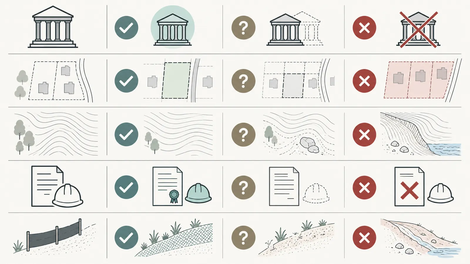
Use the evidence matrix to choose a candidate path, not to declare approval #
The correct output is a candidate path with explicit reasons and an owner for each unresolved gate. The matrix below turns the researched examples into a comparison tool. It is deliberately not a national permit chart.
| Gate | Simplified-path candidate | Site-specific-plan candidate | Stop and escalate |
|---|---|---|---|
| Authority | Authority names a simplified, individual-lot, or agreement process for this parcel | Authority requires a standard plan, civil set, or calculations | No one can identify the reviewer or current form |
| Common plan | Written confirmation that work is outside a common plan or is covered by the accepted simplified process | Subdivision, phased work, shared infrastructure, or common plan changes the review | Seller, developer, and authority records conflict |
| Disturbance | Complete LOD is measured and inside the stated path’s limit | Area, phases, or off-site work exceed or complicate the simple assumptions | LOD is unknown, moving, or close to a threshold without confirmation |
| Virginia applicability, if the parcel is in Virginia | Local authority confirms the accepted process after checking use, CBPA status, common-plan status, and any lower local threshold; a detached single-family LOD below 2,500 square feet is not captured by the cited 2,500-square-foot state floor, subject to other gates | A detached single-family LOD of 2,500 square feet or more brings Article 2 and water-quantity criteria into the state applicability analysis; non-CBPA activity at 10,000 square feet or more, CBPA activity at 2,500 square feet or more, common-plan activity, or a stricter local rule may add requirements. This is a regulated-path gate, not an automatic full-plan conclusion | Structure type, CBPA/common-plan status, local threshold, or the authority’s required form is unresolved |
| Grade and slope | Finished/final grade or no mass grading; all relevant disturbed slopes fit the named assumption | Cut/fill, retaining, steep slopes, unstable fill, or new drainage require design | Signs of instability, uncontrolled runoff, or unsafe access |
| Water and buffers | Required separation and water-resource assumptions are documented | Wetland/stream delineation, buffer review, outfall, or protected-water design is needed | Water presence, jurisdiction, or boundary is uncertain before clearing |
| Overlays | No disqualifying overlay or authority confirms the simple route | CBPA, high-quality/impaired water, floodplain, or local overlay adds review | Map and field conditions disagree or impact cannot be bounded |
| Responsibility | Owner, designer, builder, and inspection/maintenance roles are written | Qualified designer or responsible land disturber must prepare or oversee work | Nobody accepts responsibility for controls, permit, or records |
| Stabilization | Final ground cover and closeout steps are feasible and assigned | Phased stabilization, engineered BMPs, or long duration needs a plan | Work would continue through wet conditions without a control/repair plan |
A simplified-path candidate means “bring these facts to the authority and ask whether its simplified process is available.” It does not mean “begin work.” A site-specific-plan candidate means the homeowner should budget and schedule a qualified designer and formal review. Stop-and-escalate means pause the disturbance decision until the authority, civil designer, wetland professional, geotechnical professional, or attorney—depending on the unresolved issue—addresses it.
Why the same acreage produces different results
Consider three illustrative, non-binding scenarios with the same 7,500-square-foot disturbance:
Scenario A: an isolated lot in Guilford County, North Carolina. The lot is outside a subdivision, has no known water within the sample’s stated separation, has no mass grading, and the proposed disturbed slopes fit the sample assumptions. Guilford County’s page says the individual lot outside a subdivision requires plan approval and a grading permit at one acre or more, while under one acre it recommends controls. The homeowner still contacts Guilford County, confirms the grading requirement and current local process, and puts the recommended controls and stabilization into the builder scope. The result is a local confirmation question, not a permit-free conclusion.
Scenario B: a lot inside a Guilford County subdivision. The exact 7,500 square feet is unchanged, but the subdivision/common-plan gate changes. Guilford County says lots within a subdivision/common plan need an approved erosion-control plan, grading permit, and NCG01 coverage. The homeowner asks the developer for the approved plan, checks whether lot construction is covered or needs a lot-specific submittal, and confirms responsibility before work. The same area is now handled as part of the development context.
Scenario C: a detached house in Richmond, Virginia. The disturbance is 7,500 square feet. The City says 4,000 square feet or more, or 2,500 square feet or more in a CBPA, requires a separate RESMP permit. The Commonwealth’s single-family 2,500-square-foot applicability rule is an additional reason not to use an under-one-acre shortcut, but Richmond’s local permit and documents control the local intake. The homeowner asks whether the single-family dwelling is eligible for an Agreement in Lieu of Plan, but recognizes that Richmond still requires a VESMP permit process, a responsible land disturber form, a small site plan, and a bond for eligible AILP work. The result is not “under an acre”; it is “follow Richmond’s local permit and eligibility path.” The City’s local guidance and Virginia’s applicability rule must both be checked.
Scenario D: a detached house elsewhere in Virginia. The same 7,500-square-foot disturbance is outside a designated CBPA, outside a common plan, and in a locality that has not supplied a lower threshold. The ordinary 10,000-square-foot non-CBPA comparison would not independently capture it, but the proposed use is a single-family detached residential structure and the disturbance exceeds 2,500 square feet. Article 2 and water-quantity technical criteria therefore enter the applicability analysis; the locality may also require water-quality criteria. The homeowner asks the local VESMP/VESCP authority which plan, agreement, permit, responsible-person record, and technical criteria apply before work starts. The result is a regulated-path confirmation question, not a conclusion that the site needs no plan and not a claim that a full site-specific plan is automatic. The regulation’s subsection (A)(2) language is the controlling source for this distinction.
These scenarios show the information gain in the worksheet: it preserves the local authority and context rather than collapsing everything into one acreage number.
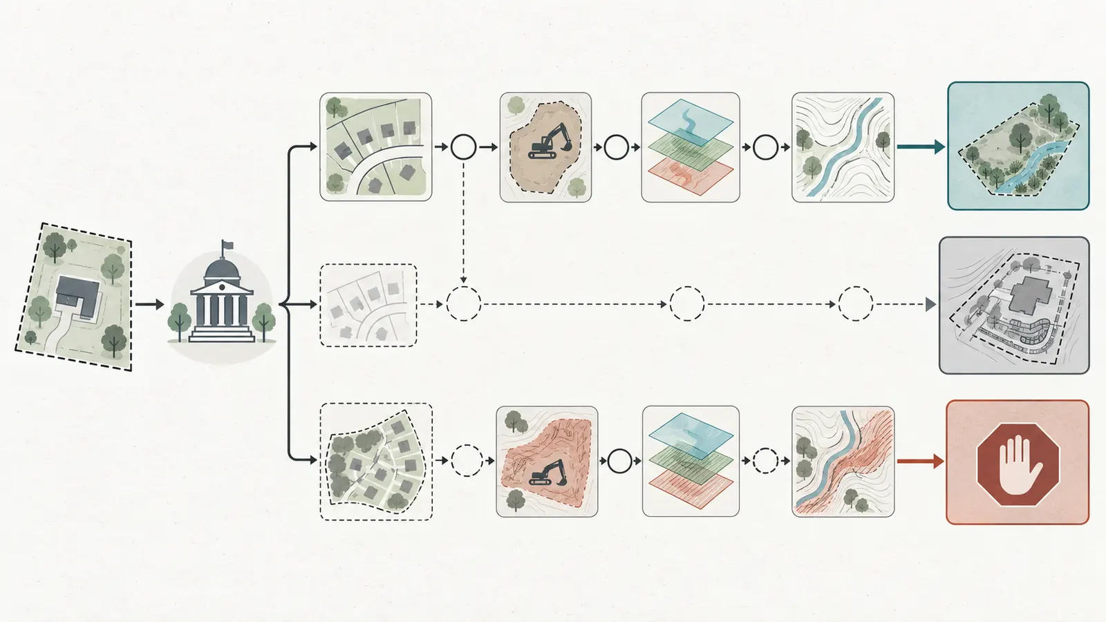
The Vacant-lot erosion-control plan-fit handoff worksheet makes the next call answerable #
The original contribution in this guide is the Vacant-lot erosion-control plan-fit handoff worksheet. It is a source-derived worksheet, not an official government form. Its method is to translate published gates from North Carolina DEQ, Virginia Administrative Code, Oregon DEQ, Guilford County, and the City of Richmond into a record that a homeowner can hand to the authority, designer, developer, and builder. Its limitation is equally important: it cannot approve a plan, establish buildability, replace a survey or delineation, or decide a disputed legal or engineering fact.
Method: Translate the published assumptions and thresholds from North Carolina DEQ, Virginia Administrative Code, Oregon DEQ, Guilford County, and the City of Richmond into fields that preserve jurisdiction, units, parcel status, limits of disturbance, confirmation date, responsible party, and unresolved questions. The worksheet outputs simplified-path candidate, site-specific-plan candidate, or stop-and-escalate.
Limitations: This is a planning and handoff tool, not a permit application, engineering design, survey, wetland delineation, soil investigation, legal opinion, or authority determination. Thresholds and local programs can change; the named authority must confirm the current path for the actual parcel before clearing or grading.
Use one worksheet per proposed design scenario. If the home footprint, driveway, grading, or utility route changes materially, create a revision rather than editing the old record until it appears as though the original scope was approved.
Part A — parcel and authority identity
| Field | Record | Verification owner | Status/date |
|---|---|---|---|
| Parcel address and parcel/APN ID | Homeowner | ||
| State, county, city/town, and reviewing office | Homeowner | ||
| Authority contact and case/email reference | Homeowner | ||
| Current rule, page, form, or permit name | Authority/homeowner | ||
| Date the authority’s direction was confirmed | Homeowner | ||
| Proposed start date and duration | Homeowner/builder | ||
| Survey, plat, contour source, date, and datum | Surveyor/designer | ||
| Local grading, building, septic, access, floodplain, or natural-resource reviews also identified | Authority/designer |
Do not leave the reviewing office as “the county” when the county has separate planning, grading, stormwater, soil and water, or delegated state-program functions. The handoff should make it obvious who can answer the threshold question and who can approve the plan.
Part B — parcel status and common-plan gate
| Question | Yes / No / Unknown | Evidence or attachment | Next action |
|---|---|---|---|
| Is the lot inside a recorded subdivision? | Plat, deed, GIS, developer file | ||
| Is it part of a common plan of development or sale? | Approved plan, authority confirmation | ||
| Are roads or utilities being built or extended for multiple lots? | Civil plan, developer scope | ||
| Was the area mass-graded or permitted as a larger phase? | Prior plan, inspection, closeout | ||
| Are adjoining lots, common areas, or future phases part of the work? | Phasing plan, authority email | ||
| Who is the current financially responsible party or permit holder? | Permit, transfer form, written confirmation | ||
| Is the lot’s prior plan still open, active, or incomplete? | Authority record and inspection history |
If any answer is Unknown, the worksheet cannot output “simplified path confirmed.” If an answer is Yes, attach the larger plan and determine whether the home-building activity is already covered or needs an individual plan, agreement, permit, or responsibility transfer.
Part C — proposed disturbance ledger
List areas separately so the total can be audited.
| Disturbance component | Square feet | Temporary or permanent | Included in LOD? | Source/measurement |
|---|---|---|---|---|
| House, foundation, basement, crawlspace, overdig | ||||
| Driveway, turnaround, construction entrance | ||||
| Clearing and tree removal equipment area | ||||
| Septic, reserve area, well, utilities, drainage | ||||
| Cut/fill, retaining, swales, outfalls, crossings | ||||
| Staging, delivery, worker parking, crane setup | ||||
| Stockpile, imported fill, export soil, waste, washout | ||||
| Other: | ||||
| Total proposed disturbance | ||||
| Total ÷ 43,560 = disturbed acres |
Have the designer or builder initial the ledger after comparing it to the site plan. If the builder says a component is “temporary,” keep it in the ledger unless the authority confirms that it is outside the applicable definition or project boundary. Temporary is a duration description, not automatically a non-disturbance description.
Part D — physical and overlay gates
| Gate | Input to record | Confirmed by | Result |
|---|---|---|---|
| Final grade | Existing and proposed contours/elevations; fill and cut areas | Surveyor/designer/authority | |
| Mass grading | Yes/no; phase and stabilization records | Developer/authority | |
| Maximum disturbed slope | Percent, location, method, and contour basis | Qualified designer/authority | |
| Water and wetlands | Map, field observation, delineation, buffer, date | Qualified delineator/authority | |
| Drainage destination | Swale, ditch, storm drain, stream, wetland, or other outfall | Designer/authority | |
| High-quality or protected water | Program name and map/date | Authority | |
| Impaired water or TMDL | Receiving water and program direction | Authority | |
| Floodplain or floodway | Map panel/date and local review | Floodplain official/designer | |
| Chesapeake Bay or local buffer | Applicable only where named by the authority | Local authority | |
| Soil/fill/stability concern | Observation and required investigation | Qualified professional | |
| Washing, stockpile, borrow, waste | Location and control/authorization | Builder/authority | |
| Permanent ground cover | Area, treatment, installer, milestone | Builder/owner/authority |
Do not mark a gate Confirmed because a map layer is blank. Mark the source and the authority’s response. The Richmond page, for example, says its CBPA maps are for planning and that site-specific RPA and RMA locations must be determined. The worksheet should preserve that distinction.
Part E — output and handoff
Select one provisional output only after recording the evidence:
- Simplified-path candidate: The authority, common-plan status, complete disturbance, physical assumptions, overlay status, responsibility, and stabilization plan appear to fit. Next action: send the worksheet and exhibit to the authority for written confirmation of the current simplified form/process before scheduling land disturbance.
- Site-specific-plan candidate: One or more assumptions fail, the authority requires a standard plan, the LOD or common plan is complex, or qualified review is needed. Next action: engage the locally accepted civil, erosion-control, environmental, or geotechnical professional and obtain a scope and schedule tied to the authority’s checklist.
- Stop-and-escalate: The reviewer is unknown, the common-plan record conflicts, water or buffer status is uncertain, unstable ground or unsafe access is suspected, or work would begin before approval/coverage. Next action: pause clearing/grading and resolve the named gate with the proper authority or qualified professional.
Then assign the next decision:
| Handoff | Owner | Information sent | Acceptance test |
|---|---|---|---|
| Authority | Homeowner | Worksheet, parcel exhibit, LOD, disturbance total, common-plan question | Current path and required forms confirmed |
| Designer | Homeowner | Survey/plat, contours, proposed house and grading concept, authority response | Plan scope and site investigations listed |
| Developer/prior permit holder | Homeowner | Subdivision plan, lot number, permit/coverage request | Coverage and responsibility boundary documented |
| Builder/excavator | Homeowner/designer | Approved plan/path, LOD exhibit, control details, sequence | Contract scope includes controls and no work outside LOD |
| Inspector/authority | Responsible party | Permit, plan, contact, inspection schedule, photos/records | Required inspection and correction process understood |
The worksheet is complete when an independent reader can answer: Who decides? What exactly will be disturbed? Which larger project counts? Which assumption is still unknown? Who pays for and installs controls? Who inspects and repairs them? What must happen before the excavator arrives? What is the next decision if a gate fails?
The handoff sequence keeps a valid plan from becoming an unauthorized job #
The plan-fit decision should be sequenced with design and contracting. A homeowner does not need to perform the hazardous work personally, but does need to make responsibility visible before contracts and mobilization.
1. Freeze the current concept long enough to measure it
Prepare the first site exhibit with a house location, driveway, utilities, drainage concept, septic or well areas where known, clearing boundary, staging, stockpiles, and restoration areas. Label it “concept for authority review” and date it. Do not let a contractor price a smaller house pad while another drawing assumes a larger driveway and utility route.
Ask the designer whether the proposed location is compatible with known setbacks, access, drainage, septic, floodplain, buffer, and foundation constraints. The answer can be preliminary. The purpose is to prevent the erosion-control exhibit from being based on a house location that is later impossible.
2. Identify the official program and request the current intake path
Send the bounded question and worksheet to the named authority. In North Carolina, distinguish NC DEQ from a delegated local program; NC DEQ says local programs can vary and may be more stringent. In Oregon, identify whether DEQ or a city or district administers the 1200-C process. In Virginia, identify the local VESMP/VESCP authority and ask how the single-family detached-residential rule applies at 2,500 square feet or more, which Article 2 and water-quantity criteria are required, whether water-quality criteria are added, and whether the locality has reduced a threshold or accepts an agreement in lieu of a plan. In Richmond, use the City’s RESMP and single-family guidance rather than assuming the statewide Virginia threshold.
Ask for a current checklist and confirm whether the authority wants the designer, owner, builder, developer, or another entity to submit. Save the response with the worksheet. A phone call can be useful, but record the caller, date, direction, and any follow-up email needed to make the instruction auditable.
3. Resolve common-plan and prior-permit responsibility
If the lot is inside a subdivision, the homeowner should not accept a contract clause saying “owner responsible for permits” without a document review. Obtain the development plan and identify whether lot-level work is covered, whether NCG01, VESMP, or 1200-C coverage exists, whether a lot-specific plan is required, and whether responsibility can be transferred.
North Carolina DEQ’s transfer-of-financial-responsibility form for certain residential lots under an individual-lot approval involving less than one acre shows why this needs care: transferring statutory financial responsibility does not by itself terminate NCG01 coverage. The form says closeout inspection after permanent stabilization and the electronic Notice of Termination remain necessary to end that coverage, subject to the form’s stated alternatives. Use the current North Carolina E&SC application and forms and ask the authority which transfer process applies. Do not generalize that form to Virginia, Oregon, or another North Carolina local program.
Virginia’s plan rule says the person responsible for carrying out the plan must provide the responsible individual’s name to the authority, subject to the agreement-in-lieu provisions. Richmond’s local page lists a responsible land disturber form and certification among documents for single-family applications. The person named in the contract, permit, plan, and field operation should be the same role the authority expects; if the builder changes, update the record before work.
4. Engage the right professional for the failed gate
Use the failed gate to define scope:
- Survey or elevations: licensed surveyor or locally qualified designer.
- Grading, drainage, erosion-control details, outfalls, retaining, or stormwater calculations: civil engineer or other professional accepted by the authority.
- Wetland, stream, buffer, or water-resource boundary: qualified environmental professional and the relevant authority.
- Fill, slope stability, settlement, or unusual subsurface conditions: geotechnical professional.
- Legal ownership, easements, recorded maintenance instruments, or disputed responsibility: attorney with the applicable state/local experience.
The homeowner can compare proposals by asking each professional to identify the source rule, assumptions, field work, deliverables, authority coordination, revisions, inspection support, and exclusions. A drawing that shows silt fence but does not resolve the LOD, outfall, slope, or water gate is not a complete answer to this decision.
5. Make the builder scope mirror the approved plan
The construction agreement should identify the approved plan or authority path, the exact LOD exhibit, control installation before disturbance, access and delivery limits, stockpile and washout locations, stabilization milestones, inspection and repair duty, weather shutdown criteria, reporting, and change-order process. Specify who obtains and pays for the permit, bond, plan revisions, inspections, fees, and professional services. If the scope is silent, the homeowner may discover that the price excluded the very controls needed to make the plan work.
Do not let a field superintendent move a construction entrance, silt fence, haul route, spoil pile, or drainage outlet without the responsible designer or authority’s direction where required. A field change can change the drainage pattern and the permitted disturbance.
6. Set the no-start condition
Write a plain-language no-start condition into the project schedule: no clearing, grubbing, grading, excavation, access expansion, stockpiling, or vertical construction that the program counts may begin until the required plan, permit, agreement, coverage, bond, and preconstruction conditions are satisfied. Oregon DEQ’s 1200-C housing guidance says construction activities may not begin until coverage is approved and directs complete applications at least 30 days before construction starts. North Carolina DEQ’s E&SC application guidance says the E&SC plan must be approved before land-disturbing activities begin for the scope described in its guidance.
The no-start condition is not a promise that one state’s timing applies elsewhere. It is a project-control question: “What exactly must be approved before this activity in this jurisdiction?” Put the answer on the schedule and in the contract.
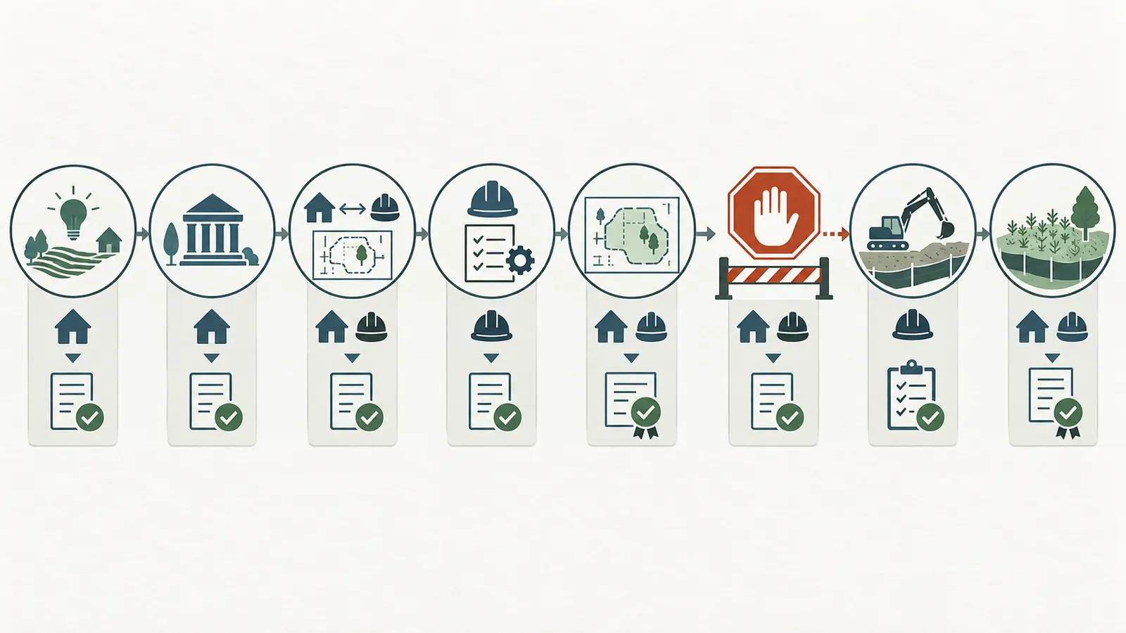
Verification is part of plan fit because controls must work in the field #
A plan-fit decision is not complete when a PDF exists. Before, during, and after disturbance, the responsible parties must verify that the field work matches the approved boundary and that controls are maintained, repaired, and stabilized as required by the actual program.
Before mobilization
Walk the site with the approved exhibit and confirm:
- Property corners, access, LOD stakes or markings, and no-work areas are understandable to the crew.
- Construction entrance, perimeter controls, inlet protection, diversions, slope drains, sediment traps, or other approved BMPs are installed in the planned sequence.
- Water, wetland, buffer, ditch, and outfall locations are marked as needed.
- Stockpile, waste, washout, equipment, fuel, and delivery locations are inside authorized areas and protected.
- The responsible field person and inspector know how to report a failed control or field condition.
- Weather and site conditions permit installation without immediately washing controls out.
This is an observation and coordination step for the homeowner, not permission to install technical controls without the approved plan or qualified direction. Do not enter an excavation, climb an unstable fill slope, approach operating equipment, or inspect a water edge where footing is uncertain. Use the responsible professional or trained site personnel for hazardous areas.
During clearing and grading
The homeowner can request dated photographs from safe locations showing the LOD, installed controls, active slopes, outlets, entrances, stockpiles, and stabilized areas. Compare the photographs with the plan and ask for the inspection record required by the permit. Oregon DEQ’s housing guidance requires BMP installation and maintenance, regular inspection, prompt correction of damaged or ineffective BMPs, and stabilization as work is completed. Virginia’s 9VAC25-875-550 plan-requirements rule requires maintenance, inspection, and repair as needed, with maintenance responsibility stated in the approved plan. North Carolina DEQ’s inspection and monitoring forms guidance explains the self-inspection requirement and provides forms for land development and lots; the applicable law, permit, and project conditions determine the records.
Treat muddy water leaving the site, a clogged inlet, an undermined fence, a blown-out entrance, sediment in a ditch, an unplanned discharge, a stockpile outside the LOD, or a newly exposed slope as a stop-and-report condition. Do not simply add more straw or silt fence from memory. The corrective action may require a different device, a stabilized outlet, a plan revision, professional review, or authority notification.
At pauses and closeout
Long pauses are a risk point. Ask who inspects a site after work stops, how inactive areas are stabilized, and who owns the controls if the builder leaves. Before the final closeout, verify that final grades drain as designed, permanent cover is established, temporary controls are removed only when authorized, and maintenance documents are transferred.
Richmond’s stormwater management page illustrates a local closeout consequence: the City says written final-inspection verification is required before a portion of the surety is released, the owner must request the inspection, and the final inspection is not completed before 75 percent of living perennial vegetation is established. That is a City of Richmond requirement described on its page, not a nationwide vegetation rule. In Oregon, DEQ says 1200-C coverage can be terminated once the site is fully stabilized. In Virginia, the approved plan carries the maintenance, inspection, and repair responsibility. Your authority may use different closeout evidence.
Failure matrix: what the observation does and does not prove
| Observation | It may indicate | It does not prove | Safest next step |
|---|---|---|---|
| No visible stream from the road | A water-resource review may be uncomplicated | That no jurisdictional water, wetland, ditch, or buffer exists | Check maps and ask whether delineation or authority confirmation is required |
| Lot is advertised as finished | Prior grading may be complete | That current contours, stabilization, and drainage fit your house | Obtain prior plan/inspection records and compare proposed grades |
| House footprint is under one acre | The footprint alone is small | That the whole LOD, common plan, or local threshold is small | Complete the disturbance ledger and common-plan gate |
| Silt fence is already installed | Someone anticipated sediment control | That it is correctly located, sufficient, maintained, or approved | Compare with the current plan and have the responsible person inspect |
| Builder says “permit is covered” | The builder may intend to manage the process | That a permit/coverage exists, is current, or covers your scope | Request permit number, approved plan, authority, named responsible party, and LOD |
| Map shows no overlay | The parcel may be outside the mapped layer | That the map is current or site-specific | Ask the authority how the overlay is determined for the proposed work |
| Soil is dry on the visit day | Conditions are temporarily dry | That the site will remain stable during rain or that fill is suitable | Use qualified review for grading, fill, and drainage; plan inspection and stabilization |
| A control failed after rain | The control or sequence is inadequate for current conditions | That more material alone will solve the design | Stop affected work, document it, and follow the plan’s corrective process |
The next decision is the professional scope and authorization date, not the equipment arrival
After completing the worksheet, choose the next paid or official action based on the failed or unknown gate. If the authority confirms a simplified process and all assumptions fit, obtain the current form or approval instruction and align the builder scope with it. If any physical or program assumption fails, obtain a site-specific plan or qualified design review before clearing or grading. If the authority, common plan, water boundary, safety, or responsibility is unclear, stop and escalate until the record is coherent.
Compact originality brief
Current answers: Official pages explain separate programs: North Carolina DEQ publishes a small-lot sample with detailed assumptions; Virginia publishes applicability, including a separate 2,500-square-foot single-family detached-residential rule and common-plan rules; Oregon DEQ explains 1200-C coverage, application timing, BMPs, and local agents; Guilford County explains subdivision versus individual-lot handling; and Richmond publishes lower local thresholds and a possible single-family agreement path. Generic search answers tend to stop at silt fence, construction entrances, or “under one acre.”
Missing decision: A homeowner needs to compare the complete proposed disturbance against authority, common-plan, finished-grade, slope, water, overlay, responsibility, and stabilization gates before paying for clearing or trusting a builder’s “small lot” label.
Original contribution: The Vacant-lot erosion-control plan-fit handoff worksheet preserves the jurisdiction, exact acreage units, LOD components, slope and water inputs, parcel status, responsible parties, source/date, authority confirmation, and failed gates. It outputs a simplified-path candidate, site-specific-plan candidate, or stop-and-escalate.
How it can be checked: A reviewer can reproduce the arithmetic from the disturbance ledger, compare each jurisdiction-specific gate with the linked authority page, inspect whether each evidence ID is cited at the point of use, and ask the named authority to confirm the current path for the actual parcel. The worksheet’s limitation is intentional: it records a decision conversation and its unresolved assumptions; it does not claim engineering approval, firsthand testing, or buildability.
Before you schedule a crew, make sure the record answers five questions in one place: Which authority decides? What is the complete disturbed area in square feet and acres? Is the lot part of a larger plan? Which assumption requires professional or field verification? What approval, coverage, agreement, inspection, and stabilization evidence must exist before and after work? If any answer is missing, the lot is not yet ready for a clearing decision.
Cite this guide
Brictale. “Does Your Vacant Lot Qualify for a Small Residential Erosion-Control Plan?.” Published 2026-09-27; updated 2026-09-27.
https://brictale.com/build/land/plan-vacant-lot-small-lot-erosion-control-plan-fit · Read the Markdown version
Original contribution: Vacant-lot erosion-control plan-fit handoff worksheet. A source-derived record for comparing a proposed home-site disturbance with the authority, common-plan, acreage, slope, water, buffer, grading, responsibility, and Virginia single-family applicability gates that determine the next review path.
Sources and scope
Evidence behind this page
- North Carolina DEQ's sample E&SC plan for small residential lots is for individual disturbed areas of 1.00 acre or less and total disturbance of not more than 1.0 acre, with additional assumptions including finished lots or no mass grading, disturbed slopes not exceeding 10%, no jurisdictional waters within 100 feet, no High-Quality Water Zone, no discharge into impaired waters, no onsite washing, no off-site material storage/waste/borrow areas, and permanent ground cover for disturbed areas not built upon.
E&SC Downloads and Forms — Sample E&SC Plan Set for Small Residential Lots
North Carolina DEQ sample-plan assumptions; these are not a national rule and DEQ reserves the right to require a site-specific plan.
Accessed · Link to this claim - North Carolina's NPDES Construction Stormwater Program applies to construction disturbing one acre or more, or less than one acre when it is part of a larger common plan of development of that size; NCG01 applies when the project is subject to the DEMLR Sediment Program.
NPDES Construction Program — NC DEQ
North Carolina statewide NPDES construction program summary; local delegated programs may have additional requirements.
Accessed · Link to this claim - North Carolina DEQ says an E&SC plan must be submitted at least 30 days before land disturbance begins on a site involving more than one acre and must be approved before land-disturbing activities begin; delegated local programs can vary and may be more stringent.
Erosion and Sediment Control Application — NC DEQ
North Carolina E&SC application and review guidance; the cited 30-day rule is for sites involving more than one acre, while local program details must be confirmed.
Accessed · Link to this claim - Guilford County, North Carolina requires homebuilding lots within a subdivision or common plan of development to have an approved erosion-control plan, grading permit, and NCG01 coverage.
Residential Lot Erosion and Sediment Control — Guilford County
Guilford County, North Carolina local residential-lot guidance; it does not establish requirements for other North Carolina counties.
Accessed · Link to this claim - Guilford County, North Carolina says an individual lot outside a subdivision or common plan requires erosion-control plan approval and a grading permit when land disturbance is equal to or greater than one acre; for less than one acre it recommends erosion and sediment controls to prevent sediment loss.
Residential Lot Erosion and Sediment Control — Guilford County
Guilford County, North Carolina local guidance for individual lot construction outside a subdivision/common plan; verify other permits and current county requirements.
Accessed · Link to this claim - Virginia's erosion and stormwater regulation treats land-disturbing activity of 10,000 square feet or more as regulated when it is less than one acre, outside a designated Chesapeake Bay Preservation Area, and not part of a common plan of development or sale, although a locality may reduce that threshold. Separately, for land-disturbing activity for single-family detached residential structures, Article 2 and water-quantity technical criteria apply at 2,500 square feet or more, whether or not the activity is in a Chesapeake Bay Preservation Area; the locality may also require water-quality technical criteria. Activity of 2,500 square feet or more in a designated Chesapeake Bay Preservation Area and less than one acre in a larger common plan reaching one acre have additional applicability rules.
9VAC25-875-470. Applicability — Virginia Administrative Code
Commonwealth of Virginia regulation; localities may reduce thresholds and additional local program conditions apply.
Accessed · Link to this claim - Virginia requires an erosion and sediment control plan for a development and its buildings regardless of phasing; when individual lots or sections in a residential development are developed by different owners, related building land-disturbing activities must be covered by a plan or an agreement in lieu of a plan signed by the property owner.
9VAC25-875-550. Erosion and sediment control plan requirements — Virginia Administrative Code
Commonwealth of Virginia regulation on plan contents and responsibility; it does not decide whether a particular locality will accept an agreement in lieu of a plan.
Accessed · Link to this claim - Virginia requires erosion and sediment control structures and systems to be maintained, inspected, and repaired as needed, with maintenance responsibilities described in the approved plan.
9VAC25-875-550. Erosion and sediment control plan requirements — Virginia Administrative Code
Commonwealth of Virginia regulation; actual inspection and maintenance procedures depend on the approved plan and authority.
Accessed · Link to this claim - Oregon DEQ's 1200-C construction stormwater permit applies to projects disturbing one acre or more or projects that are part of a larger common plan of development totaling one acre or more; clearing, grading, excavation, staging, stockpiling, demolition, and vertical construction are included in the described regulated activities once criteria are met.
1200-C Construction Stormwater Permit — Oregon DEQ Housing
Oregon DEQ housing guidance for the 1200-C permit; local grading and other natural-resource permits may also apply.
Accessed · Link to this claim - Oregon DEQ says construction activities may not begin until 1200-C permit coverage is approved and a complete application should be submitted at least 30 days before construction starts; the application includes project information, fees, a local Land Use Compatibility Statement, an erosion and sediment control plan, and applicable wetland or stream delineation and authorizations.
1200-C Construction Stormwater Permit — Process overview
Oregon DEQ 1200-C process guidance; fees and forms can change and local agents may administer the process.
Accessed · Link to this claim - Oregon DEQ's 1200-C housing guidance requires permit holders to install and maintain BMPs in the erosion-control plan, inspect regularly, fix damaged or ineffective BMPs quickly, and stabilize soil as work is completed.
1200-C Construction Stormwater Permit — During construction
Oregon DEQ 1200-C housing guidance; the approved plan and current permit control the project's exact duties.
Accessed · Link to this claim - Oregon DEQ says 1200-C permit coverage can be terminated by the permit holder once the site is fully stabilized.
1200-C Construction Stormwater Permit — Oregon DEQ Housing
Oregon DEQ 1200-C housing guidance; local 1200-CN or other permit processes may use different closeout steps.
Accessed · Link to this claim - The City of Richmond, Virginia requires a separate Richmond Erosion & Stormwater Management Program permit for land disturbance of 4,000 square feet or more, or 2,500 square feet or more in a Chesapeake Bay Protection Area, including residential development, clearing, grading, grubbing, foundations, and onsite drainage changes.
Stormwater Management — City of Richmond Department of Public Utilities
City of Richmond, Virginia local permitting page; these thresholds are not statewide Virginia thresholds.
Accessed · Link to this claim - The City of Richmond says single-family dwellings meeting its land-disturbance thresholds, whether in or out of a common plan of development, are required to submit a VESMP permit and may be eligible for an Agreement in Lieu of Plan; eligible projects still require a small site plan and bond.
Stormwater Management — What if I'm building one detached single family house?
City of Richmond, Virginia local process; eligibility is determined by the City and required documents include a responsible land disturber form and small site plan.
Accessed · Link to this claim - The City of Richmond describes Chesapeake Bay Protection Areas as including resource protection and management areas and says maps are planning guides; once a project is proposed, site-specific RPA and RMA locations must be determined.
Stormwater Management — Chesapeake Bay Protection Areas
City of Richmond, Virginia Chesapeake Bay Protection Area guidance; site-specific determinations are required for proposed projects.
Accessed · Link to this claim - North Carolina DEQ's transfer form for a residential lot under an individual-lot approval involving less than one acre says the notice does not provide relief from financial responsibility under NCG01; terminating NCG01 coverage requires a closeout inspection after permanent stabilization and the electronic Notice of Termination, unless the new owner first obtains coverage and then the prior coverage is terminated through e-NOT.
Transfer of Financial Responsibility — NC DEQ
North Carolina DEQ transfer form for the stated residential-lot and less-than-one-acre circumstances; it does not establish a transfer process for another state or local program.
Accessed · Link to this claim - NC DEQ says self-inspections are required under North Carolina law and NCG010000, and provides combined self-inspection and self-monitoring forms for land development and lots; the applicable permit and project conditions control the required records.
E&SC Downloads and Forms — Inspection and Monitoring Forms
North Carolina DEQ statewide E&SC and construction-stormwater guidance; delegated programs and the current permit may add or modify requirements.
Accessed · Link to this claim - The City of Richmond says written final-inspection verification is required before any portion of the surety is released, the owner must request the inspection, and the final inspection cannot be completed before 75% of living perennial vegetation is established.
Stormwater Management — City of Richmond Department of Public Utilities
City of Richmond, Virginia local closeout and surety-release guidance; this is not a statewide Virginia or national vegetation rule.
Accessed · Link to this claim